Santa Fe elevation
Santa Fe (New Mexico, Santa Fe County), United States elevation is 2137 meters and Santa Fe elevation in feet is 7011 ft above sea level [src 1]. Santa Fe is a seat of a first-order administrative division (feature code) with elevation that is 1858 meters (6096 ft) bigger than average city elevation in United States.
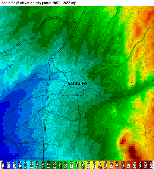
Below is the Elevation map of Santa Fe, which displays elevation range with different colors. Scale of the first map is from 2050 to 2453 m (6726 to 8048 ft) with average elevation of 2181.9 meters (=7158 ft) [note 1]
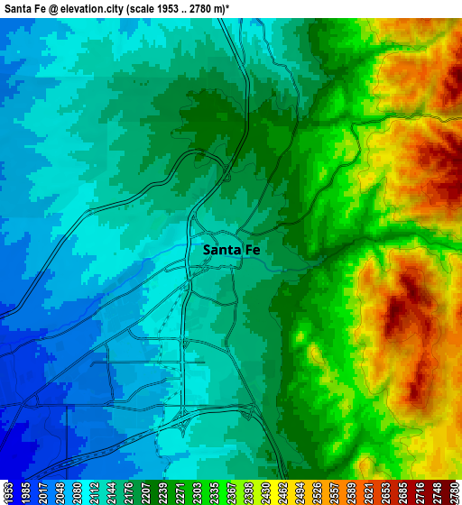
These maps also provides idea of topography and contour of this city, they are displayed at different zoom levels. More info about maps, scale and edge coordinates you can find below images.
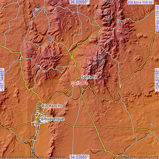
| \ | Map #1 | Map #2 | Topo.Map |
| Scale [m] | 2050..2453 m | 1953..2780 m | × |
| Scale [ft] | 6726..8048 ft | 6407..9121 ft | × |
| Average | 2181.9 m = 7158 ft | 2220.6 m = 7285 ft | × |
| Width | 7.94 km = 4.9 mi | 15.87 km = 9.9 mi | 254 km = 157.8 mi |
| Height | 7.94 km = 4.9 mi | 15.87 km = 9.9 mi | 254 km = 157.8 mi |
| ↑Max Latitude | 35.722665° | 35.758334° | 36.82095° |
| Latitude at center | 35.68698° | 35.68698° | 35.68698° |
| ↓Min Latitude | 35.651279° | 35.615562° | 34.53666° |
| ← Min Longitude | -105.981745° | -106.025691° | -107.34405° |
| Longitude center | -105.9378° | -105.9378° | -105.9378° |
| →Max Longitude | -105.893855° | -105.849909° | -104.53155° |
Nearby cities:
Cities around Santa Fe sort by population:
• Eldorado at Santa Fe elevation 2034 m
17.9 km,  179°
179°
• White Rock 1942 m
28.6 km,  303°
303°
• La Cienega 1806 m
22.3 km,  231°
231°
• Agua Fria 1999 m
8.4 km,  244°
244°
• Pojoaque 1781 m
24.1 km,  341°
341°
• Nambe 1828 m
23.3 km,  350°
350°
• La Mesilla 1713 m
31.4 km, 337°
• El Valle de Arroyo Seco 1746 m
31.8 km, 344°
• Pecos 2110 m
26.9 km,  117°
117°
• El Rancho 1731 m
25.9 km,  330°
330°
• La Puebla 1798 m
34 km, 351°
• Santa Clara Pueblo 1706 m
33.8 km, 336°
Multilingual:
 En español:
Santa Fe elevación 2137 m.
 En France:
Santa Fe élévation 2137 m.
 Auf Deutsch:
Santa Fe höhe über dem Meeresspiegel ist 2137 m.

Sources and notes:
- [note 1] Map square and city borders are not equal. Map elevation data is calculated only from area inside that square.
- [src 1] Elevation data from geonames database provided with same terms of usage.
- [src 2] The elevation map of Santa Fe is generated using elevation data from NASA's 3 arcsec (90m) resolution SRTM data.
- [src 3] Base (background) map © OpenStreetMap contributors tiles are generated by Geofabrik and OpenTopoMap.
Copyright & License:
This Santa Fe Elevation Map is licensed under CC BY-SA. You may reuse any part from this page, if you give a proper credit by linking to this URL:
 More info on terms of use page.