Sandia Knolls elevation
Sandia Knolls (New Mexico, Bernalillo County), United States elevation is 2052 meters and Sandia Knolls elevation in feet is 6732 ft above sea level [src 1]. Sandia Knolls is a populated place (feature code) with elevation that is 1773 meters (5817 ft) bigger than average city elevation in United States.
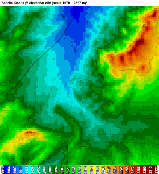
Below is the Elevation map of Sandia Knolls, which displays elevation range with different colors. Scale of the first map is from 1970 to 2327 m (6463 to 7635 ft) with average elevation of 2093.9 meters (=6870 ft) [note 1]
These maps also provides idea of topography and contour of this city, they are displayed at different zoom levels. More info about maps, scale and edge coordinates you can find below images.
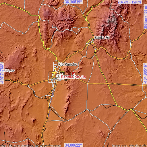
| \ | Map #1 | Topo.Map |
| Scale [m] | 1970..2327 m | × |
| Scale [ft] | 6463..7635 ft | × |
| Average | 2093.9 m = 6870 ft | × |
| Width | 7.99 km = 5 mi | 255.6 km = 158.8 mi |
| Height | 7.99 km = 5 mi | 255.6 km = 158.8 mi |
| ↑Max Latitude | 35.199848° | 36.30539° |
| Latitude at center | 35.16393° | 35.16393° |
| ↓Min Latitude | 35.127996° | 34.00622° |
| ← Min Longitude | -106.355355° | -107.71766° |
| Longitude center | -106.31141° | -106.31141° |
| →Max Longitude | -106.267465° | -104.90516° |
Nearby cities:
Cities around Sandia Knolls sort by population:
• Enchanted Hills elevation 1616 m
32 km,  306°
306°
• North Valley 1521 m
28.4 km,  272°
272°
• Bernalillo 1541 m
26.5 km,  304°
304°
• Corrales 1528 m
28.1 km,  287°
287°
• Los Ranchos de Albuquerque 1518 m
30.1 km, 269°
• Lee Acres 1519 m
30.6 km, 266°
• Placitas 1817 m
18.9 km,  327°
327°
• Edgewood 2027 m
15.8 km,  136°
136°
• Sandia Heights 1866 m
16.4 km,  275°
275°
• Moriarty 1892 m
30.7 km,  129°
129°
• Carnuel 1790 m
17.3 km,  230°
230°
• Ponderosa Pine 2296 m
20.8 km,  183°
183°
Multilingual:
 En español:
Sandia Knolls elevación 2052 m.
 En France:
Sandia Knolls élévation 2052 m.
 Auf Deutsch:
Sandia Knolls höhe über dem Meeresspiegel ist 2052 m.

Sources and notes:
- [note 1] Map square and city borders are not equal. Map elevation data is calculated only from area inside that square.
- [src 1] Elevation data from geonames database provided with same terms of usage.
- [src 2] The elevation map of Sandia Knolls is generated using elevation data from NASA's 3 arcsec (90m) resolution SRTM data.
- [src 3] Base (background) map © OpenStreetMap contributors tiles are generated by Geofabrik and OpenTopoMap.
Copyright & License:
This Sandia Knolls Elevation Map is licensed under CC BY-SA. You may reuse any part from this page, if you give a proper credit by linking to this URL:
 More info on terms of use page.