Goodland elevation
Goodland (Kansas, Sherman County), United States elevation is 1129 meters and Goodland elevation in feet is 3704 ft above sea level [src 1]. Goodland is a seat of a second-order administrative division (feature code) with elevation that is 850 meters (2789 ft) bigger than average city elevation in United States.
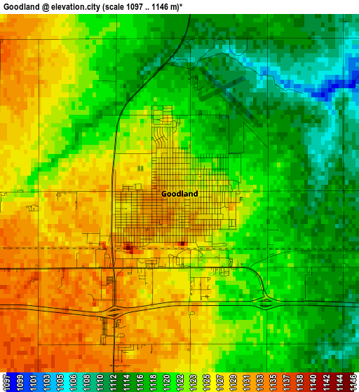
Below is the Elevation map of Goodland, which displays elevation range with different colors. Scale of the first map is from 1097 to 1146 m (3599 to 3760 ft) with average elevation of 1122.1 meters (=3681 ft) [note 1]
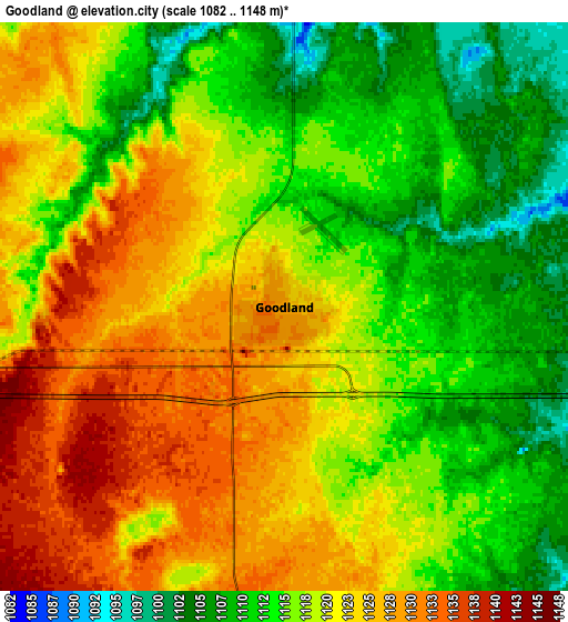
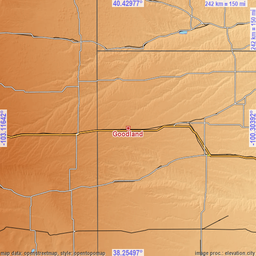
These maps also provides idea of topography and contour of this city, they are displayed at different zoom levels. More info about maps, scale and edge coordinates you can find below images.
| \ | Map #1 | Map #2 | Topo.Map |
| Scale [m] | 1097..1146 m | 1082..1148 m | × |
| Scale [ft] | 3599..3760 ft | 3550..3766 ft | × |
| Average | 1122.1 m = 3681 ft | 1118.8 m = 3671 ft | × |
| Width | 7.56 km = 4.7 mi | 15.11 km = 9.4 mi | 241.8 km = 150.2 mi |
| Height | 7.56 km = 4.7 mi | 15.11 km = 9.4 mi | 241.8 km = 150.2 mi |
| ↑Max Latitude | 39.384804° | 39.418761° | 40.42977° |
| Latitude at center | 39.35083° | 39.35083° | 39.35083° |
| ↓Min Latitude | 39.31684° | 39.282833° | 38.25497° |
| ← Min Longitude | -101.754115° | -101.798061° | -103.11642° |
| Longitude center | -101.71017° | -101.71017° | -101.71017° |
| →Max Longitude | -101.666225° | -101.622279° | -100.30392° |
Nearby cities:
Cities around Goodland sort by population:
• Colby elevation 967 m
56.8 km,  84°
84°
• Burlington 1273 m
48.4 km,  264°
264°
• Wray 1090 m
91.8 km,  331°
331°
• Oakley 936 m
76.8 km,  108°
108°
• Leoti 1014 m
101.5 km,  162°
162°
• Saint Francis 1012 m
47.5 km,  350°
350°
• Atwood 874 m
76.5 km,  48°
48°
• Hoxie 832 m
109.1 km,  89°
89°
• Benkelman 913 m
79.1 km,  11°
11°
• Cheyenne Wells 1315 m
80.9 km,  223°
223°
• Tribune 1105 m
98 km,  182°
182°
• Sharon Springs 1065 m
50.5 km, 184°
Multilingual:
 En español:
Goodland elevación 1129 m.
 En France:
Goodland élévation 1129 m.
 Auf Deutsch:
Goodland höhe über dem Meeresspiegel ist 1129 m.

Sources and notes:
- [note 1] Map square and city borders are not equal. Map elevation data is calculated only from area inside that square.
- [src 1] Elevation data from geonames database provided with same terms of usage.
- [src 2] The elevation map of Goodland is generated using elevation data from NASA's 3 arcsec (90m) resolution SRTM data.
- [src 3] Base (background) map © OpenStreetMap contributors tiles are generated by Geofabrik and OpenTopoMap.
Copyright & License:
This Goodland Elevation Map is licensed under CC BY-SA. You may reuse any part from this page, if you give a proper credit by linking to this URL:
 More info on terms of use page.