Littleton elevation
Littleton (Colorado, Arapahoe County), United States elevation is 1635 meters and Littleton elevation in feet is 5364 ft above sea level [src 1]. Littleton is a seat of a second-order administrative division (feature code) with elevation that is 1356 meters (4449 ft) bigger than average city elevation in United States.
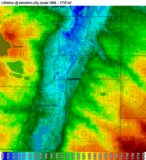
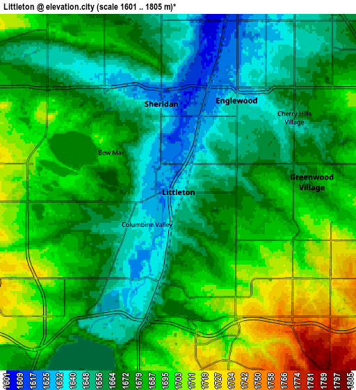
Below is the Elevation map of Littleton, which displays elevation range with different colors. Scale of the first map is from 1606 to 1718 m (5269 to 5636 ft) with average elevation of 1655.7 meters (=5432 ft) [note 1]
These maps also provides idea of topography and contour of this city, they are displayed at different zoom levels. More info about maps, scale and edge coordinates you can find below images.
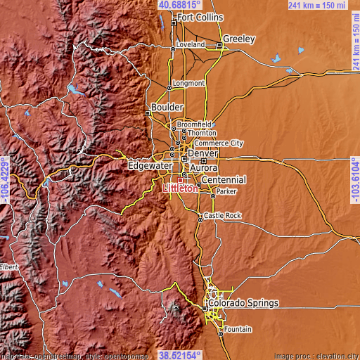
| \ | Map #1 | Map #2 | Topo.Map |
| Scale [m] | 1606..1718 m | 1601..1805 m | × |
| Scale [ft] | 5269..5636 ft | 5253..5922 ft | × |
| Average | 1655.7 m = 5432 ft | 1675.9 m = 5498 ft | × |
| Width | 7.53 km = 4.7 mi | 15.06 km = 9.4 mi | 240.9 km = 149.7 mi |
| Height | 7.53 km = 4.7 mi | 15.06 km = 9.4 mi | 240.9 km = 149.7 mi |
| ↑Max Latitude | 39.647166° | 39.680995° | 40.68815° |
| Latitude at center | 39.61332° | 39.61332° | 39.61332° |
| ↓Min Latitude | 39.579458° | 39.545579° | 38.52154° |
| ← Min Longitude | -105.060595° | -105.104541° | -106.4229° |
| Longitude center | -105.01665° | -105.01665° | -105.01665° |
| →Max Longitude | -104.972705° | -104.928759° | -103.6104° |
Nearby cities:
Cities around Littleton sort by population:
• Lakewood elevation 1682 m
11.6 km,  331°
331°
• Highlands Ranch 1741 m
7.7 km,  148°
148°
• Southglenn 1710 m
6.2 km,  117°
117°
• Englewood 1642 m
4.6 km,  32°
32°
• Ken Caryl 1761 m
9.2 km,  243°
243°
• Castlewood 1750 m
10.4 km,  107°
107°
• Columbine 1691 m
5.3 km, 237°
• Greenwood Village 1674 m
5.7 km,  85°
85°
• Cherry Hills Village 1658 m
5.8 km,  57°
57°
• Sheridan 1625 m
3.8 km,  348°
348°
• Holly Hills 1681 m
10.4 km,  54°
54°
• Columbine Valley 1635 m
1.9 km,  224°
224°
Multilingual:
 En español:
Littleton elevación 1635 m.
 En France:
Littleton élévation 1635 m.
 Auf Deutsch:
Littleton höhe über dem Meeresspiegel ist 1635 m.
 На русском:
Литтлтон, Литлтон высота над уровнем моря 1635 м
Sources and notes:
- [note 1] Map square and city borders are not equal. Map elevation data is calculated only from area inside that square.
- [src 1] Elevation data from geonames database provided with same terms of usage.
- [src 2] The elevation map of Littleton is generated using elevation data from NASA's 3 arcsec (90m) resolution SRTM data.
- [src 3] Base (background) map © OpenStreetMap contributors tiles are generated by Geofabrik and OpenTopoMap.
Copyright & License:
This Littleton Elevation Map is licensed under CC BY-SA. You may reuse any part from this page, if you give a proper credit by linking to this URL:
 More info on terms of use page.