Castle Rock elevation
Castle Rock (Colorado, Douglas County), United States elevation is 1903 meters and Castle Rock elevation in feet is 6243 ft above sea level [src 1]. Castle Rock is a seat of a second-order administrative division (feature code) with elevation that is 1624 meters (5328 ft) bigger than average city elevation in United States.
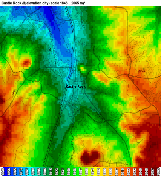
Below is the Elevation map of Castle Rock, which displays elevation range with different colors. Scale of the first map is from 1848 to 2065 m (6063 to 6775 ft) with average elevation of 1955 meters (=6414 ft) [note 1]
These maps also provides idea of topography and contour of this city, they are displayed at different zoom levels. More info about maps, scale and edge coordinates you can find below images.

| \ | Map #1 | Map #2 | Topo.Map |
| Scale [m] | 1848..2065 m | 1777..2267 m | × |
| Scale [ft] | 6063..6775 ft | 5830..7438 ft | × |
| Average | 1955 m = 6414 ft | 1954.1 m = 6411 ft | × |
| Width | 7.55 km = 4.7 mi | 15.11 km = 9.4 mi | 241.7 km = 150.2 mi |
| Height | 7.55 km = 4.7 mi | 15.11 km = 9.4 mi | 241.7 km = 150.2 mi |
| ↑Max Latitude | 39.406173° | 39.44012° | 40.45082° |
| Latitude at center | 39.37221° | 39.37221° | 39.37221° |
| ↓Min Latitude | 39.33823° | 39.304234° | 38.27668° |
| ← Min Longitude | -104.900035° | -104.943981° | -106.26234° |
| Longitude center | -104.85609° | -104.85609° | -104.85609° |
| →Max Longitude | -104.812145° | -104.768199° | -103.44984° |
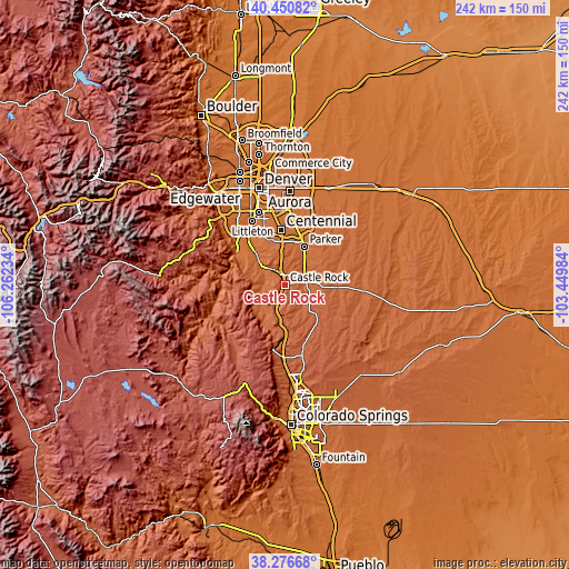
Nearby cities:
Cities around Castle Rock sort by population:
• Parker elevation 1795 m
18.2 km,  26°
26°
• Lone Tree 1779 m
20.1 km,  352°
352°
• The Pinery 1909 m
13.9 km,  48°
48°
• Castle Pines North 1949 m
11.6 km,  343°
343°
• Stonegate 1795 m
18.2 km,  14°
14°
• Castle Pines 2000 m
10.1 km, 340°
• Ponderosa Park 2037 m
18.1 km,  77°
77°
• Acres Green 1783 m
20.8 km, 350°
• Meridian 1815 m
18.6 km,  2°
2°
• Perry Park 1982 m
17.4 km,  222°
222°
• Elizabeth 1981 m
22.3 km,  93°
93°
• Carriage Club 1835 m
18.2 km, 347°
Multilingual:
 En español:
Castle Rock elevación 1903 m.
 En France:
Castle Rock élévation 1903 m.
 Auf Deutsch:
Castle Rock höhe über dem Meeresspiegel ist 1903 m.

Sources and notes:
- [note 1] Map square and city borders are not equal. Map elevation data is calculated only from area inside that square.
- [src 1] Elevation data from geonames database provided with same terms of usage.
- [src 2] The elevation map of Castle Rock is generated using elevation data from NASA's 3 arcsec (90m) resolution SRTM data.
- [src 3] Base (background) map © OpenStreetMap contributors tiles are generated by Geofabrik and OpenTopoMap.
Copyright & License:
This Castle Rock Elevation Map is licensed under CC BY-SA. You may reuse any part from this page, if you give a proper credit by linking to this URL:
 More info on terms of use page.