San Leandro elevation
San Leandro (California, Alameda County), United States elevation is 19 meters and San Leandro elevation in feet is 62 ft above sea level [src 1]. San Leandro is a populated place (feature code) with elevation that is 260 meters (853 ft) smaller than average city elevation in United States.
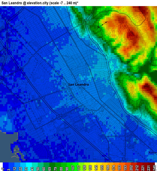
Below is the Elevation map of San Leandro, which displays elevation range with different colors. Scale of the first map is from -7 to 240 m (-23 to 787 ft) with average elevation of 36.7 meters (=120 ft) [note 1]
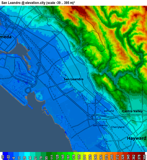
These maps also provides idea of topography and contour of this city, they are displayed at different zoom levels. More info about maps, scale and edge coordinates you can find below images.
| \ | Map #1 | Map #2 | Topo.Map |
| Scale [m] | -7..240 m | -39..395 m | × |
| Scale [ft] | -23..787 ft | -128..1296 ft | × |
| Average | 36.7 m = 120 ft | 72.1 m = 237 ft | × |
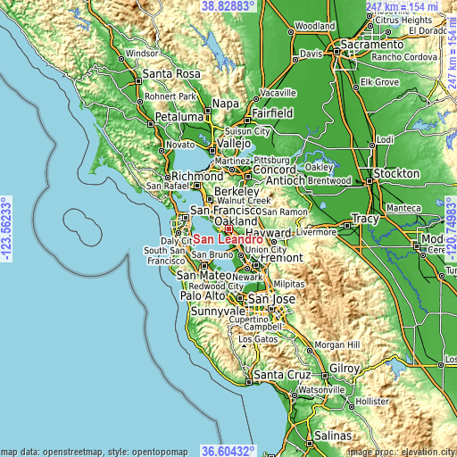
| Width | 7.73 km = 4.8 mi | 15.46 km = 9.6 mi | 247.3 km = 153.7 mi |
| Height | 7.73 km = 4.8 mi | 15.46 km = 9.6 mi | 247.3 km = 153.7 mi |
| ↑Max Latitude | 37.759681° | 37.794415° | 38.82883° |
| Latitude at center | 37.72493° | 37.72493° | 37.72493° |
| ↓Min Latitude | 37.690163° | 37.65538° | 36.60432° |
| ← Min Longitude | -122.200025° | -122.243971° | -123.56233° |
| Longitude center | -122.15608° | -122.15608° | -122.15608° |
| →Max Longitude | -122.112135° | -122.068189° | -120.74983° |
Nearby cities:
Cities around San Leandro sort by population:
• Oakland elevation 24 m
13.4 km,  311°
311°
• Hayward 32 m
9.1 km,  133°
133°
• Alameda 12 m
8.8 km,  300°
300°
• San Ramon 146 m
16.8 km,  68°
68°
• Castro Valley 49 m
7 km,  119°
119°
• San Lorenzo 10 m
5.6 km,  150°
150°
• Ashland 11 m
5 km, 132°
• Moraga 149 m
12.4 km,  10°
10°
• Cherryland 18 m
6.9 km,  137°
137°
• Emeryville 10 m
16.4 km,  316°
316°
• Piedmont 97 m
12.9 km,  329°
329°
• Fairview 174 m
11 km, 117°
Multilingual:
 En español:
San Leandro elevación 19 m.
 En France:
San Leandro élévation 19 m.
 Auf Deutsch:
San Leandro höhe über dem Meeresspiegel ist 19 m.

Sources and notes:
- [note 1] Map square and city borders are not equal. Map elevation data is calculated only from area inside that square.
- [src 1] Elevation data from geonames database provided with same terms of usage.
- [src 2] The elevation map of San Leandro is generated using elevation data from NASA's 3 arcsec (90m) resolution SRTM data.
- [src 3] Base (background) map © OpenStreetMap contributors tiles are generated by Geofabrik and OpenTopoMap.
Copyright & License:
This San Leandro Elevation Map is licensed under CC BY-SA. You may reuse any part from this page, if you give a proper credit by linking to this URL:
 More info on terms of use page.