Rohnert Park elevation
Rohnert Park (California, Sonoma County), United States elevation is 31 meters and Rohnert Park elevation in feet is 102 ft above sea level [src 1]. Rohnert Park is a populated place (feature code) with elevation that is 248 meters (814 ft) smaller than average city elevation in United States.
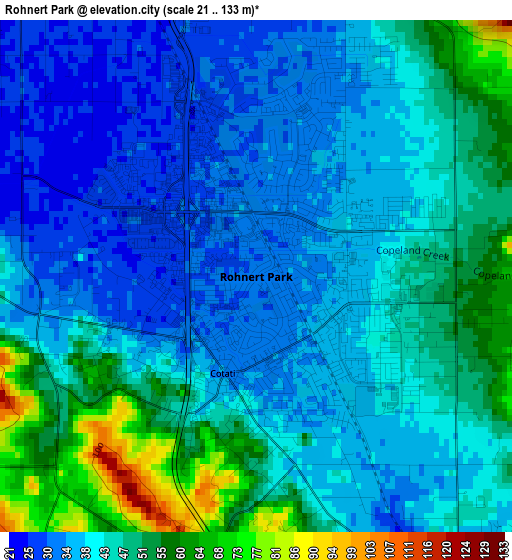
Below is the Elevation map of Rohnert Park, which displays elevation range with different colors. Scale of the first map is from 21 to 133 m (69 to 436 ft) with average elevation of 42.3 meters (=139 ft) [note 1]
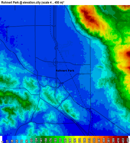
These maps also provides idea of topography and contour of this city, they are displayed at different zoom levels. More info about maps, scale and edge coordinates you can find below images.
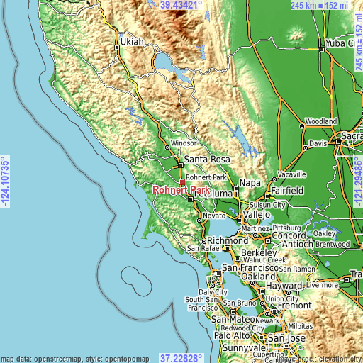
| \ | Map #1 | Map #2 | Topo.Map |
| Scale [m] | 21..133 m | 4..450 m | × |
| Scale [ft] | 69..436 ft | 13..1476 ft | × |
| Average | 42.3 m = 139 ft | 81.4 m = 267 ft | × |
| Width | 7.66 km = 4.8 mi | 15.33 km = 9.5 mi | 245.3 km = 152.4 mi |
| Height | 7.67 km = 4.8 mi | 15.33 km = 9.5 mi | 245.3 km = 152.4 mi |
| ↑Max Latitude | 38.3741° | 38.408544° | 39.43421° |
| Latitude at center | 38.33964° | 38.33964° | 38.33964° |
| ↓Min Latitude | 38.305163° | 38.27067° | 37.22828° |
| ← Min Longitude | -122.745045° | -122.788991° | -124.10735° |
| Longitude center | -122.7011° | -122.7011° | -122.7011° |
| →Max Longitude | -122.657155° | -122.613209° | -121.29485° |
Nearby cities:
Cities around Rohnert Park sort by population:
• Santa Rosa elevation 55 m
11.3 km,  354°
354°
• Petaluma 4 m
13.2 km,  154°
154°
• Sebastopol 26 m
12.8 km,  302°
302°
• Cotati 34 m
1.5 km,  200°
200°
• Boyes Hot Springs 43 m
19.3 km,  98°
98°
• Roseland 43 m
9.5 km, 345°
• Fetters Hot Springs-Agua Caliente 51 m
18.8 km, 96°
• El Verano 33 m
18.9 km, 104°
• Penngrove 27 m
5.4 km, 145°
• Graton 30 m
18.2 km,  306°
306°
• Eldridge 63 m
16.6 km,  86°
86°
• Kenwood 127 m
15.8 km,  58°
58°
Multilingual:
 En español:
Rohnert Park elevación 31 m.
 En France:
Rohnert Park élévation 31 m.
 Auf Deutsch:
Rohnert Park höhe über dem Meeresspiegel ist 31 m.

Sources and notes:
- [note 1] Map square and city borders are not equal. Map elevation data is calculated only from area inside that square.
- [src 1] Elevation data from geonames database provided with same terms of usage.
- [src 2] The elevation map of Rohnert Park is generated using elevation data from NASA's 3 arcsec (90m) resolution SRTM data.
- [src 3] Base (background) map © OpenStreetMap contributors tiles are generated by Geofabrik and OpenTopoMap.
Copyright & License:
This Rohnert Park Elevation Map is licensed under CC BY-SA. You may reuse any part from this page, if you give a proper credit by linking to this URL:
 More info on terms of use page.