Perris elevation
Perris (California, Riverside County), United States elevation is 445 meters and Perris elevation in feet is 1460 ft above sea level [src 1]. Perris is a populated place (feature code) with elevation that is 166 meters (545 ft) bigger than average city elevation in United States.
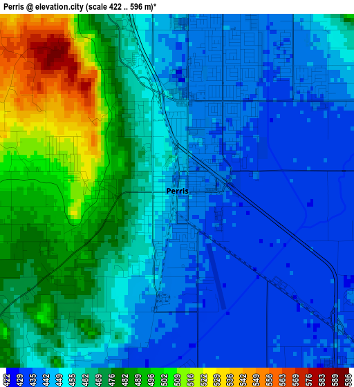
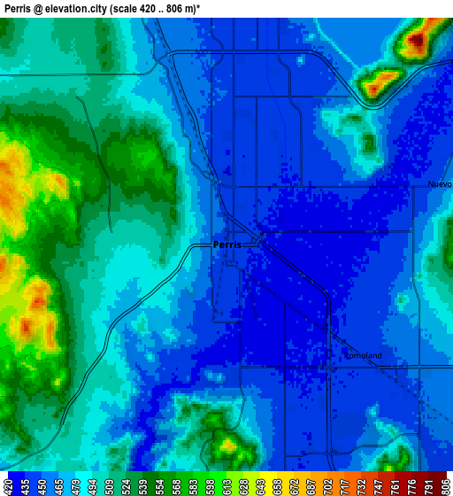
Below is the Elevation map of Perris, which displays elevation range with different colors. Scale of the first map is from 422 to 596 m (1385 to 1955 ft) with average elevation of 460.7 meters (=1511 ft) [note 1]
These maps also provides idea of topography and contour of this city, they are displayed at different zoom levels. More info about maps, scale and edge coordinates you can find below images.
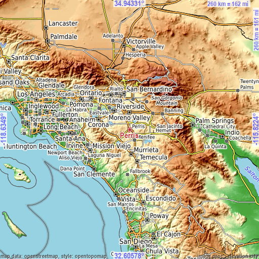
| \ | Map #1 | Map #2 | Topo.Map |
| Scale [m] | 422..596 m | 420..806 m | × |
| Scale [ft] | 1385..1955 ft | 1378..2644 ft | × |
| Average | 460.7 m = 1511 ft | 484.7 m = 1590 ft | × |
| Width | 8.12 km = 5 mi | 16.25 km = 10.1 mi | 259.9 km = 161.5 mi |
| Height | 8.12 km = 5 mi | 16.24 km = 10.1 mi | 259.9 km = 161.5 mi |
| ↑Max Latitude | 33.819038° | 33.855539° | 34.94331° |
| Latitude at center | 33.78252° | 33.78252° | 33.78252° |
| ↓Min Latitude | 33.745987° | 33.709438° | 32.60578° |
| ← Min Longitude | -117.272595° | -117.316541° | -118.6349° |
| Longitude center | -117.22865° | -117.22865° | -117.22865° |
| →Max Longitude | -117.184705° | -117.140759° | -115.8224° |
Nearby cities:
Cities around Perris sort by population:
• Menifee elevation 452 m
9.7 km,  128°
128°
• Sun City 440 m
8.7 km,  160°
160°
• Mead Valley 507 m
8.4 km,  312°
312°
• Canyon Lake 422 m
11.6 km,  200°
200°
• Good Hope 474 m
4.1 km,  240°
240°
• Nuevo 456 m
7.9 km,  74°
74°
• Homeland 492 m
11.9 km,  111°
111°
• Meadowbrook 499 m
8.2 km,  219°
219°
• Lakeview 446 m
12 km,  58°
58°
• Romoland 442 m
6.4 km, 129°
• Quail Valley 473 m
8.5 km,  190°
190°
• March Air Force Base 469 m
12.6 km,  345°
345°
Multilingual:
 En español:
Perris elevación 445 m.
 En France:
Perris élévation 445 m.


Sources and notes:
- [note 1] Map square and city borders are not equal. Map elevation data is calculated only from area inside that square.
- [src 1] Elevation data from geonames database provided with same terms of usage.
- [src 2] The elevation map of Perris is generated using elevation data from NASA's 3 arcsec (90m) resolution SRTM data.
- [src 3] Base (background) map © OpenStreetMap contributors tiles are generated by Geofabrik and OpenTopoMap.
Copyright & License:
This Perris Elevation Map is licensed under CC BY-SA. You may reuse any part from this page, if you give a proper credit by linking to this URL:
 More info on terms of use page.