Palo Alto elevation
Palo Alto (California, Santa Clara County), United States elevation is 10 meters and Palo Alto elevation in feet is 33 ft above sea level [src 1]. Palo Alto is a populated place (feature code) with elevation that is 269 meters (883 ft) smaller than average city elevation in United States.
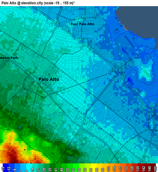
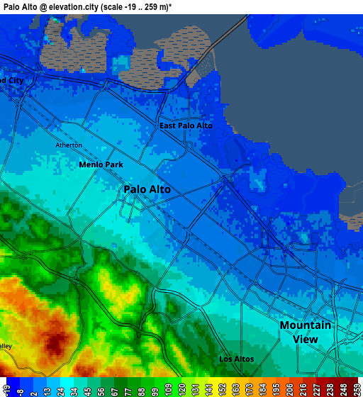
Below is the Elevation map of Palo Alto, which displays elevation range with different colors. Scale of the first map is from -19 to 155 m (-62 to 509 ft) with average elevation of 17 meters (=56 ft) [note 1]
These maps also provides idea of topography and contour of this city, they are displayed at different zoom levels. More info about maps, scale and edge coordinates you can find below images.
| \ | Map #1 | Map #2 | Topo.Map |
| Scale [m] | -19..155 m | -19..259 m | × |
| Scale [ft] | -62..509 ft | -62..850 ft | × |
| Average | 17 m = 56 ft | 39.1 m = 128 ft | × |
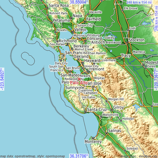
| Width | 7.76 km = 4.8 mi | 15.52 km = 9.6 mi | 248.3 km = 154.3 mi |
| Height | 7.76 km = 4.8 mi | 15.52 km = 9.6 mi | 248.3 km = 154.3 mi |
| ↑Max Latitude | 37.476763° | 37.51163° | 38.55004° |
| Latitude at center | 37.44188° | 37.44188° | 37.44188° |
| ↓Min Latitude | 37.406981° | 37.372065° | 36.31706° |
| ← Min Longitude | -122.186965° | -122.230911° | -123.54927° |
| Longitude center | -122.14302° | -122.14302° | -122.14302° |
| →Max Longitude | -122.099075° | -122.055129° | -120.73677° |
Nearby cities:
Cities around Palo Alto sort by population:
• Redwood City elevation 8 m
9.5 km,  300°
300°
• Mountain View 34 m
8.1 km,  139°
139°
• Menlo Park 20 m
3.7 km,  291°
291°
• Los Altos 47 m
6.8 km,  157°
157°
• East Palo Alto 3 m
3 km,  3°
3°
• North Fair Oaks 9 m
6 km,  307°
307°
• Stanford 30 m
2.8 km,  225°
225°
• Los Altos Hills 78 m
6.9 km,  175°
175°
• Atherton 19 m
5.3 km, 294°
• Woodside 118 m
9.9 km,  262°
262°
• West Menlo Park 35 m
5.4 km, 260°
• Ladera 92 m
6.8 km, 226°
Multilingual:
 En español:
Palo Alto elevación 10 m.
 En France:
Palo Alto élévation 10 m.
 Auf Deutsch:
Palo Alto höhe über dem Meeresspiegel ist 10 m.
 На русском:
Пало Альто, Пало-Альто высота над уровнем моря 10 м
Sources and notes:
- [note 1] Map square and city borders are not equal. Map elevation data is calculated only from area inside that square.
- [src 1] Elevation data from geonames database provided with same terms of usage.
- [src 2] The elevation map of Palo Alto is generated using elevation data from NASA's 3 arcsec (90m) resolution SRTM data.
- [src 3] Base (background) map © OpenStreetMap contributors tiles are generated by Geofabrik and OpenTopoMap.
Copyright & License:
This Palo Alto Elevation Map is licensed under CC BY-SA. You may reuse any part from this page, if you give a proper credit by linking to this URL:
 More info on terms of use page.