Murrieta Hot Springs elevation
Murrieta Hot Springs (California, Riverside County), United States elevation is 363 meters and Murrieta Hot Springs elevation in feet is 1191 ft above sea level [src 1]. Murrieta Hot Springs is a section of populated place (feature code) with elevation that is 84 meters (276 ft) bigger than average city elevation in United States.
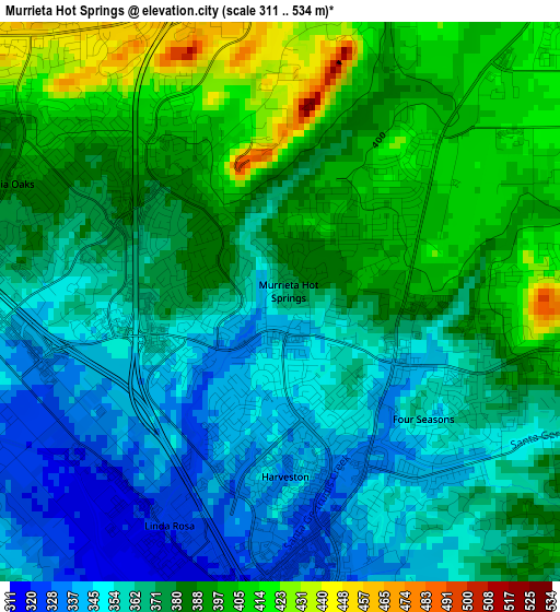
Below is the Elevation map of Murrieta Hot Springs, which displays elevation range with different colors. Scale of the first map is from 311 to 534 m (1020 to 1752 ft) with average elevation of 374.8 meters (=1230 ft) [note 1]
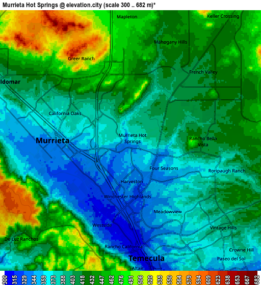
These maps also provides idea of topography and contour of this city, they are displayed at different zoom levels. More info about maps, scale and edge coordinates you can find below images.
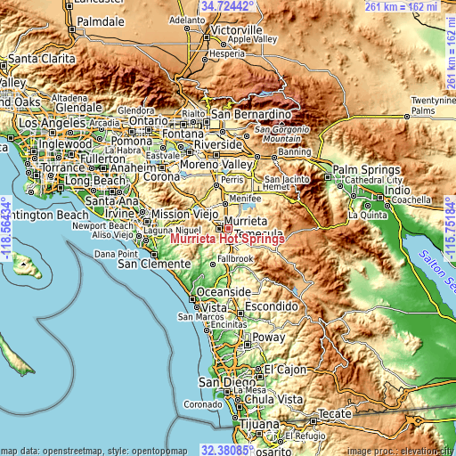
| \ | Map #1 | Map #2 | Topo.Map |
| Scale [m] | 311..534 m | 300..682 m | × |
| Scale [ft] | 1020..1752 ft | 984..2238 ft | × |
| Average | 374.8 m = 1230 ft | 414.4 m = 1360 ft | × |
| Width | 8.14 km = 5.1 mi | 16.29 km = 10.1 mi | 260.6 km = 161.9 mi |
| Height | 8.14 km = 5.1 mi | 16.29 km = 10.1 mi | 260.6 km = 161.9 mi |
| ↑Max Latitude | 33.597192° | 33.633788° | 34.72442° |
| Latitude at center | 33.56058° | 33.56058° | 33.56058° |
| ↓Min Latitude | 33.523953° | 33.48731° | 32.38085° |
| ← Min Longitude | -117.202035° | -117.245981° | -118.56434° |
| Longitude center | -117.15809° | -117.15809° | -117.15809° |
| →Max Longitude | -117.114145° | -117.070199° | -115.75184° |
Nearby cities:
Cities around Murrieta Hot Springs sort by population:
• Temecula elevation 308 m
7.5 km,  173°
173°
• Murrieta 336 m
5.2 km,  261°
261°
• Menifee 452 m
18.7 km,  3°
3°
• Lake Elsinore 397 m
19.7 km,  307°
307°
• Wildomar 385 m
12.1 km,  290°
290°
• Sun City 440 m
16.9 km,  347°
347°
• Lakeland Village 396 m
19.3 km,  296°
296°
• Canyon Lake 422 m
17.5 km,  322°
322°
• Sedco Hills 389 m
15.2 km, 306°
• Winchester 450 m
17.6 km,  22°
22°
• Rainbow 318 m
16.7 km,  176°
176°
• Quail Valley 473 m
18.2 km,  333°
333°
Multilingual:
 En español:
Murrieta Hot Springs elevación 363 m.
 En France:
Murrieta Hot Springs élévation 363 m.
 Auf Deutsch:
Murrieta Hot Springs höhe über dem Meeresspiegel ist 363 m.
 На русском:
Murrieta Hot Springs высота над уровнем моря 363 м
Sources and notes:
- [note 1] Map square and city borders are not equal. Map elevation data is calculated only from area inside that square.
- [src 1] Elevation data from geonames database provided with same terms of usage.
- [src 2] The elevation map of Murrieta Hot Springs is generated using elevation data from NASA's 3 arcsec (90m) resolution SRTM data.
- [src 3] Base (background) map © OpenStreetMap contributors tiles are generated by Geofabrik and OpenTopoMap.
Copyright & License:
This Murrieta Hot Springs Elevation Map is licensed under CC BY-SA. You may reuse any part from this page, if you give a proper credit by linking to this URL:
 More info on terms of use page.