Montara elevation
Montara (California, San Mateo County), United States elevation is 32 meters and Montara elevation in feet is 105 ft above sea level [src 1]. Montara is a populated place (feature code) with elevation that is 247 meters (810 ft) smaller than average city elevation in United States.
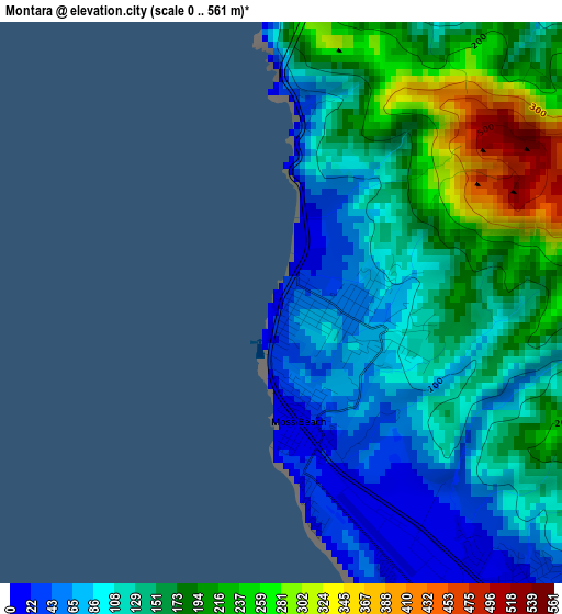
Below is the Elevation map of Montara, which displays elevation range with different colors. Scale of the first map is from 0 to 561 m (0 to 1841 ft) with average elevation of 144.1 meters (=473 ft) [note 1]
These maps also provides idea of topography and contour of this city, they are displayed at different zoom levels. More info about maps, scale and edge coordinates you can find below images.
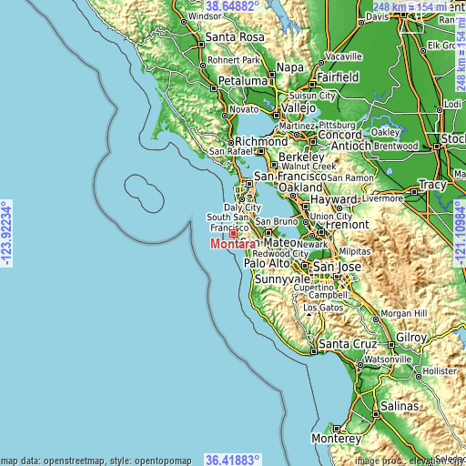
| \ | Map #1 | Topo.Map |
| Scale [m] | 0..561 m | × |
| Scale [ft] | 0..1841 ft | × |
| Average | 144.1 m = 473 ft | × |
| Width | 7.75 km = 4.8 mi | 248 km = 154.1 mi |
| Height | 7.75 km = 4.8 mi | 247.9 km = 154 mi |
| ↑Max Latitude | 37.576996° | 38.64882° |
| Latitude at center | 37.54216° | 37.54216° |
| ↓Min Latitude | 37.507307° | 36.41883° |
| ← Min Longitude | -122.560035° | -123.92234° |
| Longitude center | -122.51609° | -122.51609° |
| →Max Longitude | -122.472145° | -121.10984° |
Nearby cities:
Cities around Montara sort by population:
• South San Francisco elevation 5 m
15.7 km,  37°
37°
• San Bruno 5 m
13.5 km, 43°
• Pacifica 25 m
8.4 km,  17°
17°
• Burlingame 12 m
14 km,  70°
70°
• Millbrae 10 m
13 km,  61°
61°
• Half Moon Bay 21 m
11.7 km,  138°
138°
• Hillsborough 93 m
12.6 km, 73°
• El Granada 10 m
6 km, 136°
• Broadmoor 111 m
16.3 km,  10°
10°
• Highlands-Baywood Park 182 m
15.2 km,  98°
98°
• Moss Beach 17 m
1.7 km,  171°
171°
• Colma 36 m
15.8 km, 18°
Multilingual:
 En español:
Montara elevación 32 m.
 En France:
Montara élévation 32 m.


Sources and notes:
- [note 1] Map square and city borders are not equal. Map elevation data is calculated only from area inside that square.
- [src 1] Elevation data from geonames database provided with same terms of usage.
- [src 2] The elevation map of Montara is generated using elevation data from NASA's 3 arcsec (90m) resolution SRTM data.
- [src 3] Base (background) map © OpenStreetMap contributors tiles are generated by Geofabrik and OpenTopoMap.
Copyright & License:
This Montara Elevation Map is licensed under CC BY-SA. You may reuse any part from this page, if you give a proper credit by linking to this URL:
 More info on terms of use page.