Hacienda Heights elevation
Hacienda Heights (California, Los Angeles County), United States elevation is 138 meters and Hacienda Heights elevation in feet is 453 ft above sea level [src 1]. Hacienda Heights is a populated place (feature code) with elevation that is 141 meters (463 ft) smaller than average city elevation in United States.
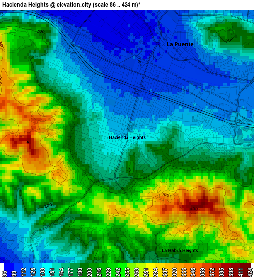
Below is the Elevation map of Hacienda Heights, which displays elevation range with different colors. Scale of the first map is from 86 to 424 m (282 to 1391 ft) with average elevation of 190.3 meters (=624 ft) [note 1]
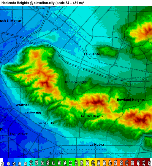
These maps also provides idea of topography and contour of this city, they are displayed at different zoom levels. More info about maps, scale and edge coordinates you can find below images.
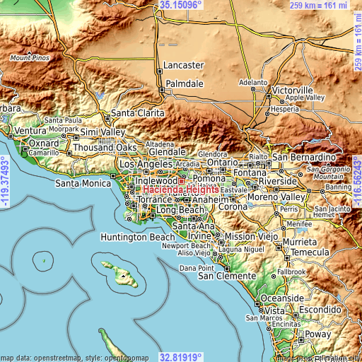
| \ | Map #1 | Map #2 | Topo.Map |
| Scale [m] | 86..424 m | 34..431 m | × |
| Scale [ft] | 282..1391 ft | 112..1414 ft | × |
| Average | 190.3 m = 624 ft | 144.8 m = 475 ft | × |
| Width | 8.1 km = 5 mi | 16.2 km = 10.1 mi | 259.3 km = 161.1 mi |
| Height | 8.1 km = 5 mi | 16.2 km = 10.1 mi | 259.3 km = 161.1 mi |
| ↑Max Latitude | 34.029497° | 34.065909° | 35.15096° |
| Latitude at center | 33.99307° | 33.99307° | 33.99307° |
| ↓Min Latitude | 33.956627° | 33.920168° | 32.81919° |
| ← Min Longitude | -118.012625° | -118.056571° | -119.37493° |
| Longitude center | -117.96868° | -117.96868° | -117.96868° |
| →Max Longitude | -117.924735° | -117.880789° | -116.56243° |
Nearby cities:
Cities around Hacienda Heights sort by population:
• West Covina elevation 120 m
8.8 km,  18°
18°
• Whittier 117 m
6.1 km,  255°
255°
• La Habra 92 m
7.1 km,  163°
163°
• South Whittier 46 m
8.1 km,  233°
233°
• Rowland Heights 163 m
6.1 km,  107°
107°
• La Puente 107 m
3.5 km,  30°
30°
• Valinda 106 m
6.2 km, 21°
• West Puente Valley 100 m
6.5 km,  0°
0°
• South San Jose Hills 127 m
6.3 km,  69°
69°
• Avocado Heights 102 m
5.2 km,  336°
336°
• East La Mirada 75 m
7.9 km,  193°
193°
• La Habra Heights 227 m
4 km, 155°
Multilingual:
 En español:
Hacienda Heights elevación 138 m.
 En France:
Hacienda Heights élévation 138 m.
 Auf Deutsch:
Hacienda Heights höhe über dem Meeresspiegel ist 138 m.

Sources and notes:
- [note 1] Map square and city borders are not equal. Map elevation data is calculated only from area inside that square.
- [src 1] Elevation data from geonames database provided with same terms of usage.
- [src 2] The elevation map of Hacienda Heights is generated using elevation data from NASA's 3 arcsec (90m) resolution SRTM data.
- [src 3] Base (background) map © OpenStreetMap contributors tiles are generated by Geofabrik and OpenTopoMap.
Copyright & License:
This Hacienda Heights Elevation Map is licensed under CC BY-SA. You may reuse any part from this page, if you give a proper credit by linking to this URL:
 More info on terms of use page.