Glendora elevation
Glendora (California, Los Angeles County), United States elevation is 239 meters and Glendora elevation in feet is 784 ft above sea level [src 1]. Glendora is a populated place (feature code) with elevation that is 40 meters (131 ft) smaller than average city elevation in United States.
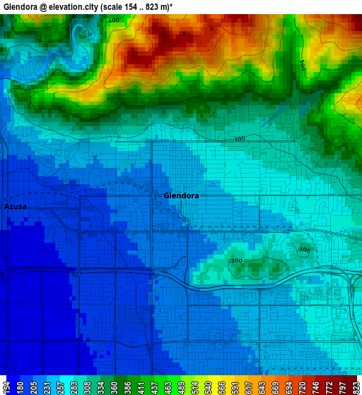
Below is the Elevation map of Glendora, which displays elevation range with different colors. Scale of the first map is from 154 to 823 m (505 to 2700 ft) with average elevation of 307.5 meters (=1009 ft) [note 1]
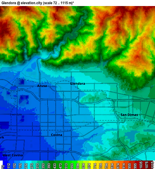
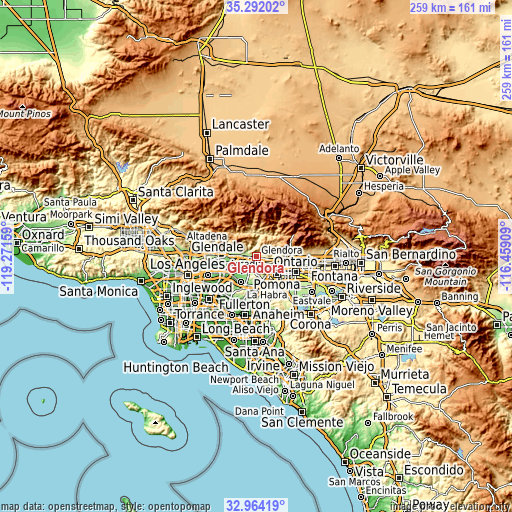
These maps also provides idea of topography and contour of this city, they are displayed at different zoom levels. More info about maps, scale and edge coordinates you can find below images.
| \ | Map #1 | Map #2 | Topo.Map |
| Scale [m] | 154..823 m | 72..1115 m | × |
| Scale [ft] | 505..2700 ft | 236..3658 ft | × |
| Average | 307.5 m = 1009 ft | 398.5 m = 1307 ft | × |
| Width | 8.09 km = 5 mi | 16.18 km = 10.1 mi | 258.8 km = 160.8 mi |
| Height | 8.09 km = 5 mi | 16.18 km = 10.1 mi | 258.8 km = 160.8 mi |
| ↑Max Latitude | 34.172486° | 34.208836° | 35.29202° |
| Latitude at center | 34.13612° | 34.13612° | 34.13612° |
| ↓Min Latitude | 34.099738° | 34.063341° | 32.96419° |
| ← Min Longitude | -117.909285° | -117.953231° | -119.27159° |
| Longitude center | -117.86534° | -117.86534° | -117.86534° |
| →Max Longitude | -117.821395° | -117.777449° | -116.45909° |
Nearby cities:
Cities around Glendora sort by population:
• West Covina elevation 120 m
10.1 km,  222°
222°
• Baldwin Park 115 m
10.5 km,  237°
237°
• Azusa 187 m
3.9 km,  265°
265°
• Covina 170 m
5.6 km,  204°
204°
• San Dimas 295 m
6.3 km,  121°
121°
• La Verne 328 m
9.8 km,  113°
113°
• Duarte 155 m
10.3 km, 272°
• Vincent 141 m
6.8 km,  232°
232°
• Citrus 179 m
3.4 km, 225°
• Charter Oak 233 m
4.1 km,  154°
154°
• Irwindale 144 m
7.2 km, 243°
• Bradbury 208 m
9.8 km,  277°
277°
Multilingual:
 En español:
Glendora elevación 239 m.
 En France:
Glendora élévation 239 m.
 Auf Deutsch:
Glendora höhe über dem Meeresspiegel ist 239 m.

Sources and notes:
- [note 1] Map square and city borders are not equal. Map elevation data is calculated only from area inside that square.
- [src 1] Elevation data from geonames database provided with same terms of usage.
- [src 2] The elevation map of Glendora is generated using elevation data from NASA's 3 arcsec (90m) resolution SRTM data.
- [src 3] Base (background) map © OpenStreetMap contributors tiles are generated by Geofabrik and OpenTopoMap.
Copyright & License:
This Glendora Elevation Map is licensed under CC BY-SA. You may reuse any part from this page, if you give a proper credit by linking to this URL:
 More info on terms of use page.