Foothill Ranch elevation
Foothill Ranch (California, Orange County), United States elevation is 280 meters and Foothill Ranch elevation in feet is 919 ft above sea level [src 1]. Foothill Ranch is a section of populated place (feature code) with elevation that is 1 meters (3 ft) bigger than average city elevation in United States.
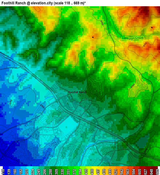
Below is the Elevation map of Foothill Ranch, which displays elevation range with different colors. Scale of the first map is from 118 to 669 m (387 to 2195 ft) with average elevation of 305.3 meters (=1002 ft) [note 1]
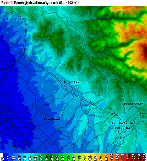
These maps also provides idea of topography and contour of this city, they are displayed at different zoom levels. More info about maps, scale and edge coordinates you can find below images.
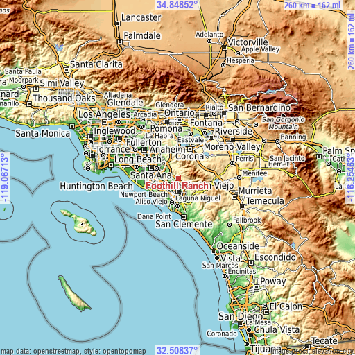
| \ | Map #1 | Map #2 | Topo.Map |
| Scale [m] | 118..669 m | 63..1302 m | × |
| Scale [ft] | 387..2195 ft | 207..4272 ft | × |
| Average | 305.3 m = 1002 ft | 322.8 m = 1059 ft | × |
| Width | 8.13 km = 5.1 mi | 16.26 km = 10.1 mi | 260.2 km = 161.7 mi |
| Height | 8.13 km = 5.1 mi | 16.26 km = 10.1 mi | 260.2 km = 161.7 mi |
| ↑Max Latitude | 33.722968° | 33.759511° | 34.84852° |
| Latitude at center | 33.68641° | 33.68641° | 33.68641° |
| ↓Min Latitude | 33.649836° | 33.613246° | 32.50837° |
| ← Min Longitude | -117.704825° | -117.748771° | -119.06713° |
| Longitude center | -117.66088° | -117.66088° | -117.66088° |
| →Max Longitude | -117.616935° | -117.572989° | -116.25463° |
Nearby cities:
Cities around Foothill Ranch sort by population:
• Irvine elevation 22 m
15.1 km,  262°
262°
• Mission Viejo 127 m
9.7 km,  186°
186°
• Lake Forest 150 m
5.1 km,  210°
210°
• Aliso Viejo 133 m
14.8 km,  204°
204°
• Rancho Santa Margarita 285 m
7.4 km,  133°
133°
• Laguna Hills 112 m
9.5 km, 210°
• Ladera Ranch 164 m
13.1 km,  169°
169°
• Laguna Woods 117 m
10.4 km,  215°
215°
• Coto De Caza 217 m
11.4 km,  143°
143°
• Portola Hills 388 m
2.9 km,  106°
106°
• Las Flores 211 m
11.4 km,  163°
163°
• Trabuco Canyon 319 m
7 km, 112°
Multilingual:
 En español:
Foothill Ranch elevación 280 m.
 En France:
Foothill Ranch élévation 280 m.
 Auf Deutsch:
Foothill Ranch höhe über dem Meeresspiegel ist 280 m.

Sources and notes:
- [note 1] Map square and city borders are not equal. Map elevation data is calculated only from area inside that square.
- [src 1] Elevation data from geonames database provided with same terms of usage.
- [src 2] The elevation map of Foothill Ranch is generated using elevation data from NASA's 3 arcsec (90m) resolution SRTM data.
- [src 3] Base (background) map © OpenStreetMap contributors tiles are generated by Geofabrik and OpenTopoMap.
Copyright & License:
This Foothill Ranch Elevation Map is licensed under CC BY-SA. You may reuse any part from this page, if you give a proper credit by linking to this URL:
 More info on terms of use page.