East San Gabriel elevation
East San Gabriel (California, Los Angeles County), United States elevation is 114 meters and East San Gabriel elevation in feet is 374 ft above sea level [src 1]. East San Gabriel is a section of populated place (feature code) with elevation that is 165 meters (541 ft) smaller than average city elevation in United States.
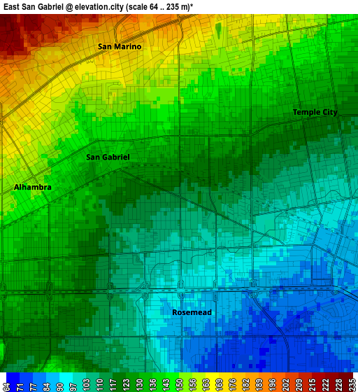
Below is the Elevation map of East San Gabriel, which displays elevation range with different colors. Scale of the first map is from 64 to 235 m (210 to 771 ft) with average elevation of 125.6 meters (=412 ft) [note 1]
These maps also provides idea of topography and contour of this city, they are displayed at different zoom levels. More info about maps, scale and edge coordinates you can find below images.
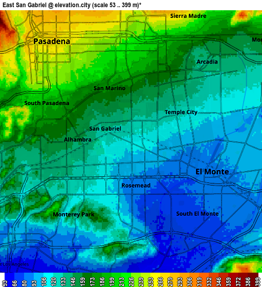
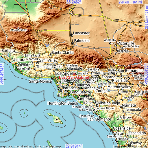
| \ | Map #1 | Map #2 | Topo.Map |
| Scale [m] | 64..235 m | 53..399 m | × |
| Scale [ft] | 210..771 ft | 174..1309 ft | × |
| Average | 125.6 m = 412 ft | 144.5 m = 474 ft | × |
| Width | 8.09 km = 5 mi | 16.19 km = 10.1 mi | 259 km = 160.9 mi |
| Height | 8.09 km = 5 mi | 16.19 km = 10.1 mi | 259 km = 160.9 mi |
| ↑Max Latitude | 34.128065° | 34.164435° | 35.2482° |
| Latitude at center | 34.09168° | 34.09168° | 34.09168° |
| ↓Min Latitude | 34.055279° | 34.018863° | 32.91914° |
| ← Min Longitude | -118.135125° | -118.179071° | -119.49743° |
| Longitude center | -118.09118° | -118.09118° | -118.09118° |
| →Max Longitude | -118.047235° | -118.003289° | -116.68493° |
Nearby cities:
Cities around East San Gabriel sort by population:
• El Monte elevation 91 m
6.4 km,  113°
113°
• Alhambra 153 m
3.3 km,  276°
276°
• Monterey Park 118 m
4.4 km,  221°
221°
• Rosemead 96 m
2.1 km,  126°
126°
• San Gabriel 129 m
1.4 km,  290°
290°
• Temple City 126 m
3.5 km,  60°
60°
• South Pasadena 202 m
6.1 km,  296°
296°
• South El Monte 76 m
6 km,  137°
137°
• San Marino 177 m
3.6 km,  336°
336°
• South San Gabriel 110 m
4.7 km,  183°
183°
• East Pasadena 193 m
5.4 km,  17°
17°
• North El Monte 103 m
6.3 km,  78°
78°
Multilingual:
 En español:
East San Gabriel elevación 114 m.
 En France:
East San Gabriel élévation 114 m.
 Auf Deutsch:
East San Gabriel höhe über dem Meeresspiegel ist 114 m.

Sources and notes:
- [note 1] Map square and city borders are not equal. Map elevation data is calculated only from area inside that square.
- [src 1] Elevation data from geonames database provided with same terms of usage.
- [src 2] The elevation map of East San Gabriel is generated using elevation data from NASA's 3 arcsec (90m) resolution SRTM data.
- [src 3] Base (background) map © OpenStreetMap contributors tiles are generated by Geofabrik and OpenTopoMap.
Copyright & License:
This East San Gabriel Elevation Map is licensed under CC BY-SA. You may reuse any part from this page, if you give a proper credit by linking to this URL:
 More info on terms of use page.