Citrus Heights elevation
Citrus Heights (California, Sacramento County), United States elevation is 52 meters and Citrus Heights elevation in feet is 171 ft above sea level [src 1]. Citrus Heights is a populated place (feature code) with elevation that is 227 meters (745 ft) smaller than average city elevation in United States.
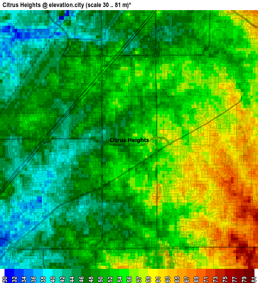
Below is the Elevation map of Citrus Heights, which displays elevation range with different colors. Scale of the first map is from 30 to 81 m (98 to 266 ft) with average elevation of 51.1 meters (=168 ft) [note 1]
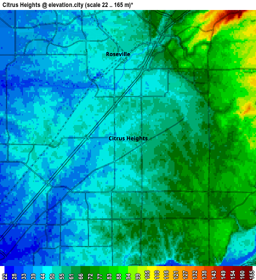
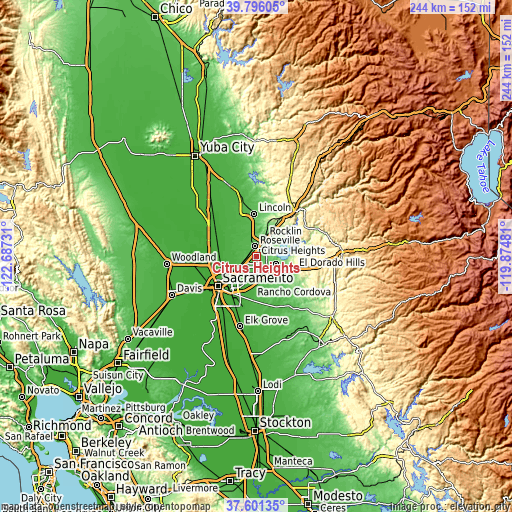
These maps also provides idea of topography and contour of this city, they are displayed at different zoom levels. More info about maps, scale and edge coordinates you can find below images.
| \ | Map #1 | Map #2 | Topo.Map |
| Scale [m] | 30..81 m | 22..165 m | × |
| Scale [ft] | 98..266 ft | 72..541 ft | × |
| Average | 51.1 m = 168 ft | 56.2 m = 184 ft | × |
| Width | 7.63 km = 4.7 mi | 15.25 km = 9.5 mi | 244 km = 151.6 mi |
| Height | 7.63 km = 4.7 mi | 15.25 km = 9.5 mi | 244 km = 151.6 mi |
| ↑Max Latitude | 38.741405° | 38.775673° | 39.79605° |
| Latitude at center | 38.70712° | 38.70712° | 38.70712° |
| ↓Min Latitude | 38.672819° | 38.638501° | 37.60135° |
| ← Min Longitude | -121.325005° | -121.368951° | -122.68731° |
| Longitude center | -121.28106° | -121.28106° | -121.28106° |
| →Max Longitude | -121.237115° | -121.193169° | -119.87481° |
Nearby cities:
Cities around Citrus Heights sort by population:
• Roseville elevation 51 m
5 km,  353°
353°
• Folsom 66 m
9.7 km,  109°
109°
• Rancho Cordova 28 m
13.3 km,  188°
188°
• Carmichael 39 m
10.8 km,  202°
202°
• Rocklin 76 m
10.1 km,  22°
22°
• Antelope 49 m
4.2 km,  271°
271°
• North Highlands 30 m
8.3 km,  253°
253°
• Orangevale 74 m
5.8 km,  123°
123°
• Foothill Farms 41 m
6.9 km,  242°
242°
• Fair Oaks 58 m
7 km,  173°
173°
• Granite Bay 132 m
11.9 km,  58°
58°
• Gold River 37 m
9.5 km,  161°
161°
Multilingual:
 En español:
Citrus Heights elevación 52 m.
 En France:
Citrus Heights élévation 52 m.
 Auf Deutsch:
Citrus Heights höhe über dem Meeresspiegel ist 52 m.

Sources and notes:
- [note 1] Map square and city borders are not equal. Map elevation data is calculated only from area inside that square.
- [src 1] Elevation data from geonames database provided with same terms of usage.
- [src 2] The elevation map of Citrus Heights is generated using elevation data from NASA's 3 arcsec (90m) resolution SRTM data.
- [src 3] Base (background) map © OpenStreetMap contributors tiles are generated by Geofabrik and OpenTopoMap.
Copyright & License:
This Citrus Heights Elevation Map is licensed under CC BY-SA. You may reuse any part from this page, if you give a proper credit by linking to this URL:
 More info on terms of use page.