Atascadero elevation
Atascadero (California, San Luis Obispo County), United States elevation is 269 meters and Atascadero elevation in feet is 883 ft above sea level [src 1]. Atascadero is a populated place (feature code) with elevation that is 10 meters (33 ft) smaller than average city elevation in United States.
Below is the Elevation map of Atascadero, which displays elevation range with different colors. Scale of the first map is from 237 to 523 m (778 to 1716 ft) with average elevation of 304 meters (=997 ft) [note 1]
These maps also provides idea of topography and contour of this city, they are displayed at different zoom levels. More info about maps, scale and edge coordinates you can find below images.
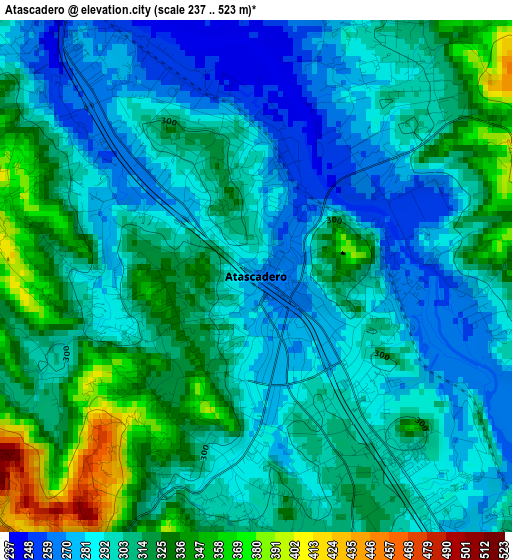
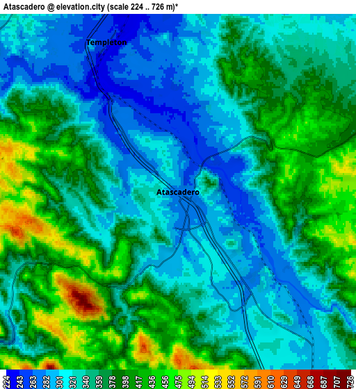
| \ | Map #1 | Map #2 | Topo.Map |
| Scale [m] | 237..523 m | 224..726 m | × |
| Scale [ft] | 778..1716 ft | 735..2382 ft | × |
| Average | 304 m = 997 ft | 356 m = 1168 ft | × |
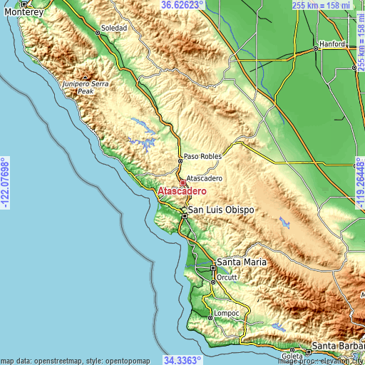
| Width | 7.96 km = 4.9 mi | 15.91 km = 9.9 mi | 254.6 km = 158.2 mi |
| Height | 7.96 km = 4.9 mi | 15.91 km = 9.9 mi | 254.6 km = 158.2 mi |
| ↑Max Latitude | 35.525193° | 35.560951° | 36.62623° |
| Latitude at center | 35.48942° | 35.48942° | 35.48942° |
| ↓Min Latitude | 35.453631° | 35.417826° | 34.3363° |
| ← Min Longitude | -120.714675° | -120.758621° | -122.07698° |
| Longitude center | -120.67073° | -120.67073° | -120.67073° |
| →Max Longitude | -120.626785° | -120.582839° | -119.26448° |
Nearby cities:
Cities around Atascadero sort by population:
• San Luis Obispo elevation 74 m
23 km,  177°
177°
• Paso Robles 231 m
15.4 km,  353°
353°
• Los Osos 42 m
24.7 km,  216°
216°
• Morro Bay 21 m
21.3 km,  229°
229°
• Templeton 249 m
7.4 km,  334°
334°
• Cambria 20 m
38 km,  282°
282°
• Cayucos 20 m
20.7 km,  255°
255°
• Lake Nacimiento 296 m
32.6 km,  324°
324°
• San Miguel 192 m
29.3 km,  355°
355°
• Avila Beach 25 m
34.9 km,  189°
189°
• Shandon 318 m
32.5 km,  55°
55°
• Santa Margarita 308 m
12.4 km,  153°
153°
Multilingual:
 En español:
Atascadero elevación 269 m.
 En France:
Atascadero élévation 269 m.
 Auf Deutsch:
Atascadero höhe über dem Meeresspiegel ist 269 m.

Sources and notes:
- [note 1] Map square and city borders are not equal. Map elevation data is calculated only from area inside that square.
- [src 1] Elevation data from geonames database provided with same terms of usage.
- [src 2] The elevation map of Atascadero is generated using elevation data from NASA's 3 arcsec (90m) resolution SRTM data.
- [src 3] Base (background) map © OpenStreetMap contributors tiles are generated by Geofabrik and OpenTopoMap.
Copyright & License:
This Atascadero Elevation Map is licensed under CC BY-SA. You may reuse any part from this page, if you give a proper credit by linking to this URL:
 More info on terms of use page.