Deer Valley elevation
Deer Valley (Arizona, Maricopa County), United States elevation is 416 meters and Deer Valley elevation in feet is 1365 ft above sea level [src 1]. Deer Valley is a populated place (feature code) with elevation that is 137 meters (449 ft) bigger than average city elevation in United States.
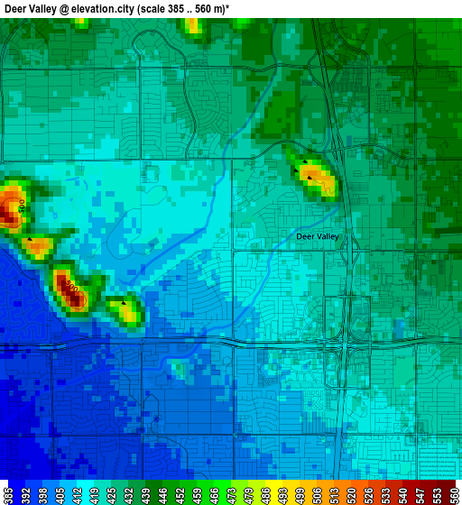
Below is the Elevation map of Deer Valley, which displays elevation range with different colors. Scale of the first map is from 385 to 560 m (1263 to 1837 ft) with average elevation of 421.5 meters (=1383 ft) [note 1]
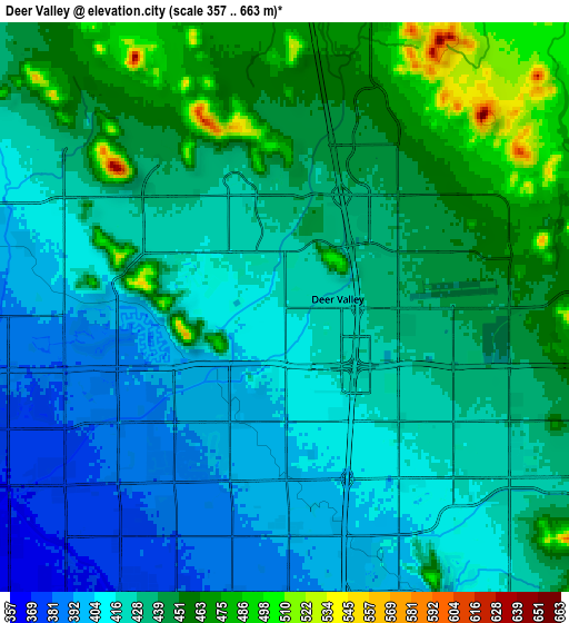
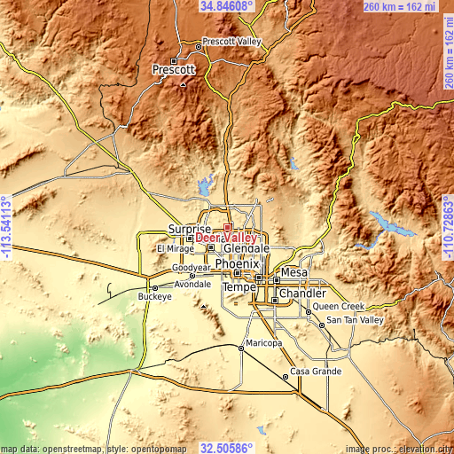
These maps also provides idea of topography and contour of this city, they are displayed at different zoom levels. More info about maps, scale and edge coordinates you can find below images.
| \ | Map #1 | Map #2 | Topo.Map |
| Scale [m] | 385..560 m | 357..663 m | × |
| Scale [ft] | 1263..1837 ft | 1171..2175 ft | × |
| Average | 421.5 m = 1383 ft | 431.2 m = 1415 ft | × |
| Width | 8.13 km = 5.1 mi | 16.26 km = 10.1 mi | 260.2 km = 161.7 mi |
| Height | 8.13 km = 5.1 mi | 16.26 km = 10.1 mi | 260.2 km = 161.7 mi |
| ↑Max Latitude | 33.72049° | 33.757034° | 34.84608° |
| Latitude at center | 33.68393° | 33.68393° | 33.68393° |
| ↓Min Latitude | 33.647355° | 33.610764° | 32.50586° |
| ← Min Longitude | -112.178825° | -112.222771° | -113.54113° |
| Longitude center | -112.13488° | -112.13488° | -112.13488° |
| →Max Longitude | -112.090935° | -112.046989° | -110.72863° |
Nearby cities:
Cities around Deer Valley sort by population:
• Glendale elevation 350 m
16.8 km,  196°
196°
• Maryvale 341 m
20.6 km,  191°
191°
• Peoria 347 m
14.9 km,  219°
219°
• Surprise 357 m
19.3 km,  252°
252°
• Alhambra 346 m
20.6 km,  179°
179°
• Encanto 350 m
23.3 km,  167°
167°
• Sun City 347 m
15.9 km,  232°
232°
• El Mirage 345 m
19.2 km, 245°
• Sun City West 376 m
19.3 km,  262°
262°
• Anthem 566 m
20.4 km,  356°
356°
• Youngtown 343 m
18.5 km,  237°
237°
• Cave Creek 649 m
23.8 km,  45°
45°
Multilingual:
 En español:
Deer Valley elevación 416 m.
 En France:
Deer Valley élévation 416 m.
 Auf Deutsch:
Deer Valley höhe über dem Meeresspiegel ist 416 m.

Sources and notes:
- [note 1] Map square and city borders are not equal. Map elevation data is calculated only from area inside that square.
- [src 1] Elevation data from geonames database provided with same terms of usage.
- [src 2] The elevation map of Deer Valley is generated using elevation data from NASA's 3 arcsec (90m) resolution SRTM data.
- [src 3] Base (background) map © OpenStreetMap contributors tiles are generated by Geofabrik and OpenTopoMap.
Copyright & License:
This Deer Valley Elevation Map is licensed under CC BY-SA. You may reuse any part from this page, if you give a proper credit by linking to this URL:
 More info on terms of use page.