Bullhead City elevation
Bullhead City (Arizona, Mohave County), United States elevation is 173 meters and Bullhead City elevation in feet is 568 ft above sea level [src 1]. Bullhead City is a populated place (feature code) with elevation that is 106 meters (348 ft) smaller than average city elevation in United States.
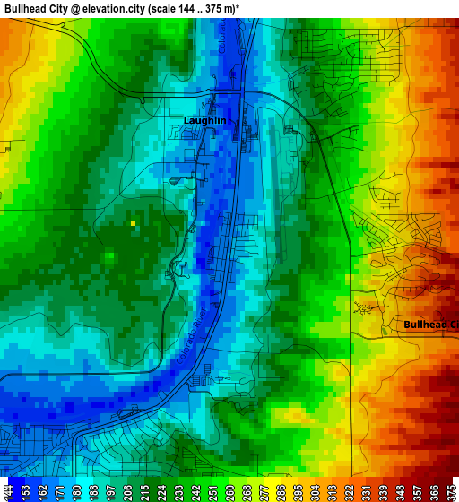
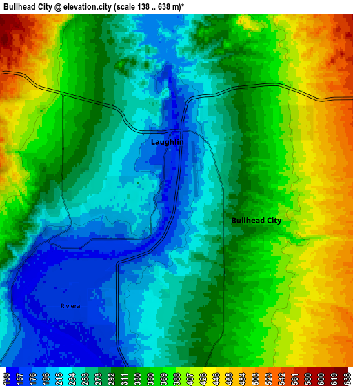
Below is the Elevation map of Bullhead City, which displays elevation range with different colors. Scale of the first map is from 144 to 375 m (472 to 1230 ft) with average elevation of 233.2 meters (=765 ft) [note 1]
These maps also provides idea of topography and contour of this city, they are displayed at different zoom levels. More info about maps, scale and edge coordinates you can find below images.
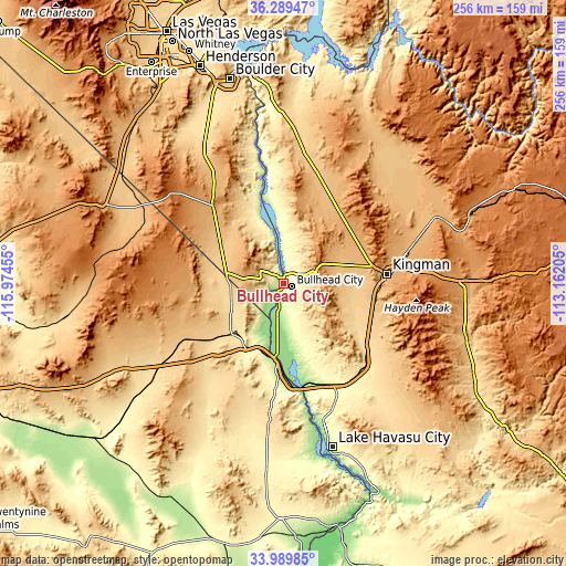
| \ | Map #1 | Map #2 | Topo.Map |
| Scale [m] | 144..375 m | 138..638 m | × |
| Scale [ft] | 472..1230 ft | 453..2093 ft | × |
| Average | 233.2 m = 765 ft | 312.5 m = 1025 ft | × |
| Width | 7.99 km = 5 mi | 15.98 km = 9.9 mi | 255.7 km = 158.9 mi |
| Height | 7.99 km = 5 mi | 15.98 km = 9.9 mi | 255.7 km = 158.9 mi |
| ↑Max Latitude | 35.183705° | 35.219614° | 36.28947° |
| Latitude at center | 35.14778° | 35.14778° | 35.14778° |
| ↓Min Latitude | 35.111839° | 35.075883° | 33.98985° |
| ← Min Longitude | -114.612245° | -114.656191° | -115.97455° |
| Longitude center | -114.5683° | -114.5683° | -114.5683° |
| →Max Longitude | -114.524355° | -114.480409° | -113.16205° |
Nearby cities:
Cities around Bullhead City sort by population:
• Lake Havasu City elevation 228 m
77.2 km,  163°
163°
• Kingman 1024 m
47.1 km,  84°
84°
• New Kingman-Butler 1047 m
50.4 km, 75°
• Golden Valley 857 m
32.5 km, 75°
• Laughlin 169 m
2.3 km,  349°
349°
• Needles 151 m
33.6 km,  187°
187°
• Mohave Valley 144 m
23.9 km,  184°
184°
• Desert Hills 168 m
68.4 km, 164°
• Golden Shores 207 m
41.5 km,  168°
168°
• Dolan Springs 1030 m
56.2 km,  28°
28°
• Valle Vista 969 m
70.4 km,  65°
65°
• Willow Valley 148 m
26.5 km, 187°
Multilingual:
 En español:
Bullhead City elevación 173 m.
 En France:
Bullhead City élévation 173 m.
 Auf Deutsch:
Bullhead City höhe über dem Meeresspiegel ist 173 m.

Sources and notes:
- [note 1] Map square and city borders are not equal. Map elevation data is calculated only from area inside that square.
- [src 1] Elevation data from geonames database provided with same terms of usage.
- [src 2] The elevation map of Bullhead City is generated using elevation data from NASA's 3 arcsec (90m) resolution SRTM data.
- [src 3] Base (background) map © OpenStreetMap contributors tiles are generated by Geofabrik and OpenTopoMap.
Copyright & License:
This Bullhead City Elevation Map is licensed under CC BY-SA. You may reuse any part from this page, if you give a proper credit by linking to this URL:
 More info on terms of use page.