Weirton elevation
Weirton (West Virginia, Hancock County), United States elevation is 233 meters and Weirton elevation in feet is 764 ft above sea level [src 1]. Weirton is a populated place (feature code) with elevation that is 46 meters (151 ft) smaller than average city elevation in United States.
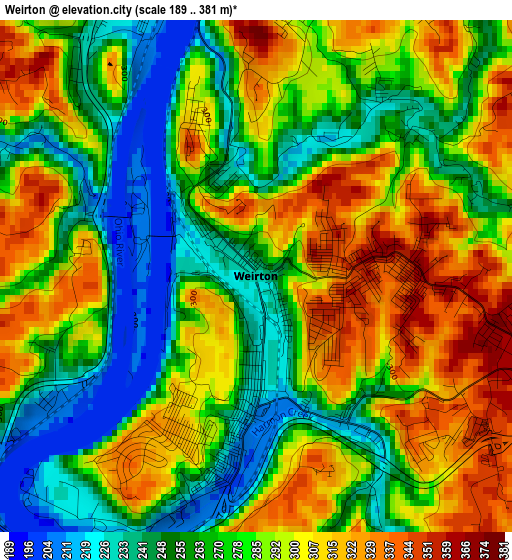
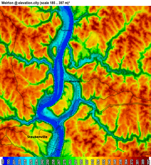
Below is the Elevation map of Weirton, which displays elevation range with different colors. Scale of the first map is from 189 to 381 m (620 to 1250 ft) with average elevation of 282 meters (=925 ft) [note 1]
These maps also provides idea of topography and contour of this city, they are displayed at different zoom levels. More info about maps, scale and edge coordinates you can find below images.
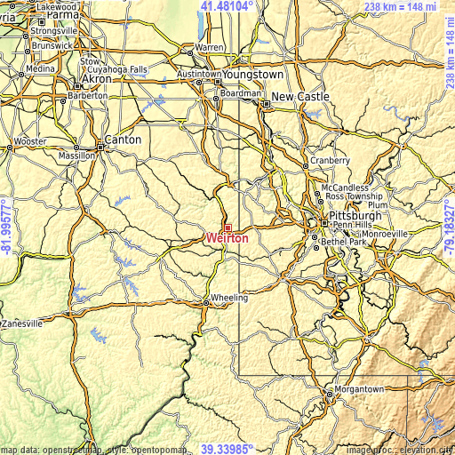
| \ | Map #1 | Map #2 | Topo.Map |
| Scale [m] | 189..381 m | 185..397 m | × |
| Scale [ft] | 620..1250 ft | 607..1302 ft | × |
| Average | 282 m = 925 ft | 312.5 m = 1025 ft | × |
| Width | 7.44 km = 4.6 mi | 14.88 km = 9.2 mi | 238.1 km = 147.9 mi |
| Height | 7.44 km = 4.6 mi | 14.88 km = 9.2 mi | 238.1 km = 147.9 mi |
| ↑Max Latitude | 40.452408° | 40.48584° | 41.48104° |
| Latitude at center | 40.41896° | 40.41896° | 40.41896° |
| ↓Min Latitude | 40.385495° | 40.352014° | 39.33985° |
| ← Min Longitude | -80.633465° | -80.677411° | -81.99577° |
| Longitude center | -80.58952° | -80.58952° | -80.58952° |
| →Max Longitude | -80.545575° | -80.501629° | -79.18327° |
Nearby cities:
Cities around Weirton sort by population:
• Weirton Heights elevation 365 m
4.4 km,  105°
105°
• Steubenville 318 m
6.6 km,  214°
214°
• Toronto 212 m
5.1 km,  349°
349°
• Wintersville 383 m
10.8 km,  243°
243°
• Wellsville 215 m
21.1 km, 346°
• Mingo Junction 238 m
10.9 km,  189°
189°
• Follansbee 203 m
10.2 km,  183°
183°
• Wellsburg 206 m
16.4 km, 185°
• Hooverson Heights 309 m
10.5 km,  174°
174°
• Brilliant 203 m
17.4 km, 190°
• Burgettstown 299 m
17.2 km,  103°
103°
• New Cumberland 213 m
8.8 km, 350°
Multilingual:
 En español:
Weirton elevación 233 m.
 En France:
Weirton élévation 233 m.


Sources and notes:
- [note 1] Map square and city borders are not equal. Map elevation data is calculated only from area inside that square.
- [src 1] Elevation data from geonames database provided with same terms of usage.
- [src 2] The elevation map of Weirton is generated using elevation data from NASA's 3 arcsec (90m) resolution SRTM data.
- [src 3] Base (background) map © OpenStreetMap contributors tiles are generated by Geofabrik and OpenTopoMap.
Copyright & License:
This Weirton Elevation Map is licensed under CC BY-SA. You may reuse any part from this page, if you give a proper credit by linking to this URL:
 More info on terms of use page.