Tomah elevation
Tomah (Wisconsin, Monroe County), United States elevation is 297 meters and Tomah elevation in feet is 974 ft above sea level [src 1]. Tomah is a populated place (feature code) with elevation that is 18 meters (59 ft) bigger than average city elevation in United States.
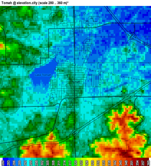
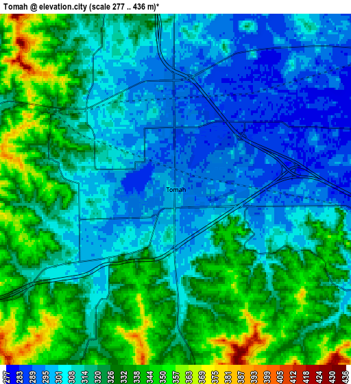
Below is the Elevation map of Tomah, which displays elevation range with different colors. Scale of the first map is from 280 to 360 m (919 to 1181 ft) with average elevation of 300.9 meters (=987 ft) [note 1]
These maps also provides idea of topography and contour of this city, they are displayed at different zoom levels. More info about maps, scale and edge coordinates you can find below images.
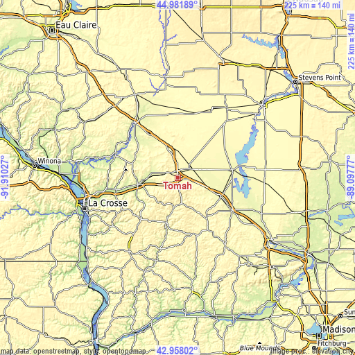
| \ | Map #1 | Map #2 | Topo.Map |
| Scale [m] | 280..360 m | 277..436 m | × |
| Scale [ft] | 919..1181 ft | 909..1430 ft | × |
| Average | 300.9 m = 987 ft | 317.4 m = 1041 ft | × |
| Width | 7.03 km = 4.4 mi | 14.06 km = 8.7 mi | 225 km = 139.8 mi |
| Height | 7.03 km = 4.4 mi | 14.06 km = 8.7 mi | 225 km = 139.8 mi |
| ↑Max Latitude | 44.010195° | 44.041792° | 44.98189° |
| Latitude at center | 43.97858° | 43.97858° | 43.97858° |
| ↓Min Latitude | 43.946949° | 43.9153° | 42.95802° |
| ← Min Longitude | -90.547965° | -90.591911° | -91.91027° |
| Longitude center | -90.50402° | -90.50402° | -90.50402° |
| →Max Longitude | -90.460075° | -90.416129° | -89.09777° |
Nearby cities:
Cities around Tomah sort by population:
• Sparta elevation 243 m
25 km,  261°
261°
• West Salem 229 m
47.1 km, 259°
• Mauston 271 m
39.7 km,  120°
120°
• Black River Falls 244 m
44.8 km,  321°
321°
• New Lisbon 275 m
29.3 km,  112°
112°
• Westby 398 m
45.5 km,  218°
218°
• Adams 295 m
54.9 km,  92°
92°
• Bangor 226 m
40.1 km, 256°
• Hillsboro 305 m
38.5 km,  160°
160°
• Elroy 301 m
32.3 km,  144°
144°
• Cashton 415 m
34.3 km, 219°
• Portland 396 m
36.7 km,  230°
230°
Multilingual:
 En español:
Tomah elevación 297 m.
 En France:
Tomah élévation 297 m.


Sources and notes:
- [note 1] Map square and city borders are not equal. Map elevation data is calculated only from area inside that square.
- [src 1] Elevation data from geonames database provided with same terms of usage.
- [src 2] The elevation map of Tomah is generated using elevation data from NASA's 3 arcsec (90m) resolution SRTM data.
- [src 3] Base (background) map © OpenStreetMap contributors tiles are generated by Geofabrik and OpenTopoMap.
Copyright & License:
This Tomah Elevation Map is licensed under CC BY-SA. You may reuse any part from this page, if you give a proper credit by linking to this URL:
 More info on terms of use page.