Pell Lake elevation
Pell Lake (Wisconsin, Walworth County), United States elevation is 268 meters and Pell Lake elevation in feet is 879 ft above sea level [src 1]. Pell Lake is a populated place (feature code) with elevation that is 11 meters (36 ft) smaller than average city elevation in United States.
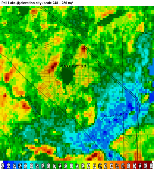
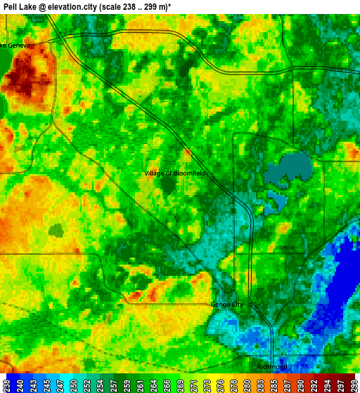
Below is the Elevation map of Pell Lake, which displays elevation range with different colors. Scale of the first map is from 248 to 286 m (814 to 938 ft) with average elevation of 263.6 meters (=865 ft) [note 1]
These maps also provides idea of topography and contour of this city, they are displayed at different zoom levels. More info about maps, scale and edge coordinates you can find below images.
| \ | Map #1 | Map #2 | Topo.Map |
| Scale [m] | 248..286 m | 238..299 m | × |
| Scale [ft] | 814..938 ft | 781..981 ft | × |
| Average | 263.6 m = 865 ft | 265.1 m = 870 ft | × |
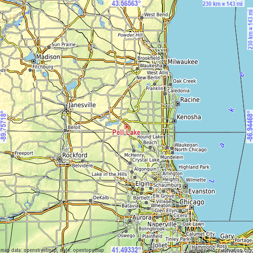
| Width | 7.2 km = 4.5 mi | 14.4 km = 8.9 mi | 230.4 km = 143.2 mi |
| Height | 7.2 km = 4.5 mi | 14.4 km = 8.9 mi | 230.4 km = 143.2 mi |
| ↑Max Latitude | 42.570442° | 42.602797° | 43.56563° |
| Latitude at center | 42.53807° | 42.53807° | 42.53807° |
| ↓Min Latitude | 42.505681° | 42.473276° | 41.49332° |
| ← Min Longitude | -88.394875° | -88.438821° | -89.75718° |
| Longitude center | -88.35093° | -88.35093° | -88.35093° |
| →Max Longitude | -88.306985° | -88.263039° | -86.94468° |
Nearby cities:
Cities around Pell Lake sort by population:
• Burlington elevation 236 m
16.7 km,  21°
21°
• Lake Geneva 268 m
9 km,  311°
311°
• Twin Lakes 246 m
8.5 km,  95°
95°
• Spring Grove 235 m
14.1 km,  138°
138°
• Genoa City 255 m
4.8 km,  157°
157°
• Como 289 m
13.6 km, 307°
• Williams Bay 269 m
16.2 km,  285°
285°
• Bohners Lake 260 m
11.1 km,  31°
31°
• Silver Lake 232 m
15.2 km,  86°
86°
• Richmond 251 m
7.8 km,  151°
151°
• Powers Lake 266 m
4.9 km,  69°
69°
• Hebron 286 m
9.9 km,  222°
222°
Multilingual:
 En español:
Pell Lake elevación 268 m.
 En France:
Pell Lake élévation 268 m.
 Auf Deutsch:
Pell Lake höhe über dem Meeresspiegel ist 268 m.

Sources and notes:
- [note 1] Map square and city borders are not equal. Map elevation data is calculated only from area inside that square.
- [src 1] Elevation data from geonames database provided with same terms of usage.
- [src 2] The elevation map of Pell Lake is generated using elevation data from NASA's 3 arcsec (90m) resolution SRTM data.
- [src 3] Base (background) map © OpenStreetMap contributors tiles are generated by Geofabrik and OpenTopoMap.
Copyright & License:
This Pell Lake Elevation Map is licensed under CC BY-SA. You may reuse any part from this page, if you give a proper credit by linking to this URL:
 More info on terms of use page.