McFarland elevation
McFarland (Wisconsin, Dane County), United States elevation is 266 meters and McFarland elevation in feet is 873 ft above sea level [src 1]. McFarland is a populated place (feature code) with elevation that is 13 meters (43 ft) smaller than average city elevation in United States.
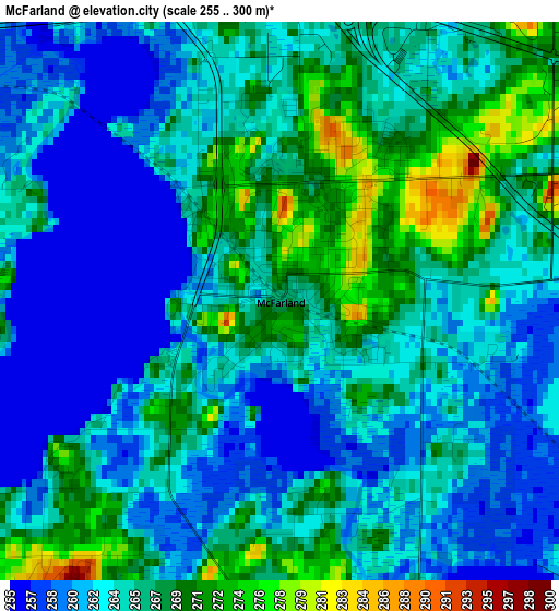
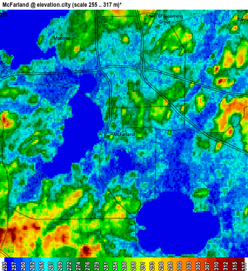
Below is the Elevation map of McFarland, which displays elevation range with different colors. Scale of the first map is from 255 to 300 m (837 to 984 ft) with average elevation of 264.7 meters (=868 ft) [note 1]
These maps also provides idea of topography and contour of this city, they are displayed at different zoom levels. More info about maps, scale and edge coordinates you can find below images.
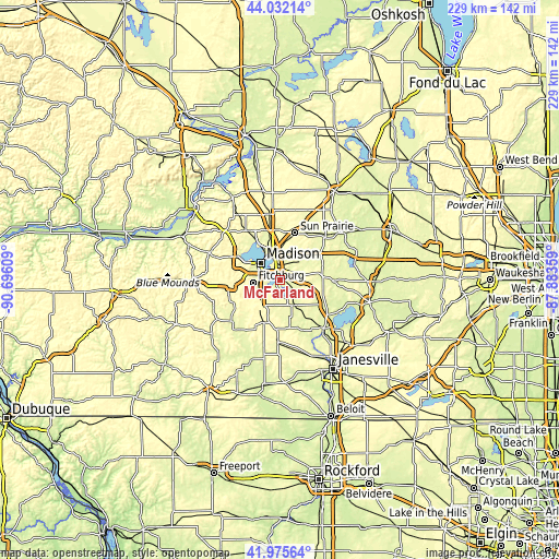
| \ | Map #1 | Map #2 | Topo.Map |
| Scale [m] | 255..300 m | 255..317 m | × |
| Scale [ft] | 837..984 ft | 837..1040 ft | × |
| Average | 264.7 m = 868 ft | 269.1 m = 883 ft | × |
| Width | 7.15 km = 4.4 mi | 14.29 km = 8.9 mi | 228.7 km = 142.1 mi |
| Height | 7.15 km = 4.4 mi | 14.29 km = 8.9 mi | 228.7 km = 142.1 mi |
| ↑Max Latitude | 43.044625° | 43.076732° | 44.03214° |
| Latitude at center | 43.0125° | 43.0125° | 43.0125° |
| ↓Min Latitude | 42.980359° | 42.9482° | 41.97564° |
| ← Min Longitude | -89.333785° | -89.377731° | -90.69609° |
| Longitude center | -89.28984° | -89.28984° | -89.28984° |
| →Max Longitude | -89.245895° | -89.201949° | -87.88359° |
Nearby cities:
Cities around McFarland sort by population:
• Madison elevation 272 m
11.3 km,  306°
306°
• Fitchburg 310 m
15.7 km,  248°
248°
• Middleton 291 m
19.8 km,  298°
298°
• Stoughton 269 m
12.1 km,  151°
151°
• Oregon 289 m
12.3 km,  218°
218°
• Monona 272 m
6.6 km,  327°
327°
• Cottage Grove 270 m
10.2 km,  46°
46°
• Deerfield 268 m
18 km,  75°
75°
• Rutland 289 m
15.6 km,  198°
198°
• Shorewood Hills 277 m
14.6 km, 299°
• Brooklyn 303 m
18.8 km, 200°
• Maple Bluff 274 m
13.8 km, 328°
Multilingual:
 En español:
McFarland elevación 266 m.
 En France:
McFarland élévation 266 m.
 Auf Deutsch:
McFarland höhe über dem Meeresspiegel ist 266 m.

Sources and notes:
- [note 1] Map square and city borders are not equal. Map elevation data is calculated only from area inside that square.
- [src 1] Elevation data from geonames database provided with same terms of usage.
- [src 2] The elevation map of McFarland is generated using elevation data from NASA's 3 arcsec (90m) resolution SRTM data.
- [src 3] Base (background) map © OpenStreetMap contributors tiles are generated by Geofabrik and OpenTopoMap.
Copyright & License:
This McFarland Elevation Map is licensed under CC BY-SA. You may reuse any part from this page, if you give a proper credit by linking to this URL:
 More info on terms of use page.