Lannon elevation
Lannon (Wisconsin, Waukesha County), United States elevation is 281 meters and Lannon elevation in feet is 922 ft above sea level [src 1]. Lannon is a populated place (feature code) with elevation that is 2 meters (7 ft) bigger than average city elevation in United States.
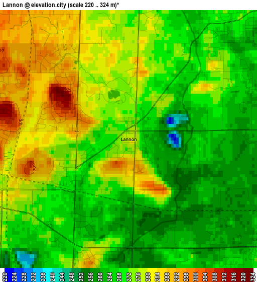
Below is the Elevation map of Lannon, which displays elevation range with different colors. Scale of the first map is from 220 to 324 m (722 to 1063 ft) with average elevation of 272 meters (=892 ft) [note 1]
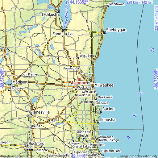
These maps also provides idea of topography and contour of this city, they are displayed at different zoom levels. More info about maps, scale and edge coordinates you can find below images.
| \ | Map #1 | Topo.Map |
| Scale [m] | 220..324 m | × |
| Scale [ft] | 722..1063 ft | × |
| Average | 272 m = 892 ft | × |
| Width | 7.13 km = 4.4 mi | 228.2 km = 141.8 mi |
| Height | 7.13 km = 4.4 mi | 228.2 km = 141.8 mi |
| ↑Max Latitude | 43.178175° | 44.16352° |
| Latitude at center | 43.14612° | 43.14612° |
| ↓Min Latitude | 43.114049° | 42.1115° |
| ← Min Longitude | -88.210145° | -89.57245° |
| Longitude center | -88.1662° | -88.1662° |
| →Max Longitude | -88.122255° | -86.75995° |
Nearby cities:
Cities around Lannon sort by population:
• Waukesha elevation 252 m
15.9 km,  199°
199°
• Brookfield 254 m
10.7 km,  152°
152°
• Menomonee Falls 264 m
5.4 km,  47°
47°
• Mequon 224 m
13.5 km,  55°
55°
• Germantown 265 m
10.2 km,  26°
26°
• Richfield 301 m
12.4 km,  349°
349°
• Sussex 285 m
4.7 km,  253°
253°
• Hartland 289 m
15 km, 252°
• Pewaukee 267 m
10.6 km,  226°
226°
• Elm Grove 229 m
13.5 km, 148°
• Merton 299 m
11.4 km,  270°
270°
• Butler 229 m
9 km,  119°
119°
Multilingual:
 En español:
Lannon elevación 281 m.
 En France:
Lannon élévation 281 m.


Sources and notes:
- [note 1] Map square and city borders are not equal. Map elevation data is calculated only from area inside that square.
- [src 1] Elevation data from geonames database provided with same terms of usage.
- [src 2] The elevation map of Lannon is generated using elevation data from NASA's 3 arcsec (90m) resolution SRTM data.
- [src 3] Base (background) map © OpenStreetMap contributors tiles are generated by Geofabrik and OpenTopoMap.
Copyright & License:
This Lannon Elevation Map is licensed under CC BY-SA. You may reuse any part from this page, if you give a proper credit by linking to this URL:
 More info on terms of use page.