Glendale elevation
Glendale (Wisconsin, Milwaukee County), United States elevation is 199 meters and Glendale elevation in feet is 653 ft above sea level [src 1]. Glendale is a populated place (feature code) with elevation that is 80 meters (262 ft) smaller than average city elevation in United States.
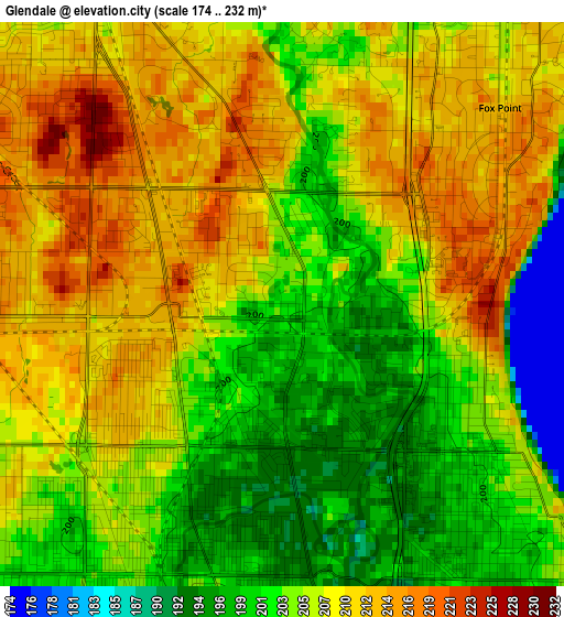
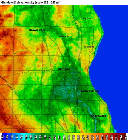
Below is the Elevation map of Glendale, which displays elevation range with different colors. Scale of the first map is from 174 to 232 m (571 to 761 ft) with average elevation of 206.1 meters (=676 ft) [note 1]
These maps also provides idea of topography and contour of this city, they are displayed at different zoom levels. More info about maps, scale and edge coordinates you can find below images.
| \ | Map #1 | Map #2 | Topo.Map |
| Scale [m] | 174..232 m | 172..247 m | × |
| Scale [ft] | 571..761 ft | 564..810 ft | × |
| Average | 206.1 m = 676 ft | 203.8 m = 669 ft | × |
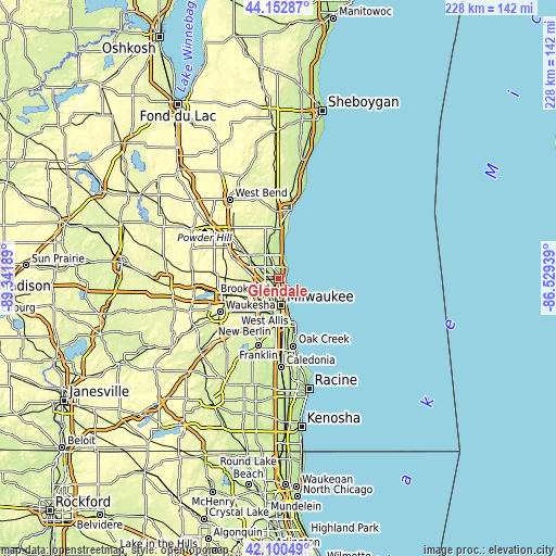
| Width | 7.13 km = 4.4 mi | 14.26 km = 8.9 mi | 228.2 km = 141.8 mi |
| Height | 7.13 km = 4.4 mi | 14.26 km = 8.9 mi | 228.2 km = 141.8 mi |
| ↑Max Latitude | 43.16735° | 43.199394° | 44.15287° |
| Latitude at center | 43.13529° | 43.13529° | 43.13529° |
| ↓Min Latitude | 43.103213° | 43.071119° | 42.10049° |
| ← Min Longitude | -87.979585° | -88.023531° | -89.34189° |
| Longitude center | -87.93564° | -87.93564° | -87.93564° |
| →Max Longitude | -87.891695° | -87.847749° | -86.52939° |
Nearby cities:
Cities around Glendale sort by population:
• Milwaukee elevation 203 m
11 km,  167°
167°
• Wauwatosa 201 m
11.2 km,  211°
211°
• Mequon 224 m
11.8 km,  319°
319°
• Whitefish Bay 203 m
3.8 km,  130°
130°
• Shorewood 208 m
6.4 km,  142°
142°
• Brown Deer 210 m
3.9 km, 323°
• Fox Point 213 m
3.7 km,  48°
48°
• Bayside 206 m
5.8 km,  29°
29°
• West Milwaukee 201 m
14 km,  192°
192°
• Thiensville 208 m
11.9 km,  342°
342°
• Butler 229 m
11.3 km,  253°
253°
• River Hills 215 m
4.4 km,  12°
12°
Multilingual:
 En español:
Glendale elevación 199 m.
 En France:
Glendale élévation 199 m.
 Auf Deutsch:
Glendale höhe über dem Meeresspiegel ist 199 m.

Sources and notes:
- [note 1] Map square and city borders are not equal. Map elevation data is calculated only from area inside that square.
- [src 1] Elevation data from geonames database provided with same terms of usage.
- [src 2] The elevation map of Glendale is generated using elevation data from NASA's 3 arcsec (90m) resolution SRTM data.
- [src 3] Base (background) map © OpenStreetMap contributors tiles are generated by Geofabrik and OpenTopoMap.
Copyright & License:
This Glendale Elevation Map is licensed under CC BY-SA. You may reuse any part from this page, if you give a proper credit by linking to this URL:
 More info on terms of use page.