Wyoming elevation
Wyoming (Pennsylvania, Luzerne County), United States elevation is 177 meters and Wyoming elevation in feet is 581 ft above sea level [src 1]. Wyoming is a populated place (feature code) with elevation that is 102 meters (335 ft) smaller than average city elevation in United States.
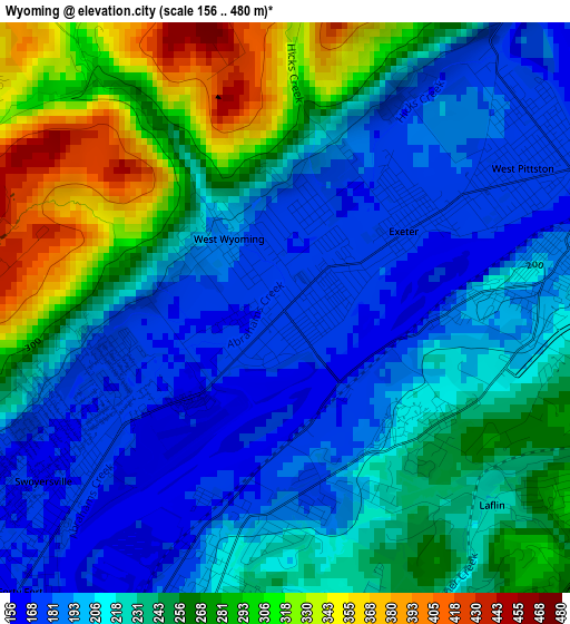
Below is the Elevation map of Wyoming, which displays elevation range with different colors. Scale of the first map is from 156 to 480 m (512 to 1575 ft) with average elevation of 231.8 meters (=760 ft) [note 1]
These maps also provides idea of topography and contour of this city, they are displayed at different zoom levels. More info about maps, scale and edge coordinates you can find below images.
| \ | Map #1 | Topo.Map |
| Scale [m] | 156..480 m | × |
| Scale [ft] | 512..1575 ft | × |
| Average | 231.8 m = 760 ft | × |
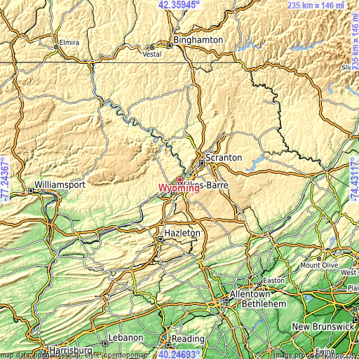
| Width | 7.34 km = 4.6 mi | 234.9 km = 146 mi |
| Height | 7.34 km = 4.6 mi | 234.9 km = 146 mi |
| ↑Max Latitude | 41.34475° | 42.35945° |
| Latitude at center | 41.31175° | 41.31175° |
| ↓Min Latitude | 41.278733° | 40.24693° |
| ← Min Longitude | -75.881365° | -77.24367° |
| Longitude center | -75.83742° | -75.83742° |
| →Max Longitude | -75.793475° | -74.43117° |
Nearby cities:
Cities around Wyoming sort by population:
• Pittston elevation 181 m
4.3 km,  68°
68°
• Exeter 174 m
1.8 km,  57°
57°
• Swoyersville 167 m
3.8 km,  234°
234°
• West Pittston 171 m
4.1 km, 64°
• Plains 199 m
4.2 km,  194°
194°
• Forty Fort 168 m
5 km,  223°
223°
• West Wyoming 186 m
1.1 km,  321°
321°
• Inkerman 242 m
2.5 km,  124°
124°
• Laflin 225 m
3.7 km,  133°
133°
• Hudson 196 m
4.1 km,  178°
178°
• Browntown 216 m
4.2 km,  92°
92°
• Hilldale 183 m
2.5 km, 177°
Multilingual:
 En español:
Wyoming elevación 177 m.
 En France:
Wyoming élévation 177 m.


Sources and notes:
- [note 1] Map square and city borders are not equal. Map elevation data is calculated only from area inside that square.
- [src 1] Elevation data from geonames database provided with same terms of usage.
- [src 2] The elevation map of Wyoming is generated using elevation data from NASA's 3 arcsec (90m) resolution SRTM data.
- [src 3] Base (background) map © OpenStreetMap contributors tiles are generated by Geofabrik and OpenTopoMap.
Copyright & License:
This Wyoming Elevation Map is licensed under CC BY-SA. You may reuse any part from this page, if you give a proper credit by linking to this URL:
 More info on terms of use page.