Radnor elevation
Radnor (Pennsylvania, Delaware County), United States elevation is 133 meters and Radnor elevation in feet is 436 ft above sea level [src 1]. Radnor is a populated place (feature code) with elevation that is 146 meters (479 ft) smaller than average city elevation in United States.
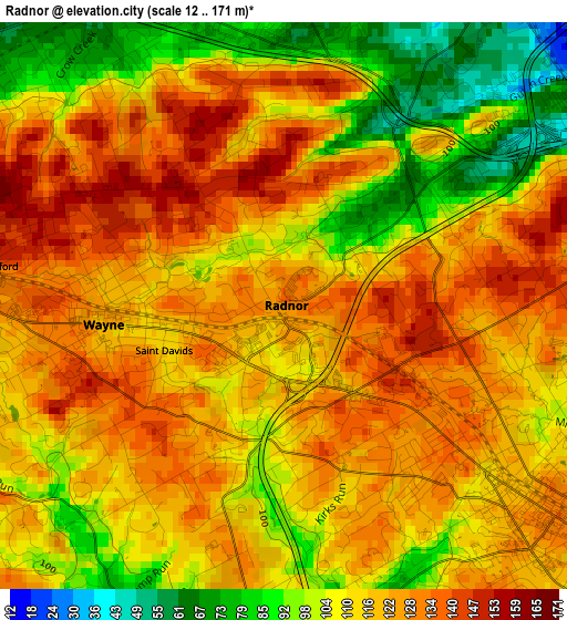
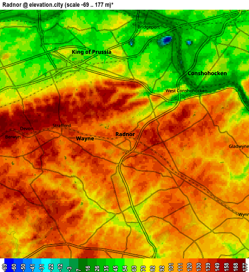
Below is the Elevation map of Radnor, which displays elevation range with different colors. Scale of the first map is from 12 to 171 m (39 to 561 ft) with average elevation of 115.3 meters (=378 ft) [note 1]
These maps also provides idea of topography and contour of this city, they are displayed at different zoom levels. More info about maps, scale and edge coordinates you can find below images.
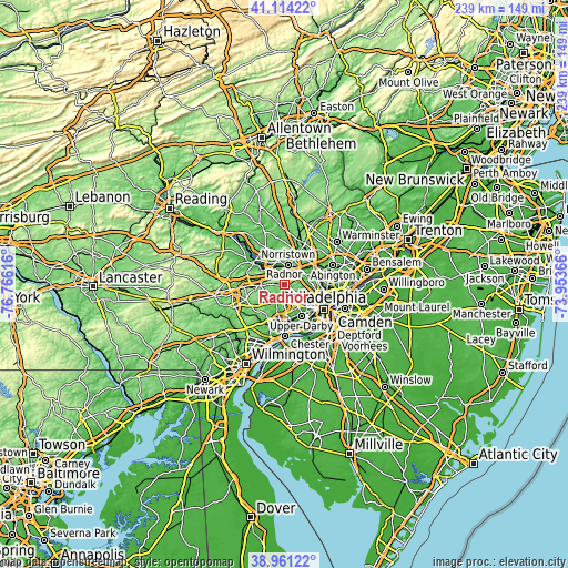
| \ | Map #1 | Map #2 | Topo.Map |
| Scale [m] | 12..171 m | -69..177 m | × |
| Scale [ft] | 39..561 ft | -226..581 ft | × |
| Average | 115.3 m = 378 ft | 94.9 m = 311 ft | × |
| Width | 7.48 km = 4.6 mi | 14.96 km = 9.3 mi | 239.4 km = 148.8 mi |
| Height | 7.48 km = 4.6 mi | 14.96 km = 9.3 mi | 239.4 km = 148.8 mi |
| ↑Max Latitude | 40.079853° | 40.113469° | 41.11422° |
| Latitude at center | 40.04622° | 40.04622° | 40.04622° |
| ↓Min Latitude | 40.01257° | 39.978904° | 38.96122° |
| ← Min Longitude | -75.403855° | -75.447801° | -76.76616° |
| Longitude center | -75.35991° | -75.35991° | -75.35991° |
| →Max Longitude | -75.315965° | -75.272019° | -73.95366° |
Nearby cities:
Cities around Radnor sort by population:
• Norristown elevation 48 m
8.5 km,  11°
11°
• Wayne 123 m
2.4 km,  264°
264°
• King of Prussia 58 m
5.7 km,  327°
327°
• Ardmore 109 m
7.7 km,  124°
124°
• Broomall 112 m
7.2 km,  177°
177°
• Conshohocken 64 m
6.2 km,  53°
53°
• Chesterbrook 60 m
9.1 km,  291°
291°
• Bridgeport 31 m
6.7 km, 10°
• Bryn Mawr 131 m
5.5 km, 121°
• Berwyn 160 m
6.7 km,  268°
268°
• Devon 159 m
5.9 km, 273°
• West Conshohocken 66 m
4.5 km, 54°
Multilingual:
 En español:
Radnor elevación 133 m.
 En France:
Radnor élévation 133 m.


Sources and notes:
- [note 1] Map square and city borders are not equal. Map elevation data is calculated only from area inside that square.
- [src 1] Elevation data from geonames database provided with same terms of usage.
- [src 2] The elevation map of Radnor is generated using elevation data from NASA's 3 arcsec (90m) resolution SRTM data.
- [src 3] Base (background) map © OpenStreetMap contributors tiles are generated by Geofabrik and OpenTopoMap.
Copyright & License:
This Radnor Elevation Map is licensed under CC BY-SA. You may reuse any part from this page, if you give a proper credit by linking to this URL:
 More info on terms of use page.