Monongahela elevation
Monongahela (Pennsylvania, Washington County), United States elevation is 235 meters and Monongahela elevation in feet is 771 ft above sea level [src 1]. Monongahela is a populated place (feature code) with elevation that is 44 meters (144 ft) smaller than average city elevation in United States.
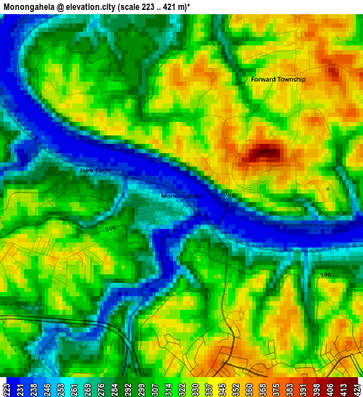
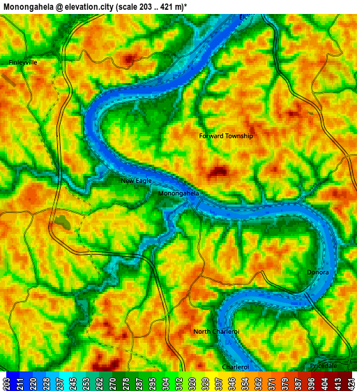
Below is the Elevation map of Monongahela, which displays elevation range with different colors. Scale of the first map is from 223 to 421 m (732 to 1381 ft) with average elevation of 305.3 meters (=1002 ft) [note 1]
These maps also provides idea of topography and contour of this city, they are displayed at different zoom levels. More info about maps, scale and edge coordinates you can find below images.
| \ | Map #1 | Map #2 | Topo.Map |
| Scale [m] | 223..421 m | 203..421 m | × |
| Scale [ft] | 732..1381 ft | 666..1381 ft | × |
| Average | 305.3 m = 1002 ft | 314.2 m = 1031 ft | × |
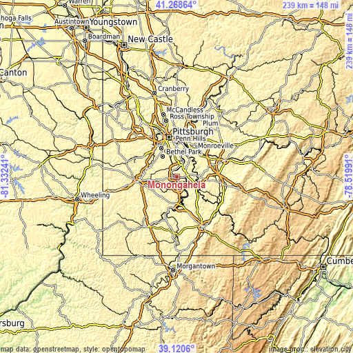
| Width | 7.46 km = 4.6 mi | 14.93 km = 9.3 mi | 238.8 km = 148.4 mi |
| Height | 7.46 km = 4.6 mi | 14.93 km = 9.3 mi | 238.8 km = 148.4 mi |
| ↑Max Latitude | 40.236685° | 40.270224° | 41.26864° |
| Latitude at center | 40.20313° | 40.20313° | 40.20313° |
| ↓Min Latitude | 40.169558° | 40.135969° | 39.1206° |
| ← Min Longitude | -79.970105° | -80.014051° | -81.33241° |
| Longitude center | -79.92616° | -79.92616° | -79.92616° |
| →Max Longitude | -79.882215° | -79.838269° | -78.51991° |
Nearby cities:
Cities around Monongahela sort by population:
• Monessen elevation 340 m
6.9 km,  151°
151°
• Donora 247 m
6.7 km,  119°
119°
• Charleroi 241 m
7.6 km,  161°
161°
• Gastonville 305 m
8.4 km,  315°
315°
• New Eagle 238 m
1.8 km,  286°
286°
• North Belle Vernon 275 m
9.6 km, 149°
• Wickerham Manor-Fisher 347 m
3.3 km, 150°
• Baidland 308 m
3.9 km,  256°
256°
• Elizabeth 238 m
8 km,  22°
22°
• North Charleroi 248 m
6 km, 164°
• Fellsburg 339 m
8.9 km,  104°
104°
• Speers 252 m
9.6 km, 155°
Multilingual:
 En español:
Monongahela elevación 235 m.
 En France:
Monongahela élévation 235 m.
 Auf Deutsch:
Monongahela höhe über dem Meeresspiegel ist 235 m.

Sources and notes:
- [note 1] Map square and city borders are not equal. Map elevation data is calculated only from area inside that square.
- [src 1] Elevation data from geonames database provided with same terms of usage.
- [src 2] The elevation map of Monongahela is generated using elevation data from NASA's 3 arcsec (90m) resolution SRTM data.
- [src 3] Base (background) map © OpenStreetMap contributors tiles are generated by Geofabrik and OpenTopoMap.
Copyright & License:
This Monongahela Elevation Map is licensed under CC BY-SA. You may reuse any part from this page, if you give a proper credit by linking to this URL:
 More info on terms of use page.