Lorane elevation
Lorane (Pennsylvania, Berks County), United States elevation is 60 meters and Lorane elevation in feet is 197 ft above sea level [src 1]. Lorane is a populated place (feature code) with elevation that is 219 meters (719 ft) smaller than average city elevation in United States.
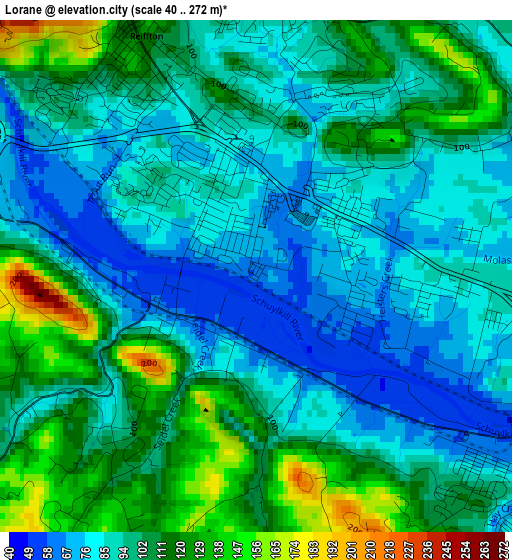
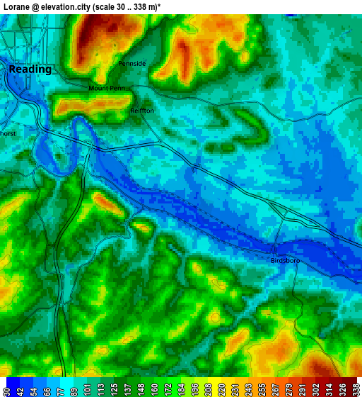
Below is the Elevation map of Lorane, which displays elevation range with different colors. Scale of the first map is from 40 to 272 m (131 to 892 ft) with average elevation of 97.6 meters (=320 ft) [note 1]
These maps also provides idea of topography and contour of this city, they are displayed at different zoom levels. More info about maps, scale and edge coordinates you can find below images.
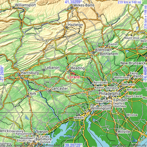
| \ | Map #1 | Map #2 | Topo.Map |
| Scale [m] | 40..272 m | 30..338 m | × |
| Scale [ft] | 131..892 ft | 98..1109 ft | × |
| Average | 97.6 m = 320 ft | 123.8 m = 406 ft | × |
| Width | 7.45 km = 4.6 mi | 14.91 km = 9.3 mi | 238.5 km = 148.2 mi |
| Height | 7.45 km = 4.6 mi | 14.91 km = 9.3 mi | 238.5 km = 148.2 mi |
| ↑Max Latitude | 40.321943° | 40.35544° | 41.35259° |
| Latitude at center | 40.28843° | 40.28843° | 40.28843° |
| ↓Min Latitude | 40.2549° | 40.221354° | 39.20725° |
| ← Min Longitude | -75.898595° | -75.942541° | -77.2609° |
| Longitude center | -75.85465° | -75.85465° | -75.85465° |
| →Max Longitude | -75.810705° | -75.766759° | -74.4484° |
Nearby cities:
Cities around Lorane sort by population:
• Reading elevation 83 m
8.1 km,  310°
310°
• Birdsboro 52 m
5 km,  121°
121°
• Pennside 110 m
5.8 km,  339°
339°
• West Reading 94 m
9.3 km,  302°
302°
• Reiffton 123 m
3.8 km, 335°
• Jacksonwald 104 m
4 km,  6°
6°
• Mount Penn 154 m
5.4 km,  325°
325°
• Kenhorst 106 m
7.6 km,  288°
288°
• Flying Hills 126 m
5.2 km,  255°
255°
• Saint Lawrence 92 m
4.5 km, 341°
• Grill 97 m
7.4 km,  278°
278°
• Stony Creek Mills 117 m
6.5 km,  348°
348°
Multilingual:
 En español:
Lorane elevación 60 m.
 En France:
Lorane élévation 60 m.


Sources and notes:
- [note 1] Map square and city borders are not equal. Map elevation data is calculated only from area inside that square.
- [src 1] Elevation data from geonames database provided with same terms of usage.
- [src 2] The elevation map of Lorane is generated using elevation data from NASA's 3 arcsec (90m) resolution SRTM data.
- [src 3] Base (background) map © OpenStreetMap contributors tiles are generated by Geofabrik and OpenTopoMap.
Copyright & License:
This Lorane Elevation Map is licensed under CC BY-SA. You may reuse any part from this page, if you give a proper credit by linking to this URL:
 More info on terms of use page.