Glenside elevation
Glenside (Pennsylvania, Montgomery County), United States elevation is 85 meters and Glenside elevation in feet is 279 ft above sea level [src 1]. Glenside is a populated place (feature code) with elevation that is 194 meters (636 ft) smaller than average city elevation in United States.
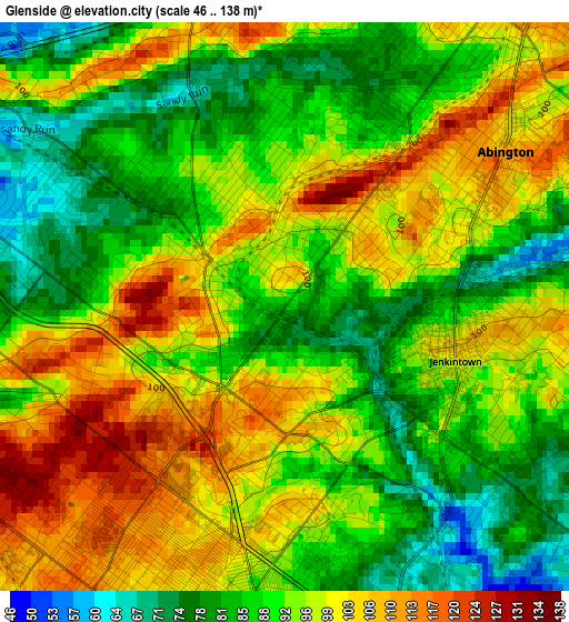
Below is the Elevation map of Glenside, which displays elevation range with different colors. Scale of the first map is from 46 to 138 m (151 to 453 ft) with average elevation of 93.3 meters (=306 ft) [note 1]
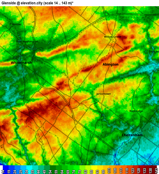
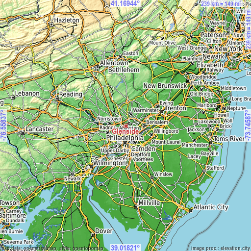
These maps also provides idea of topography and contour of this city, they are displayed at different zoom levels. More info about maps, scale and edge coordinates you can find below images.
| \ | Map #1 | Map #2 | Topo.Map |
| Scale [m] | 46..138 m | 14..143 m | × |
| Scale [ft] | 151..453 ft | 46..469 ft | × |
| Average | 93.3 m = 306 ft | 80.6 m = 264 ft | × |
| Width | 7.47 km = 4.6 mi | 14.95 km = 9.3 mi | 239.2 km = 148.6 mi |
| Height | 7.47 km = 4.6 mi | 14.95 km = 9.3 mi | 239.2 km = 148.6 mi |
| ↑Max Latitude | 40.135935° | 40.169524° | 41.16944° |
| Latitude at center | 40.10233° | 40.10233° | 40.10233° |
| ↓Min Latitude | 40.068708° | 40.03507° | 39.01821° |
| ← Min Longitude | -75.196065° | -75.240011° | -76.55837° |
| Longitude center | -75.15212° | -75.15212° | -75.15212° |
| →Max Longitude | -75.108175° | -75.064229° | -73.74587° |
Nearby cities:
Cities around Glenside sort by population:
• Willow Grove elevation 87 m
5.6 km,  33°
33°
• Horsham 78 m
8.7 km,  13°
13°
• Ambler 69 m
8.3 km,  314°
314°
• Oreland 83 m
2.8 km, 309°
• Dresher 64 m
4.5 km,  343°
343°
• Wyndmoor 130 m
3.9 km,  233°
233°
• Fort Washington 77 m
6.5 km, 312°
• Flourtown 61 m
5.1 km,  271°
271°
• Jenkintown 104 m
2.4 km,  107°
107°
• Wyncote 98 m
0.9 km,  161°
161°
• Rockledge 77 m
5.8 km, 113°
• Bryn Athyn 77 m
7.9 km,  65°
65°
Multilingual:
 En español:
Glenside elevación 85 m.
 En France:
Glenside élévation 85 m.


Sources and notes:
- [note 1] Map square and city borders are not equal. Map elevation data is calculated only from area inside that square.
- [src 1] Elevation data from geonames database provided with same terms of usage.
- [src 2] The elevation map of Glenside is generated using elevation data from NASA's 3 arcsec (90m) resolution SRTM data.
- [src 3] Base (background) map © OpenStreetMap contributors tiles are generated by Geofabrik and OpenTopoMap.
Copyright & License:
This Glenside Elevation Map is licensed under CC BY-SA. You may reuse any part from this page, if you give a proper credit by linking to this URL:
 More info on terms of use page.