Ellport elevation
Ellport (Pennsylvania, Lawrence County), United States elevation is 273 meters and Ellport elevation in feet is 896 ft above sea level [src 1]. Ellport is a populated place (feature code) with elevation that is 6 meters (20 ft) smaller than average city elevation in United States.
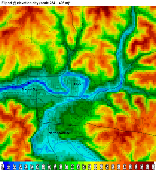
Below is the Elevation map of Ellport, which displays elevation range with different colors. Scale of the first map is from 234 to 406 m (768 to 1332 ft) with average elevation of 323.7 meters (=1062 ft) [note 1]
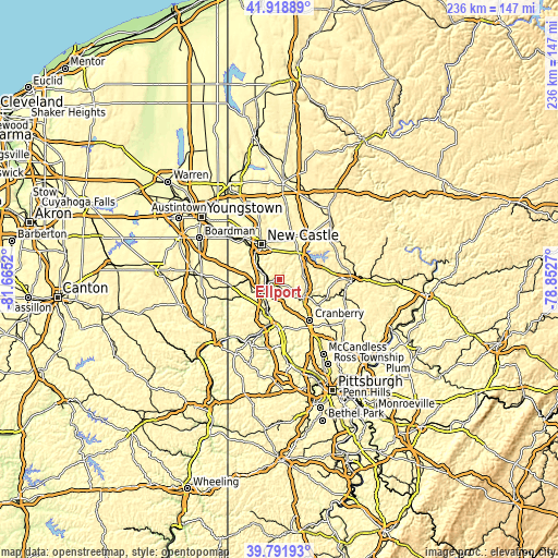
These maps also provides idea of topography and contour of this city, they are displayed at different zoom levels. More info about maps, scale and edge coordinates you can find below images.
| \ | Map #1 | Topo.Map |
| Scale [m] | 234..406 m | × |
| Scale [ft] | 768..1332 ft | × |
| Average | 323.7 m = 1062 ft | × |
| Width | 7.39 km = 4.6 mi | 236.5 km = 147 mi |
| Height | 7.39 km = 4.6 mi | 236.5 km = 147 mi |
| ↑Max Latitude | 40.897176° | 41.91889° |
| Latitude at center | 40.86395° | 40.86395° |
| ↓Min Latitude | 40.830707° | 39.79193° |
| ← Min Longitude | -80.302895° | -81.6652° |
| Longitude center | -80.25895° | -80.25895° |
| →Max Longitude | -80.215005° | -78.8527° |
Nearby cities:
Cities around Ellport sort by population:
• New Castle elevation 251 m
17.2 km,  334°
334°
• Beaver Falls 243 m
13.4 km,  202°
202°
• Ellwood City 269 m
2.3 km,  263°
263°
• New Brighton 223 m
15.5 km, 196°
• Beaver 243 m
19.1 km,  191°
191°
• Zelienople 290 m
12.9 km,  126°
126°
• Rochester 241 m
18.1 km, 187°
• Big Beaver 346 m
9.8 km,  243°
243°
• Oakland 342 m
16.8 km, 326°
• New Beaver 375 m
9.5 km,  278°
278°
• West Mayfield 334 m
11.5 km,  215°
215°
• Prospect 418 m
18.4 km,  75°
75°
Multilingual:
 En español:
Ellport elevación 273 m.
 En France:
Ellport élévation 273 m.


Sources and notes:
- [note 1] Map square and city borders are not equal. Map elevation data is calculated only from area inside that square.
- [src 1] Elevation data from geonames database provided with same terms of usage.
- [src 2] The elevation map of Ellport is generated using elevation data from NASA's 3 arcsec (90m) resolution SRTM data.
- [src 3] Base (background) map © OpenStreetMap contributors tiles are generated by Geofabrik and OpenTopoMap.
Copyright & License:
This Ellport Elevation Map is licensed under CC BY-SA. You may reuse any part from this page, if you give a proper credit by linking to this URL:
 More info on terms of use page.