Duryea elevation
Duryea (Pennsylvania, Luzerne County), United States elevation is 219 meters and Duryea elevation in feet is 719 ft above sea level [src 1]. Duryea is a populated place (feature code) with elevation that is 60 meters (197 ft) smaller than average city elevation in United States.
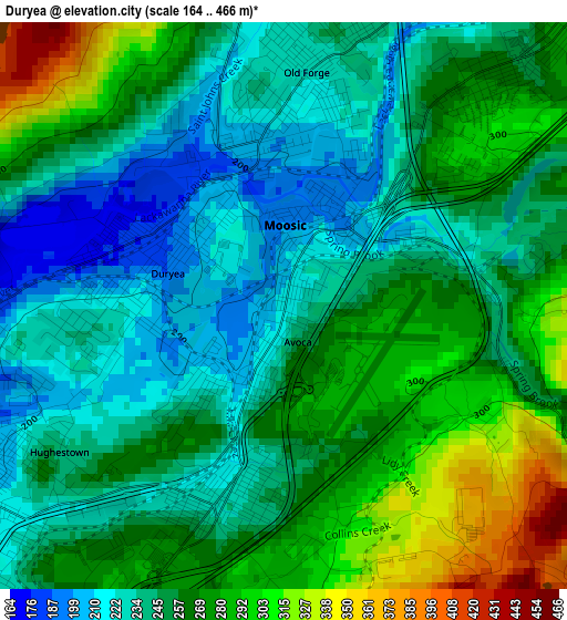
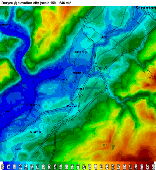
Below is the Elevation map of Duryea, which displays elevation range with different colors. Scale of the first map is from 164 to 466 m (538 to 1529 ft) with average elevation of 256.4 meters (=841 ft) [note 1]
These maps also provides idea of topography and contour of this city, they are displayed at different zoom levels. More info about maps, scale and edge coordinates you can find below images.
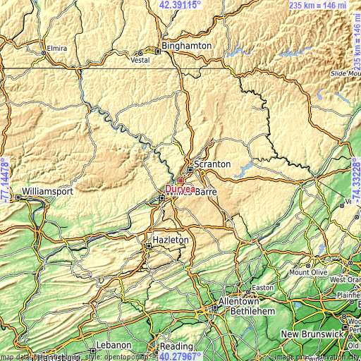
| \ | Map #1 | Map #2 | Topo.Map |
| Scale [m] | 164..466 m | 159..646 m | × |
| Scale [ft] | 538..1529 ft | 522..2119 ft | × |
| Average | 256.4 m = 841 ft | 312.5 m = 1025 ft | × |
| Width | 7.34 km = 4.6 mi | 14.67 km = 9.1 mi | 234.8 km = 145.9 mi |
| Height | 7.34 km = 4.6 mi | 14.67 km = 9.1 mi | 234.8 km = 145.9 mi |
| ↑Max Latitude | 41.376954° | 41.409921° | 42.39115° |
| Latitude at center | 41.34397° | 41.34397° | 41.34397° |
| ↓Min Latitude | 41.310969° | 41.277952° | 40.27967° |
| ← Min Longitude | -75.782475° | -75.826421° | -77.14478° |
| Longitude center | -75.73853° | -75.73853° | -75.73853° |
| →Max Longitude | -75.694585° | -75.650639° | -74.33228° |
Nearby cities:
Cities around Duryea sort by population:
• Old Forge elevation 226 m
3 km,  5°
5°
• Pittston 181 m
4.7 km,  244°
244°
• Taylor 223 m
6.2 km,  25°
25°
• Moosic 194 m
1 km,  1°
1°
• Exeter 174 m
7.2 km,  248°
248°
• West Pittston 171 m
4.9 km, 248°
• Dupont 222 m
2.2 km,  195°
195°
• Avoca 245 m
0.5 km,  158°
158°
• Inkerman 242 m
8 km,  231°
231°
• Laflin 225 m
8.3 km,  222°
222°
• Browntown 216 m
5.6 km, 227°
• Hughestown 238 m
3.5 km, 236°
Multilingual:
 En español:
Duryea elevación 219 m.
 En France:
Duryea élévation 219 m.


Sources and notes:
- [note 1] Map square and city borders are not equal. Map elevation data is calculated only from area inside that square.
- [src 1] Elevation data from geonames database provided with same terms of usage.
- [src 2] The elevation map of Duryea is generated using elevation data from NASA's 3 arcsec (90m) resolution SRTM data.
- [src 3] Base (background) map © OpenStreetMap contributors tiles are generated by Geofabrik and OpenTopoMap.
Copyright & License:
This Duryea Elevation Map is licensed under CC BY-SA. You may reuse any part from this page, if you give a proper credit by linking to this URL:
 More info on terms of use page.