Whitehouse elevation
Whitehouse (Ohio, Lucas County), United States elevation is 199 meters and Whitehouse elevation in feet is 653 ft above sea level [src 1]. Whitehouse is a populated place (feature code) with elevation that is 80 meters (262 ft) smaller than average city elevation in United States.
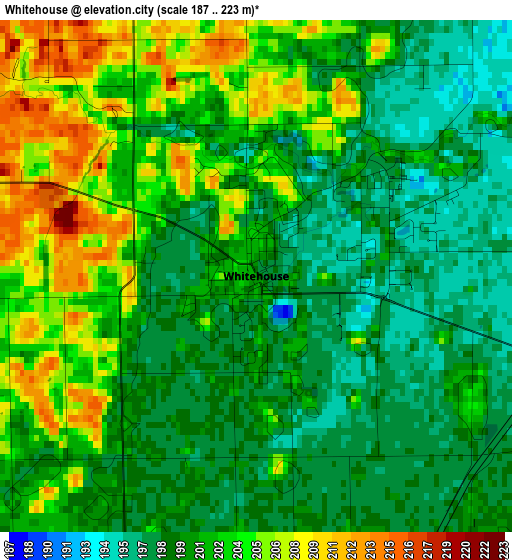
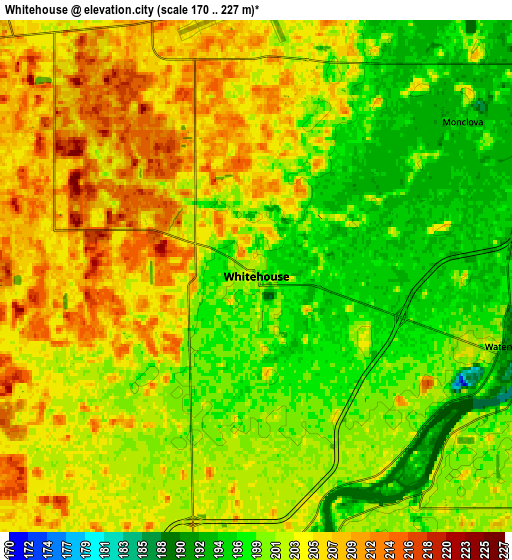
Below is the Elevation map of Whitehouse, which displays elevation range with different colors. Scale of the first map is from 187 to 223 m (614 to 732 ft) with average elevation of 201.2 meters (=660 ft) [note 1]
These maps also provides idea of topography and contour of this city, they are displayed at different zoom levels. More info about maps, scale and edge coordinates you can find below images.
| \ | Map #1 | Map #2 | Topo.Map |
| Scale [m] | 187..223 m | 170..227 m | × |
| Scale [ft] | 614..732 ft | 558..745 ft | × |
| Average | 201.2 m = 660 ft | 202.2 m = 663 ft | × |
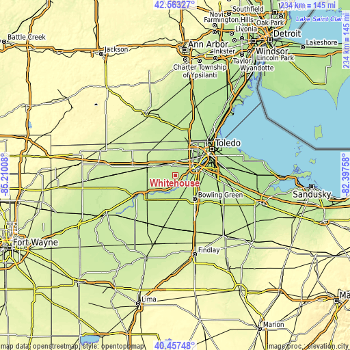
| Width | 7.32 km = 4.5 mi | 14.63 km = 9.1 mi | 234.1 km = 145.5 mi |
| Height | 7.32 km = 4.5 mi | 14.63 km = 9.1 mi | 234.1 km = 145.5 mi |
| ↑Max Latitude | 41.551835° | 41.584713° | 42.56327° |
| Latitude at center | 41.51894° | 41.51894° | 41.51894° |
| ↓Min Latitude | 41.486028° | 41.4531° | 40.45748° |
| ← Min Longitude | -83.847775° | -83.891721° | -85.21008° |
| Longitude center | -83.80383° | -83.80383° | -83.80383° |
| →Max Longitude | -83.759885° | -83.715939° | -82.39758° |
Nearby cities:
Cities around Whitehouse sort by population:
• Bowling Green elevation 213 m
20.5 km,  141°
141°
• Perrysburg 195 m
15.3 km,  73°
73°
• Maumee 195 m
13.4 km, 68°
• Rossford 188 m
22.3 km,  63°
63°
• Waterville 190 m
7.4 km,  105°
105°
• Ottawa Hills 190 m
21 km,  39°
39°
• Swanton 208 m
10.6 km,  316°
316°
• Delta 221 m
17.8 km,  289°
289°
• Holland 197 m
13.8 km,  33°
33°
• Weston 207 m
19.4 km,  178°
178°
• Haskins 204 m
10.1 km,  126°
126°
• Liberty Center 209 m
19 km,  243°
243°
Multilingual:
 En español:
Whitehouse elevación 199 m.
 En France:
Whitehouse élévation 199 m.
 Auf Deutsch:
Whitehouse höhe über dem Meeresspiegel ist 199 m.

Sources and notes:
- [note 1] Map square and city borders are not equal. Map elevation data is calculated only from area inside that square.
- [src 1] Elevation data from geonames database provided with same terms of usage.
- [src 2] The elevation map of Whitehouse is generated using elevation data from NASA's 3 arcsec (90m) resolution SRTM data.
- [src 3] Base (background) map © OpenStreetMap contributors tiles are generated by Geofabrik and OpenTopoMap.
Copyright & License:
This Whitehouse Elevation Map is licensed under CC BY-SA. You may reuse any part from this page, if you give a proper credit by linking to this URL:
 More info on terms of use page.