Strongsville elevation
Strongsville (Ohio, Cuyahoga County), United States elevation is 283 meters and Strongsville elevation in feet is 928 ft above sea level [src 1]. Strongsville is a populated place (feature code) with elevation that is 4 meters (13 ft) bigger than average city elevation in United States.
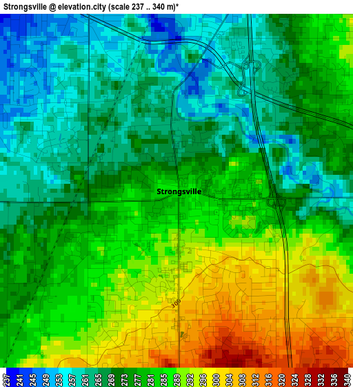
Below is the Elevation map of Strongsville, which displays elevation range with different colors. Scale of the first map is from 237 to 340 m (778 to 1115 ft) with average elevation of 277.3 meters (=910 ft) [note 1]
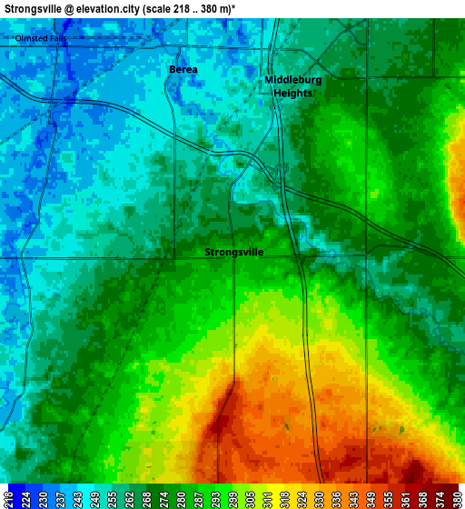
These maps also provides idea of topography and contour of this city, they are displayed at different zoom levels. More info about maps, scale and edge coordinates you can find below images.
| \ | Map #1 | Map #2 | Topo.Map |
| Scale [m] | 237..340 m | 218..380 m | × |
| Scale [ft] | 778..1115 ft | 715..1247 ft | × |
| Average | 277.3 m = 910 ft | 276.9 m = 908 ft | × |
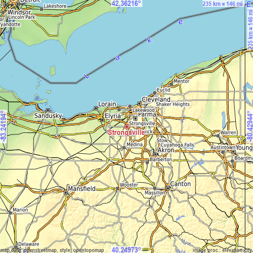
| Width | 7.34 km = 4.6 mi | 14.68 km = 9.1 mi | 234.9 km = 146 mi |
| Height | 7.34 km = 4.6 mi | 14.68 km = 9.1 mi | 234.9 km = 146 mi |
| ↑Max Latitude | 41.347499° | 41.380481° | 42.36216° |
| Latitude at center | 41.3145° | 41.3145° | 41.3145° |
| ↓Min Latitude | 41.281484° | 41.248452° | 40.24973° |
| ← Min Longitude | -81.879635° | -81.923581° | -83.24194° |
| Longitude center | -81.83569° | -81.83569° | -81.83569° |
| →Max Longitude | -81.791745° | -81.747799° | -80.42944° |
Nearby cities:
Cities around Strongsville sort by population:
• Parma elevation 264 m
13.8 km,  43°
43°
• Brunswick 359 m
8.5 km,  183°
183°
• North Olmsted 231 m
13.4 km,  326°
326°
• North Royalton 364 m
9.3 km,  90°
90°
• Parma Heights 262 m
10.5 km, 37°
• Broadview Heights 362 m
12.6 km, 90°
• Berea 238 m
6 km,  344°
344°
• Brook Park 241 m
9.7 km,  15°
15°
• Fairview Park 227 m
14.3 km,  350°
350°
• Middleburg Heights 259 m
5.6 km, 20°
• Olmsted Falls 235 m
9.1 km,  318°
318°
• Eaton Estates 245 m
14.2 km,  267°
267°
Multilingual:
 En español:
Strongsville elevación 283 m.
 En France:
Strongsville élévation 283 m.
 Auf Deutsch:
Strongsville höhe über dem Meeresspiegel ist 283 m.

Sources and notes:
- [note 1] Map square and city borders are not equal. Map elevation data is calculated only from area inside that square.
- [src 1] Elevation data from geonames database provided with same terms of usage.
- [src 2] The elevation map of Strongsville is generated using elevation data from NASA's 3 arcsec (90m) resolution SRTM data.
- [src 3] Base (background) map © OpenStreetMap contributors tiles are generated by Geofabrik and OpenTopoMap.
Copyright & License:
This Strongsville Elevation Map is licensed under CC BY-SA. You may reuse any part from this page, if you give a proper credit by linking to this URL:
 More info on terms of use page.