Saint Marys elevation
Saint Marys (Ohio, Auglaize County), United States elevation is 266 meters and Saint Marys elevation in feet is 873 ft above sea level [src 1]. Saint Marys is a populated place (feature code) with elevation that is 13 meters (43 ft) smaller than average city elevation in United States.
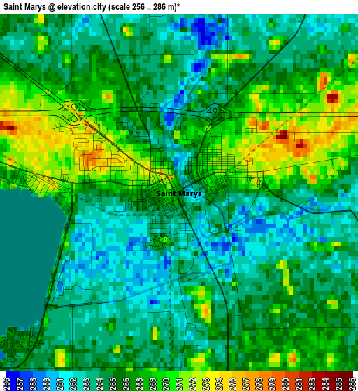
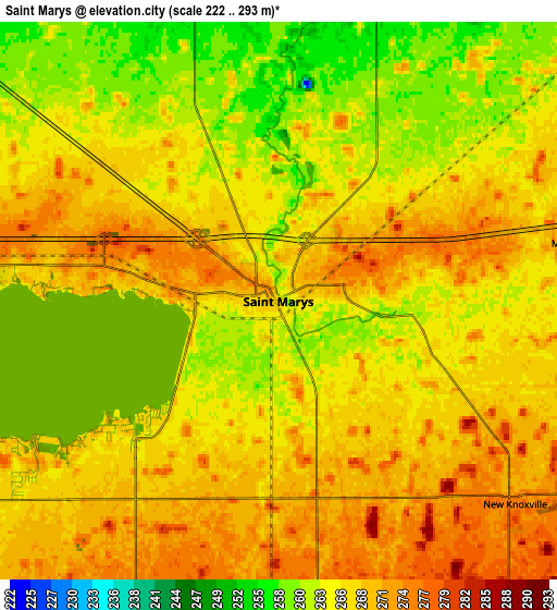
Below is the Elevation map of Saint Marys, which displays elevation range with different colors. Scale of the first map is from 256 to 286 m (840 to 938 ft) with average elevation of 266 meters (=873 ft) [note 1]
These maps also provides idea of topography and contour of this city, they are displayed at different zoom levels. More info about maps, scale and edge coordinates you can find below images.
| \ | Map #1 | Map #2 | Topo.Map |
| Scale [m] | 256..286 m | 222..293 m | × |
| Scale [ft] | 840..938 ft | 728..961 ft | × |
| Average | 266 m = 873 ft | 266.5 m = 874 ft | × |
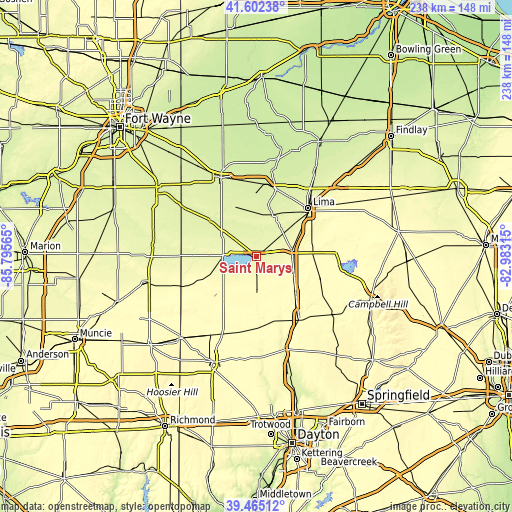
| Width | 7.43 km = 4.6 mi | 14.85 km = 9.2 mi | 237.6 km = 147.6 mi |
| Height | 7.43 km = 4.6 mi | 14.85 km = 9.2 mi | 237.6 km = 147.6 mi |
| ↑Max Latitude | 40.575657° | 40.609027° | 41.60238° |
| Latitude at center | 40.54227° | 40.54227° | 40.54227° |
| ↓Min Latitude | 40.508866° | 40.475446° | 39.46512° |
| ← Min Longitude | -84.433345° | -84.477291° | -85.79565° |
| Longitude center | -84.3894° | -84.3894° | -84.3894° |
| →Max Longitude | -84.345455° | -84.301509° | -82.98315° |
Nearby cities:
Cities around Saint Marys sort by population:
• Celina elevation 268 m
15.3 km,  272°
272°
• Wapakoneta 272 m
16.8 km,  80°
80°
• Coldwater 279 m
21.4 km,  251°
251°
• Fort Shawnee 266 m
26.6 km,  52°
52°
• New Bremen 288 m
11.7 km,  175°
175°
• Minster 296 m
16.6 km, 176°
• Saint Henry 296 m
25.3 km,  236°
236°
• Spencerville 253 m
18.8 km,  9°
9°
• Cridersville 269 m
23.7 km,  58°
58°
• Anna 314 m
24.6 km,  131°
131°
• Fort Loramie 290 m
21.3 km, 176°
• Botkins 304 m
19.5 km,  115°
115°
Multilingual:
 En español:
Saint Marys elevación 266 m.
 En France:
Saint Marys élévation 266 m.
 Auf Deutsch:
Saint Marys höhe über dem Meeresspiegel ist 266 m.

Sources and notes:
- [note 1] Map square and city borders are not equal. Map elevation data is calculated only from area inside that square.
- [src 1] Elevation data from geonames database provided with same terms of usage.
- [src 2] The elevation map of Saint Marys is generated using elevation data from NASA's 3 arcsec (90m) resolution SRTM data.
- [src 3] Base (background) map © OpenStreetMap contributors tiles are generated by Geofabrik and OpenTopoMap.
Copyright & License:
This Saint Marys Elevation Map is licensed under CC BY-SA. You may reuse any part from this page, if you give a proper credit by linking to this URL:
 More info on terms of use page.