Richfield elevation
Richfield (Ohio, Summit County), United States elevation is 354 meters and Richfield elevation in feet is 1161 ft above sea level [src 1]. Richfield is a populated place (feature code) with elevation that is 75 meters (246 ft) bigger than average city elevation in United States.
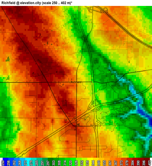
Below is the Elevation map of Richfield, which displays elevation range with different colors. Scale of the first map is from 250 to 402 m (820 to 1319 ft) with average elevation of 348.2 meters (=1142 ft) [note 1]
These maps also provides idea of topography and contour of this city, they are displayed at different zoom levels. More info about maps, scale and edge coordinates you can find below images.
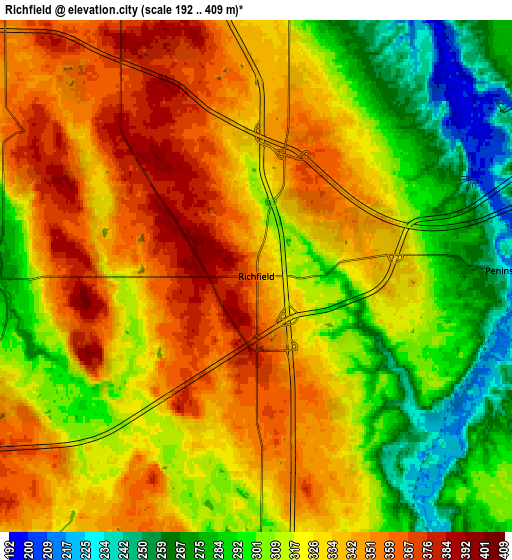
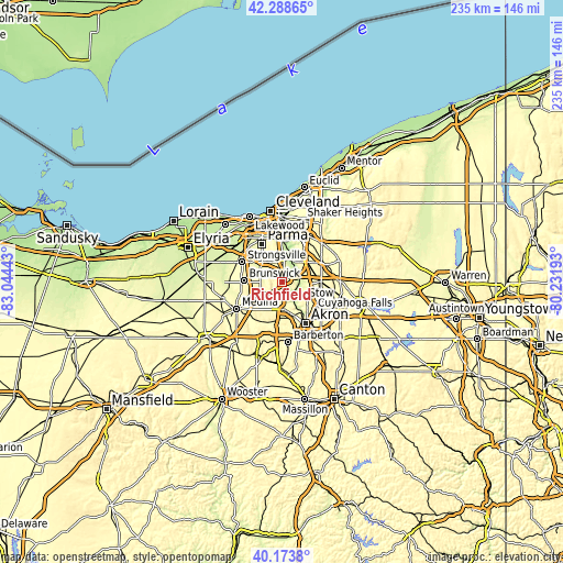
| \ | Map #1 | Map #2 | Topo.Map |
| Scale [m] | 250..402 m | 192..409 m | × |
| Scale [ft] | 820..1319 ft | 630..1342 ft | × |
| Average | 348.2 m = 1142 ft | 322.4 m = 1058 ft | × |
| Width | 7.35 km = 4.6 mi | 14.7 km = 9.1 mi | 235.1 km = 146.1 mi |
| Height | 7.35 km = 4.6 mi | 14.7 km = 9.1 mi | 235.1 km = 146.1 mi |
| ↑Max Latitude | 41.272817° | 41.305837° | 42.28865° |
| Latitude at center | 41.23978° | 41.23978° | 41.23978° |
| ↓Min Latitude | 41.206727° | 41.173657° | 40.1738° |
| ← Min Longitude | -81.682125° | -81.726071° | -83.04443° |
| Longitude center | -81.63818° | -81.63818° | -81.63818° |
| →Max Longitude | -81.594235° | -81.550289° | -80.23193° |
Nearby cities:
Cities around Richfield sort by population:
• North Royalton elevation 364 m
10.9 km,  318°
318°
• Hudson 327 m
16.5 km,  89°
89°
• Broadview Heights 362 m
9.1 km,  334°
334°
• Copley 319 m
15.7 km,  181°
181°
• Brecksville 270 m
8.9 km,  6°
6°
• Macedonia 300 m
13.6 km,  52°
52°
• Fairlawn 309 m
12.7 km,  169°
169°
• Independence 261 m
14.3 km,  0°
0°
• Montrose-Ghent 317 m
9.6 km, 182°
• Northfield 320 m
14.9 km,  38°
38°
• Walton Hills 302 m
15.4 km,  24°
24°
• Boston Heights 325 m
10.8 km,  75°
75°
Multilingual:
 En español:
Richfield elevación 354 m.
 En France:
Richfield élévation 354 m.
 Auf Deutsch:
Richfield höhe über dem Meeresspiegel ist 354 m.

Sources and notes:
- [note 1] Map square and city borders are not equal. Map elevation data is calculated only from area inside that square.
- [src 1] Elevation data from geonames database provided with same terms of usage.
- [src 2] The elevation map of Richfield is generated using elevation data from NASA's 3 arcsec (90m) resolution SRTM data.
- [src 3] Base (background) map © OpenStreetMap contributors tiles are generated by Geofabrik and OpenTopoMap.
Copyright & License:
This Richfield Elevation Map is licensed under CC BY-SA. You may reuse any part from this page, if you give a proper credit by linking to this URL:
 More info on terms of use page.