Port Clinton elevation
Port Clinton (Ohio, Ottawa County), United States elevation is 176 meters and Port Clinton elevation in feet is 577 ft above sea level [src 1]. Port Clinton is a seat of a second-order administrative division (feature code) with elevation that is 103 meters (338 ft) smaller than average city elevation in United States.
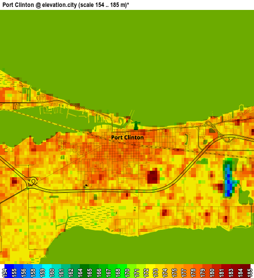
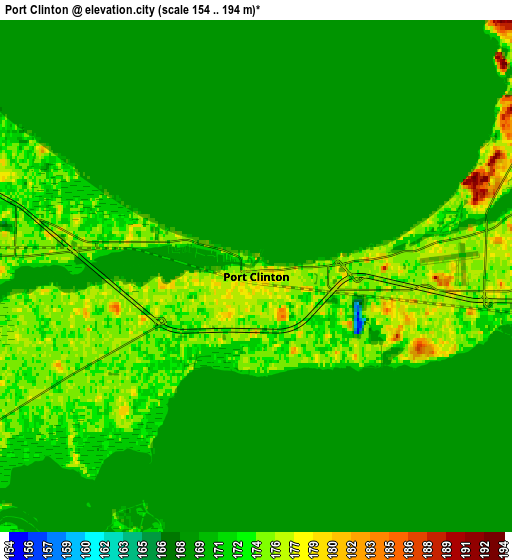
Below is the Elevation map of Port Clinton, which displays elevation range with different colors. Scale of the first map is from 154 to 185 m (505 to 607 ft) with average elevation of 173.2 meters (=568 ft) [note 1]
These maps also provides idea of topography and contour of this city, they are displayed at different zoom levels. More info about maps, scale and edge coordinates you can find below images.
| \ | Map #1 | Map #2 | Topo.Map |
| Scale [m] | 154..185 m | 154..194 m | × |
| Scale [ft] | 505..607 ft | 505..636 ft | × |
| Average | 173.2 m = 568 ft | 173 m = 568 ft | × |
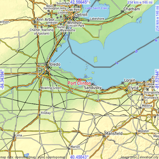
| Width | 7.32 km = 4.5 mi | 14.64 km = 9.1 mi | 234.2 km = 145.5 mi |
| Height | 7.32 km = 4.5 mi | 14.64 km = 9.1 mi | 234.2 km = 145.5 mi |
| ↑Max Latitude | 41.544899° | 41.577781° | 42.55645° |
| Latitude at center | 41.512° | 41.512° | 41.512° |
| ↓Min Latitude | 41.479085° | 41.446153° | 40.45043° |
| ← Min Longitude | -82.981635° | -83.025581° | -84.34394° |
| Longitude center | -82.93769° | -82.93769° | -82.93769° |
| →Max Longitude | -82.893745° | -82.849799° | -81.53144° |
Nearby cities:
Cities around Port Clinton sort by population:
• Sandusky elevation 183 m
20.4 km,  110°
110°
• Fremont 192 m
23.6 km,  220°
220°
• Bellevue 229 m
27.7 km,  163°
163°
• Huron 177 m
34.4 km, 112°
• Clyde 213 m
23.3 km,  187°
187°
• Mount Carmel 240 m
26.8 km,  179°
179°
• Ballville 187 m
26.1 km, 218°
• Oak Harbor 176 m
17.4 km,  268°
268°
• Gibsonburg 208 m
34.9 km,  246°
246°
• Elmore 188 m
30.1 km,  262°
262°
• Green Springs 216 m
30 km,  198°
198°
• Stony Prairie 190 m
25.4 km,  225°
225°
Multilingual:
 En español:
Port Clinton elevación 176 m.
 En France:
Port Clinton élévation 176 m.
 Auf Deutsch:
Port Clinton höhe über dem Meeresspiegel ist 176 m.

Sources and notes:
- [note 1] Map square and city borders are not equal. Map elevation data is calculated only from area inside that square.
- [src 1] Elevation data from geonames database provided with same terms of usage.
- [src 2] The elevation map of Port Clinton is generated using elevation data from NASA's 3 arcsec (90m) resolution SRTM data.
- [src 3] Base (background) map © OpenStreetMap contributors tiles are generated by Geofabrik and OpenTopoMap.
Copyright & License:
This Port Clinton Elevation Map is licensed under CC BY-SA. You may reuse any part from this page, if you give a proper credit by linking to this URL:
 More info on terms of use page.