Mentor elevation
Mentor (Ohio, Lake County), United States elevation is 211 meters and Mentor elevation in feet is 692 ft above sea level [src 1]. Mentor is a populated place (feature code) with elevation that is 68 meters (223 ft) smaller than average city elevation in United States.
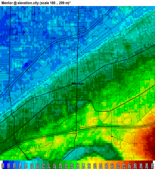
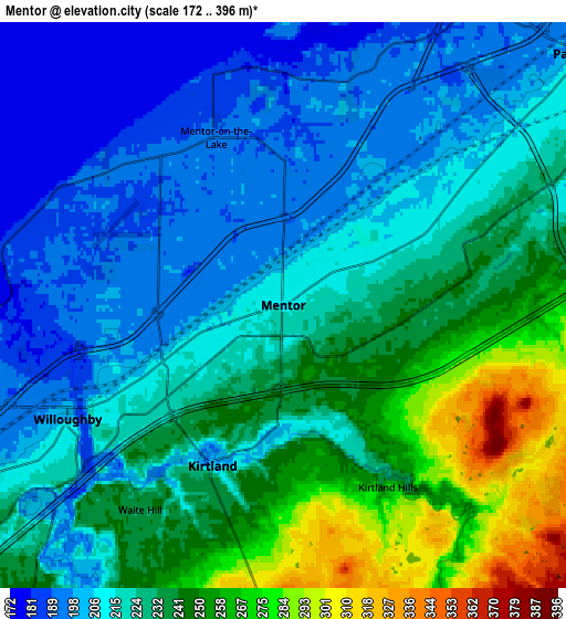
Below is the Elevation map of Mentor, which displays elevation range with different colors. Scale of the first map is from 180 to 299 m (591 to 981 ft) with average elevation of 215.5 meters (=707 ft) [note 1]
These maps also provides idea of topography and contour of this city, they are displayed at different zoom levels. More info about maps, scale and edge coordinates you can find below images.
| \ | Map #1 | Map #2 | Topo.Map |
| Scale [m] | 180..299 m | 172..396 m | × |
| Scale [ft] | 591..981 ft | 564..1299 ft | × |
| Average | 215.5 m = 707 ft | 224.8 m = 738 ft | × |
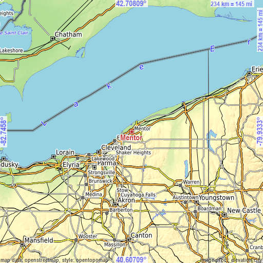
| Width | 7.3 km = 4.5 mi | 14.6 km = 9.1 mi | 233.6 km = 145.2 mi |
| Height | 7.3 km = 4.5 mi | 14.6 km = 9.1 mi | 233.6 km = 145.2 mi |
| ↑Max Latitude | 41.69898° | 41.731784° | 42.70809° |
| Latitude at center | 41.66616° | 41.66616° | 41.66616° |
| ↓Min Latitude | 41.633323° | 41.60047° | 40.60709° |
| ← Min Longitude | -81.383495° | -81.427441° | -82.7458° |
| Longitude center | -81.33955° | -81.33955° | -81.33955° |
| →Max Longitude | -81.295605° | -81.251659° | -79.9333° |
Nearby cities:
Cities around Mentor sort by population:
• Willoughby elevation 202 m
6.3 km,  242°
242°
• Painesville 208 m
10.1 km,  50°
50°
• Eastlake 192 m
9.3 km,  261°
261°
• Willowick 190 m
11.3 km,  251°
251°
• Wickliffe 238 m
11.6 km,  234°
234°
• Willoughby Hills 247 m
10 km,  221°
221°
• Mentor-on-the-Lake 192 m
4.7 km,  338°
338°
• Kirtland 203 m
4.5 km,  203°
203°
• Chardon 401 m
16.9 km,  110°
110°
• Mayfield 286 m
15.2 km,  213°
213°
• Fairport Harbor 188 m
10.8 km,  30°
30°
• Chesterland 375 m
16 km,  179°
179°
Multilingual:
 En español:
Mentor elevación 211 m.
 En France:
Mentor élévation 211 m.


Sources and notes:
- [note 1] Map square and city borders are not equal. Map elevation data is calculated only from area inside that square.
- [src 1] Elevation data from geonames database provided with same terms of usage.
- [src 2] The elevation map of Mentor is generated using elevation data from NASA's 3 arcsec (90m) resolution SRTM data.
- [src 3] Base (background) map © OpenStreetMap contributors tiles are generated by Geofabrik and OpenTopoMap.
Copyright & License:
This Mentor Elevation Map is licensed under CC BY-SA. You may reuse any part from this page, if you give a proper credit by linking to this URL:
 More info on terms of use page.