Martins Ferry elevation
Martins Ferry (Ohio, Belmont County), United States elevation is 216 meters and Martins Ferry elevation in feet is 709 ft above sea level [src 1]. Martins Ferry is a populated place (feature code) with elevation that is 63 meters (207 ft) smaller than average city elevation in United States.
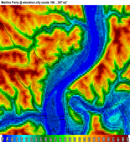
Below is the Elevation map of Martins Ferry, which displays elevation range with different colors. Scale of the first map is from 186 to 397 m (610 to 1302 ft) with average elevation of 278.6 meters (=914 ft) [note 1]
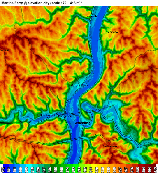
These maps also provides idea of topography and contour of this city, they are displayed at different zoom levels. More info about maps, scale and edge coordinates you can find below images.
| \ | Map #1 | Map #2 | Topo.Map |
| Scale [m] | 186..397 m | 172..413 m | × |
| Scale [ft] | 610..1302 ft | 564..1355 ft | × |
| Average | 278.6 m = 914 ft | 309.6 m = 1016 ft | × |
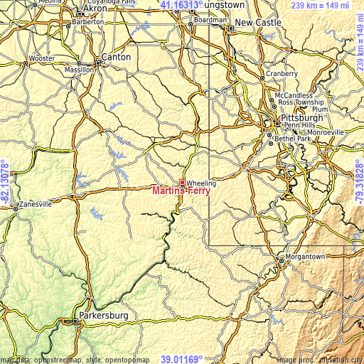
| Width | 7.48 km = 4.6 mi | 14.95 km = 9.3 mi | 239.2 km = 148.6 mi |
| Height | 7.48 km = 4.6 mi | 14.95 km = 9.3 mi | 239.2 km = 148.6 mi |
| ↑Max Latitude | 40.129518° | 40.16311° | 41.16313° |
| Latitude at center | 40.09591° | 40.09591° | 40.09591° |
| ↓Min Latitude | 40.062285° | 40.028643° | 39.01169° |
| ← Min Longitude | -80.768475° | -80.812421° | -82.13078° |
| Longitude center | -80.72453° | -80.72453° | -80.72453° |
| →Max Longitude | -80.680585° | -80.636639° | -79.31828° |
Nearby cities:
Cities around Martins Ferry sort by population:
• Wheeling elevation 208 m
3.6 km,  175°
175°
• Saint Clairsville 387 m
15 km,  263°
263°
• Bellaire 204 m
9 km,  189°
189°
• Shadyside 208 m
14.1 km, 189°
• Bethlehem 380 m
6.5 km,  153°
153°
• McMechen 207 m
12 km, 182°
• Bridgeport 198 m
3.2 km,  204°
204°
• West Liberty 367 m
13.8 km,  53°
53°
• Benwood 197 m
8.7 km, 185°
• Tiltonsville 204 m
8.2 km,  14°
14°
• Wolfhurst 206 m
5.8 km,  239°
239°
• Yorkville 199 m
6.6 km, 10°
Multilingual:
 En español:
Martins Ferry elevación 216 m.
 En France:
Martins Ferry élévation 216 m.
 Auf Deutsch:
Martins Ferry höhe über dem Meeresspiegel ist 216 m.

Sources and notes:
- [note 1] Map square and city borders are not equal. Map elevation data is calculated only from area inside that square.
- [src 1] Elevation data from geonames database provided with same terms of usage.
- [src 2] The elevation map of Martins Ferry is generated using elevation data from NASA's 3 arcsec (90m) resolution SRTM data.
- [src 3] Base (background) map © OpenStreetMap contributors tiles are generated by Geofabrik and OpenTopoMap.
Copyright & License:
This Martins Ferry Elevation Map is licensed under CC BY-SA. You may reuse any part from this page, if you give a proper credit by linking to this URL:
 More info on terms of use page.