Wykagyl elevation
Wykagyl (New York, Westchester County), United States elevation is 41 meters and Wykagyl elevation in feet is 135 ft above sea level [src 1]. Wykagyl is a populated place (feature code) with elevation that is 238 meters (781 ft) smaller than average city elevation in United States.
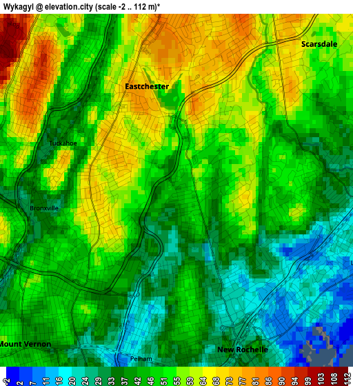
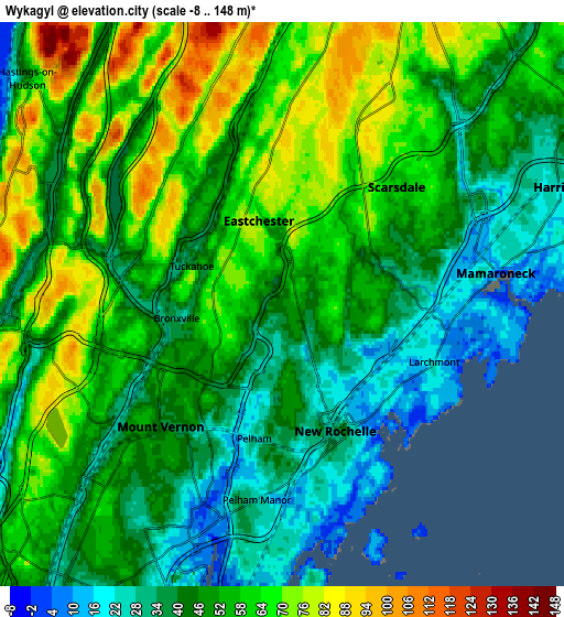
Below is the Elevation map of Wykagyl, which displays elevation range with different colors. Scale of the first map is from -2 to 112 m (-7 to 367 ft) with average elevation of 47.4 meters (=156 ft) [note 1]
These maps also provides idea of topography and contour of this city, they are displayed at different zoom levels. More info about maps, scale and edge coordinates you can find below images.
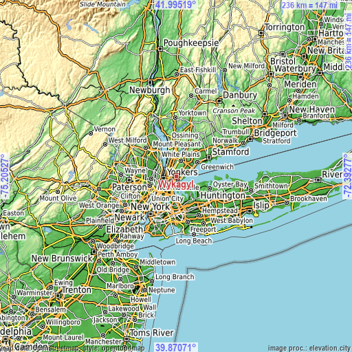
| \ | Map #1 | Map #2 | Topo.Map |
| Scale [m] | -2..112 m | -8..148 m | × |
| Scale [ft] | -7..367 ft | -26..486 ft | × |
| Average | 47.4 m = 156 ft | 51 m = 167 ft | × |
| Width | 7.38 km = 4.6 mi | 14.76 km = 9.2 mi | 236.2 km = 146.8 mi |
| Height | 7.38 km = 4.6 mi | 14.76 km = 9.2 mi | 236.2 km = 146.8 mi |
| ↑Max Latitude | 40.974677° | 41.007847° | 41.99519° |
| Latitude at center | 40.94149° | 40.94149° | 40.94149° |
| ↓Min Latitude | 40.908286° | 40.875066° | 39.87071° |
| ← Min Longitude | -73.842965° | -73.886911° | -75.20527° |
| Longitude center | -73.79902° | -73.79902° | -73.79902° |
| →Max Longitude | -73.755075° | -73.711129° | -72.39277° |
Nearby cities:
Cities around Wykagyl sort by population:
• New Rochelle elevation 37 m
3.6 km,  157°
157°
• Mount Vernon 40 m
4.5 km,  224°
224°
• Wakefield 52 m
6.6 km, 222°
• Eastchester 79 m
2 km,  336°
336°
• Mamaroneck 5 m
5.6 km,  81°
81°
• Greenville 76 m
6 km, 343°
• Pelham 27 m
3.6 km,  191°
191°
• Tuckahoe 43 m
2.6 km,  292°
292°
• Bronxville 32 m
2.8 km,  262°
262°
• Larchmont 21 m
4.2 km,  110°
110°
• Pelham Manor 25 m
5.2 km, 187°
• Eastchester 11 m
6.6 km,  201°
201°
Multilingual:
 En español:
Wykagyl elevación 41 m.
 En France:
Wykagyl élévation 41 m.


Sources and notes:
- [note 1] Map square and city borders are not equal. Map elevation data is calculated only from area inside that square.
- [src 1] Elevation data from geonames database provided with same terms of usage.
- [src 2] The elevation map of Wykagyl is generated using elevation data from NASA's 3 arcsec (90m) resolution SRTM data.
- [src 3] Base (background) map © OpenStreetMap contributors tiles are generated by Geofabrik and OpenTopoMap.
Copyright & License:
This Wykagyl Elevation Map is licensed under CC BY-SA. You may reuse any part from this page, if you give a proper credit by linking to this URL:
 More info on terms of use page.