Throgs Neck elevation
Throgs Neck (New York, Bronx), United States elevation is 10 meters and Throgs Neck elevation in feet is 33 ft above sea level [src 1]. Throgs Neck is a populated place (feature code) with elevation that is 269 meters (883 ft) smaller than average city elevation in United States.
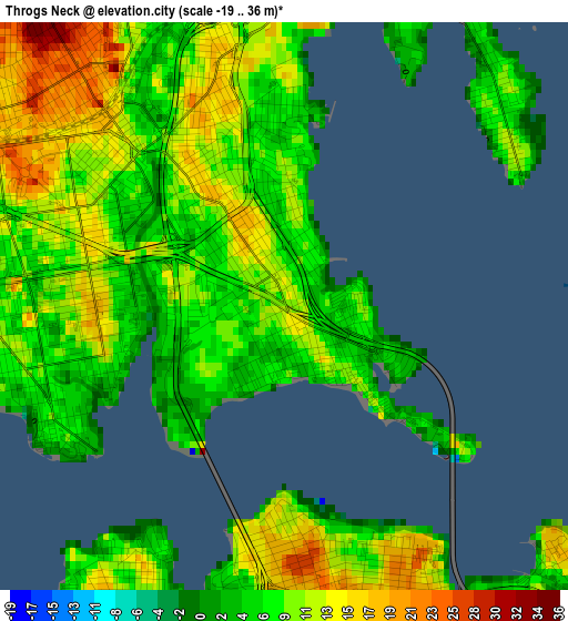
Below is the Elevation map of Throgs Neck, which displays elevation range with different colors. Scale of the first map is from -19 to 36 m (-62 to 118 ft) with average elevation of 9.6 meters (=31 ft) [note 1]
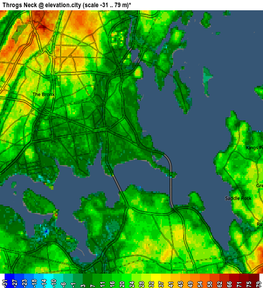
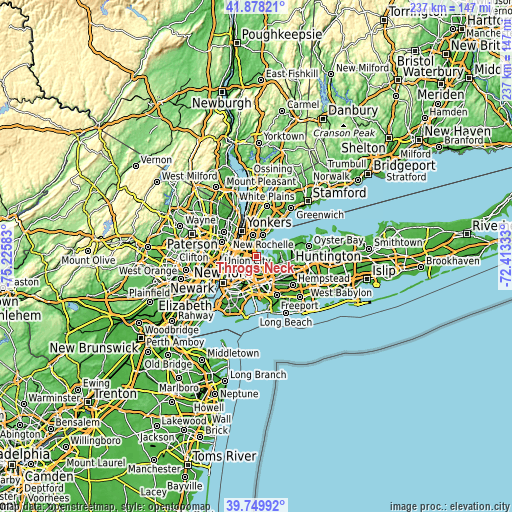
These maps also provides idea of topography and contour of this city, they are displayed at different zoom levels. More info about maps, scale and edge coordinates you can find below images.
| \ | Map #1 | Map #2 | Topo.Map |
| Scale [m] | -19..36 m | -31..79 m | × |
| Scale [ft] | -62..118 ft | -102..259 ft | × |
| Average | 9.6 m = 31 ft | 17.4 m = 57 ft | × |
| Width | 7.4 km = 4.6 mi | 14.79 km = 9.2 mi | 236.6 km = 147 mi |
| Height | 7.4 km = 4.6 mi | 14.79 km = 9.2 mi | 236.6 km = 147 mi |
| ↑Max Latitude | 40.855847° | 40.889077° | 41.87821° |
| Latitude at center | 40.8226° | 40.8226° | 40.8226° |
| ↓Min Latitude | 40.789337° | 40.756057° | 39.74992° |
| ← Min Longitude | -73.863525° | -73.907471° | -75.22583° |
| Longitude center | -73.81958° | -73.81958° | -73.81958° |
| →Max Longitude | -73.775635° | -73.731689° | -72.41333° |
Nearby cities:
Cities around Throgs Neck sort by population:
• The Bronx elevation 19 m
5 km,  307°
307°
• Bayside 27 m
7 km,  149°
149°
• Parkchester 22 m
3.9 km,  297°
297°
• Whitestone 18 m
3.1 km,  178°
178°
• College Point 23 m
4.5 km,  209°
209°
• Hunts Point 8 m
5.5 km,  258°
258°
• Unionport 12 m
2.6 km,  281°
281°
• Van Nest 15 m
4.7 km, 307°
• East Tremont 33 m
6.5 km,  292°
292°
• Baychester 12 m
5.4 km,  344°
344°
• Morris Park 26 m
4.4 km,  319°
319°
• City Island 8 m
3.9 km,  45°
45°
Multilingual:
 En español:
Throgs Neck elevación 10 m.
 En France:
Throgs Neck élévation 10 m.
 Auf Deutsch:
Throgs Neck höhe über dem Meeresspiegel ist 10 m.

Sources and notes:
- [note 1] Map square and city borders are not equal. Map elevation data is calculated only from area inside that square.
- [src 1] Elevation data from geonames database provided with same terms of usage.
- [src 2] The elevation map of Throgs Neck is generated using elevation data from NASA's 3 arcsec (90m) resolution SRTM data.
- [src 3] Base (background) map © OpenStreetMap contributors tiles are generated by Geofabrik and OpenTopoMap.
Copyright & License:
This Throgs Neck Elevation Map is licensed under CC BY-SA. You may reuse any part from this page, if you give a proper credit by linking to this URL:
 More info on terms of use page.