Saint Bonaventure elevation
Saint Bonaventure (New York, Cattaraugus County), United States elevation is 437 meters and Saint Bonaventure elevation in feet is 1434 ft above sea level [src 1]. Saint Bonaventure is a populated place (feature code) with elevation that is 158 meters (518 ft) bigger than average city elevation in United States.
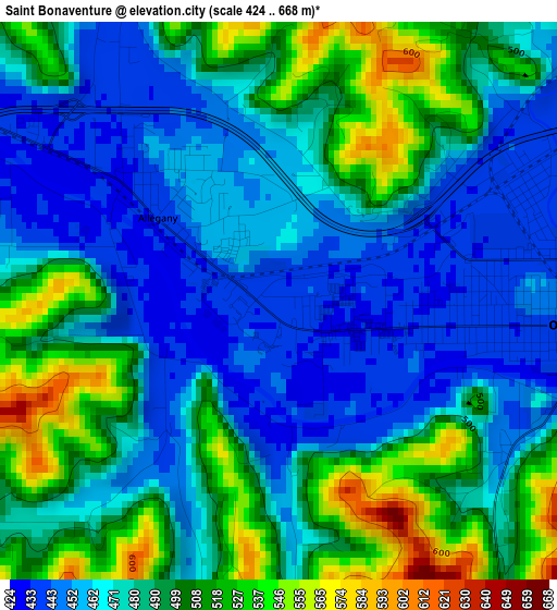
Below is the Elevation map of Saint Bonaventure, which displays elevation range with different colors. Scale of the first map is from 424 to 668 m (1391 to 2192 ft) with average elevation of 482.4 meters (=1583 ft) [note 1]
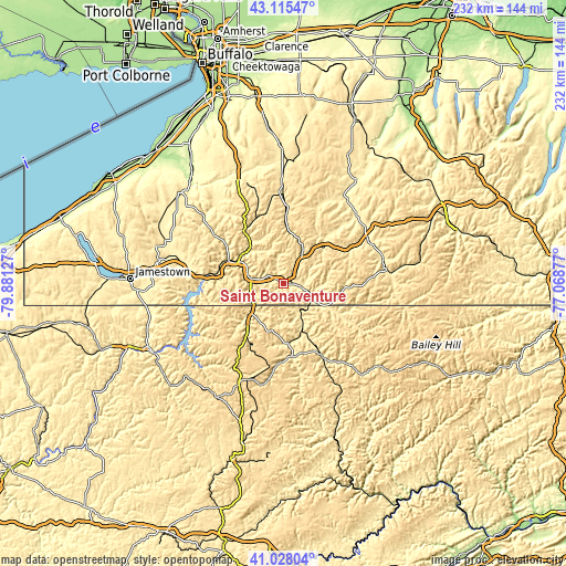
These maps also provides idea of topography and contour of this city, they are displayed at different zoom levels. More info about maps, scale and edge coordinates you can find below images.
| \ | Map #1 | Topo.Map |
| Scale [m] | 424..668 m | × |
| Scale [ft] | 1391..2192 ft | × |
| Average | 482.4 m = 1583 ft | × |
| Width | 7.25 km = 4.5 mi | 232.1 km = 144.2 mi |
| Height | 7.25 km = 4.5 mi | 232.1 km = 144.2 mi |
| ↑Max Latitude | 42.112948° | 43.11547° |
| Latitude at center | 42.08034° | 42.08034° |
| ↓Min Latitude | 42.047715° | 41.02804° |
| ← Min Longitude | -78.518965° | -79.88127° |
| Longitude center | -78.47502° | -78.47502° |
| →Max Longitude | -78.431075° | -77.06877° |
Nearby cities:
Cities around Saint Bonaventure sort by population:
• Olean elevation 443 m
3.7 km,  94°
94°
• Bradford 436 m
19.6 km,  225°
225°
• Salamanca 417 m
21.6 km,  293°
293°
• Westons Mills 443 m
8.3 km,  103°
103°
• Allegany 438 m
1.9 km,  304°
304°
• Franklinville 487 m
28.6 km,  2°
2°
• Smethport 474 m
30 km,  175°
175°
• Cuba 458 m
22.4 km,  47°
47°
• Weston Mills 445 m
8.5 km, 93°
• Foster Brook 436 m
16.6 km, 225°
• Shinglehouse 456 m
26.8 km,  118°
118°
• Bolivar 490 m
25.4 km, 93°
Multilingual:
 En español:
Saint Bonaventure elevación 437 m.
 En France:
Saint Bonaventure élévation 437 m.
 Auf Deutsch:
Saint Bonaventure höhe über dem Meeresspiegel ist 437 m.

Sources and notes:
- [note 1] Map square and city borders are not equal. Map elevation data is calculated only from area inside that square.
- [src 1] Elevation data from geonames database provided with same terms of usage.
- [src 2] The elevation map of Saint Bonaventure is generated using elevation data from NASA's 3 arcsec (90m) resolution SRTM data.
- [src 3] Base (background) map © OpenStreetMap contributors tiles are generated by Geofabrik and OpenTopoMap.
Copyright & License:
This Saint Bonaventure Elevation Map is licensed under CC BY-SA. You may reuse any part from this page, if you give a proper credit by linking to this URL:
 More info on terms of use page.