Seneca Falls elevation
Seneca Falls (New York, Seneca County), United States elevation is 138 meters and Seneca Falls elevation in feet is 453 ft above sea level [src 1]. Seneca Falls is a populated place (feature code) with elevation that is 141 meters (463 ft) smaller than average city elevation in United States.
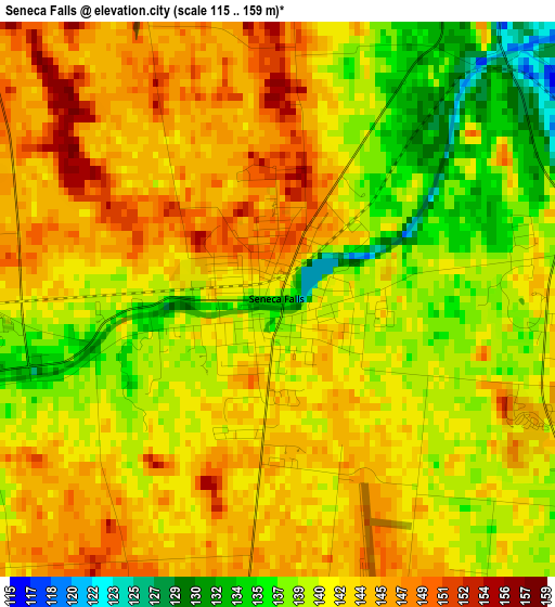
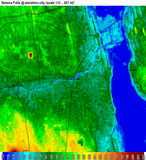
Below is the Elevation map of Seneca Falls, which displays elevation range with different colors. Scale of the first map is from 115 to 159 m (377 to 522 ft) with average elevation of 141.8 meters (=465 ft) [note 1]
These maps also provides idea of topography and contour of this city, they are displayed at different zoom levels. More info about maps, scale and edge coordinates you can find below images.
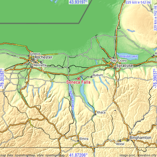
| \ | Map #1 | Map #2 | Topo.Map |
| Scale [m] | 115..159 m | 112..207 m | × |
| Scale [ft] | 377..522 ft | 367..679 ft | × |
| Average | 141.8 m = 465 ft | 141.7 m = 465 ft | × |
| Width | 7.16 km = 4.4 mi | 14.32 km = 8.9 mi | 229 km = 142.3 mi |
| Height | 7.16 km = 4.4 mi | 14.32 km = 8.9 mi | 229 km = 142.3 mi |
| ↑Max Latitude | 42.942798° | 42.974959° | 43.93197° |
| Latitude at center | 42.91062° | 42.91062° | 42.91062° |
| ↓Min Latitude | 42.878425° | 42.846214° | 41.87206° |
| ← Min Longitude | -76.840565° | -76.884511° | -78.20287° |
| Longitude center | -76.79662° | -76.79662° | -76.79662° |
| →Max Longitude | -76.752675° | -76.708729° | -75.39037° |
Nearby cities:
Cities around Seneca Falls sort by population:
• Auburn elevation 213 m
18.9 km,  82°
82°
• Geneva 136 m
15.5 km,  252°
252°
• Centerport 128 m
22 km,  48°
48°
• Waterloo 139 m
5.4 km,  263°
263°
• Lyons 125 m
23.2 km,  317°
317°
• Melrose Park 227 m
20.9 km,  90°
90°
• Clyde 124 m
20.2 km,  342°
342°
• Phelps 162 m
21.9 km,  283°
283°
• Weedsport 126 m
24.4 km, 51°
• Bridgeport 138 m
3.6 km, 80°
• Port Byron 124 m
19.7 km, 45°
• Union Springs 127 m
11.5 km,  133°
133°
Multilingual:
 En español:
Seneca Falls elevación 138 m.
 En France:
Seneca Falls élévation 138 m.
 Auf Deutsch:
Seneca Falls höhe über dem Meeresspiegel ist 138 m.

Sources and notes:
- [note 1] Map square and city borders are not equal. Map elevation data is calculated only from area inside that square.
- [src 1] Elevation data from geonames database provided with same terms of usage.
- [src 2] The elevation map of Seneca Falls is generated using elevation data from NASA's 3 arcsec (90m) resolution SRTM data.
- [src 3] Base (background) map © OpenStreetMap contributors tiles are generated by Geofabrik and OpenTopoMap.
Copyright & License:
This Seneca Falls Elevation Map is licensed under CC BY-SA. You may reuse any part from this page, if you give a proper credit by linking to this URL:
 More info on terms of use page.