Muttontown elevation
Muttontown (New York, Nassau County), United States elevation is 97 meters and Muttontown elevation in feet is 318 ft above sea level [src 1]. Muttontown is a populated place (feature code) with elevation that is 182 meters (597 ft) smaller than average city elevation in United States.
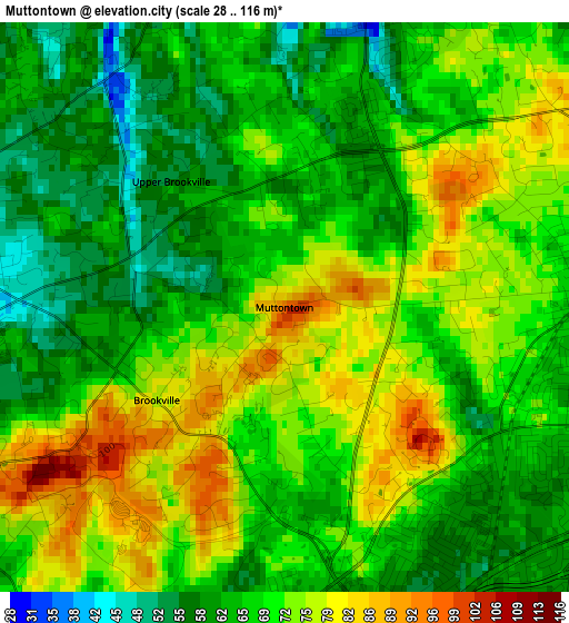
Below is the Elevation map of Muttontown, which displays elevation range with different colors. Scale of the first map is from 28 to 116 m (92 to 381 ft) with average elevation of 68.8 meters (=226 ft) [note 1]
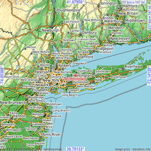
These maps also provides idea of topography and contour of this city, they are displayed at different zoom levels. More info about maps, scale and edge coordinates you can find below images.
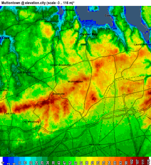
| \ | Map #1 | Map #2 | Topo.Map |
| Scale [m] | 28..116 m | -3..116 m | × |
| Scale [ft] | 92..381 ft | -10..381 ft | × |
| Average | 68.8 m = 226 ft | 55.6 m = 182 ft | × |
| Width | 7.4 km = 4.6 mi | 14.79 km = 9.2 mi | 236.6 km = 147 mi |
| Height | 7.4 km = 4.6 mi | 14.79 km = 9.2 mi | 236.6 km = 147 mi |
| ↑Max Latitude | 40.857236° | 40.890465° | 41.87958° |
| Latitude at center | 40.82399° | 40.82399° | 40.82399° |
| ↓Min Latitude | 40.790727° | 40.757448° | 39.75133° |
| ← Min Longitude | -73.591575° | -73.635521° | -74.95388° |
| Longitude center | -73.54763° | -73.54763° | -73.54763° |
| →Max Longitude | -73.503685° | -73.459739° | -72.14138° |
Nearby cities:
Cities around Muttontown sort by population:
• Hicksville elevation 49 m
6.5 km,  162°
162°
• Syosset 66 m
3.8 km,  86°
86°
• Jericho 62 m
3.6 km,  169°
169°
• Woodbury 52 m
6.7 km, 88°
• Oyster Bay 14 m
4.8 km,  15°
15°
• Glen Head 35 m
6.5 km,  281°
281°
• Old Westbury 57 m
5.9 km,  228°
228°
• Brookville 76 m
2.1 km, 234°
• East Norwich 65 m
2.7 km, 22°
• Oyster Bay Cove 26 m
6.1 km,  30°
30°
• Old Brookville 35 m
4.9 km, 280°
• Upper Brookville 58 m
2.2 km,  318°
318°
Multilingual:
 En español:
Muttontown elevación 97 m.
 En France:
Muttontown élévation 97 m.
 Auf Deutsch:
Muttontown höhe über dem Meeresspiegel ist 97 m.

Sources and notes:
- [note 1] Map square and city borders are not equal. Map elevation data is calculated only from area inside that square.
- [src 1] Elevation data from geonames database provided with same terms of usage.
- [src 2] The elevation map of Muttontown is generated using elevation data from NASA's 3 arcsec (90m) resolution SRTM data.
- [src 3] Base (background) map © OpenStreetMap contributors tiles are generated by Geofabrik and OpenTopoMap.
Copyright & License:
This Muttontown Elevation Map is licensed under CC BY-SA. You may reuse any part from this page, if you give a proper credit by linking to this URL:
 More info on terms of use page.