Milton elevation
Milton (New York, Saratoga County), United States elevation is 133 meters and Milton elevation in feet is 436 ft above sea level [src 1]. Milton is a populated place (feature code) with elevation that is 146 meters (479 ft) smaller than average city elevation in United States.
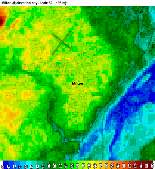
Below is the Elevation map of Milton, which displays elevation range with different colors. Scale of the first map is from 62 to 193 m (203 to 633 ft) with average elevation of 115 meters (=377 ft) [note 1]
These maps also provides idea of topography and contour of this city, they are displayed at different zoom levels. More info about maps, scale and edge coordinates you can find below images.
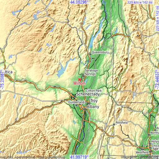
| \ | Map #1 | Topo.Map |
| Scale [m] | 62..193 m | × |
| Scale [ft] | 203..633 ft | × |
| Average | 115 m = 377 ft | × |
| Width | 7.14 km = 4.4 mi | 228.6 km = 142 mi |
| Height | 7.14 km = 4.4 mi | 228.6 km = 142 mi |
| ↑Max Latitude | 43.065804° | 44.05298° |
| Latitude at center | 43.03369° | 43.03369° |
| ↓Min Latitude | 43.00156° | 41.99719° |
| ← Min Longitude | -73.896565° | -75.25887° |
| Longitude center | -73.85262° | -73.85262° |
| →Max Longitude | -73.808675° | -72.44637° |
Nearby cities:
Cities around Milton sort by population:
• Saratoga Springs elevation 96 m
7.8 km,  45°
45°
• Scotia 77 m
24.8 km,  201°
201°
• East Glenville 115 m
16.6 km, 201°
• Ballston Spa 97 m
3.7 km,  175°
175°
• Mechanicville 28 m
19.8 km,  137°
137°
• Northumberland 32 m
23.9 km,  64°
64°
• Corinth 186 m
23.5 km,  4°
4°
• Country Knolls 94 m
13.7 km,  163°
163°
• Stillwater 30 m
19.4 km,  123°
123°
• Schuylerville 44 m
23.2 km,  71°
71°
• North Ballston Spa 126 m
1.6 km, 175°
• Hagaman 221 m
25.1 km,  254°
254°
Multilingual:
 En español:
Milton elevación 133 m.
 En France:
Milton élévation 133 m.


Sources and notes:
- [note 1] Map square and city borders are not equal. Map elevation data is calculated only from area inside that square.
- [src 1] Elevation data from geonames database provided with same terms of usage.
- [src 2] The elevation map of Milton is generated using elevation data from NASA's 3 arcsec (90m) resolution SRTM data.
- [src 3] Base (background) map © OpenStreetMap contributors tiles are generated by Geofabrik and OpenTopoMap.
Copyright & License:
This Milton Elevation Map is licensed under CC BY-SA. You may reuse any part from this page, if you give a proper credit by linking to this URL:
 More info on terms of use page.