Glenwood Landing elevation
Glenwood Landing (New York, Nassau County), United States elevation is 36 meters and Glenwood Landing elevation in feet is 118 ft above sea level [src 1]. Glenwood Landing is a populated place (feature code) with elevation that is 243 meters (797 ft) smaller than average city elevation in United States.
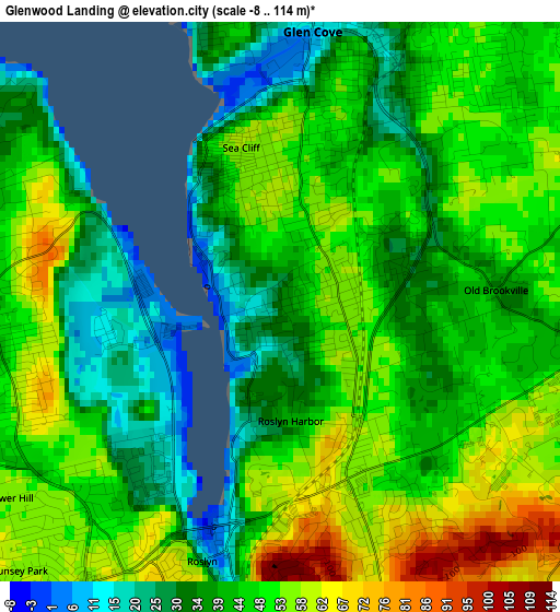
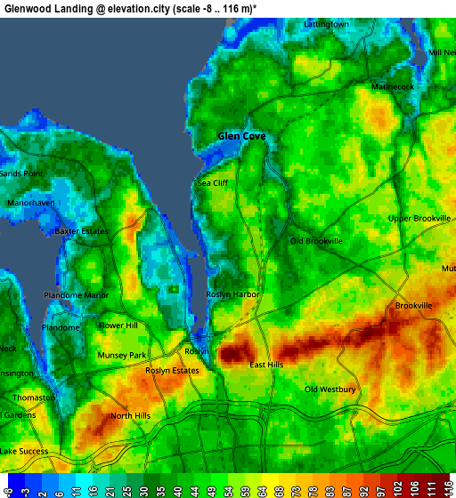
Below is the Elevation map of Glenwood Landing, which displays elevation range with different colors. Scale of the first map is from -8 to 114 m (-26 to 374 ft) with average elevation of 44.6 meters (=146 ft) [note 1]
These maps also provides idea of topography and contour of this city, they are displayed at different zoom levels. More info about maps, scale and edge coordinates you can find below images.
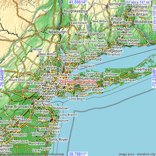
| \ | Map #1 | Map #2 | Topo.Map |
| Scale [m] | -8..114 m | -8..116 m | × |
| Scale [ft] | -26..374 ft | -26..381 ft | × |
| Average | 44.6 m = 146 ft | 46.9 m = 154 ft | × |
| Width | 7.39 km = 4.6 mi | 14.79 km = 9.2 mi | 236.6 km = 147 mi |
| Height | 7.39 km = 4.6 mi | 14.79 km = 9.2 mi | 236.6 km = 147 mi |
| ↑Max Latitude | 40.863903° | 40.897129° | 41.88614° |
| Latitude at center | 40.83066° | 40.83066° | 40.83066° |
| ↓Min Latitude | 40.797401° | 40.764125° | 39.75811° |
| ← Min Longitude | -73.682685° | -73.726631° | -75.04499° |
| Longitude center | -73.63874° | -73.63874° | -73.63874° |
| →Max Longitude | -73.594795° | -73.550849° | -72.23249° |
Nearby cities:
Cities around Glenwood Landing sort by population:
• Glen Cove elevation 9 m
3.5 km,  6°
6°
• East Hills 65 m
4.2 km,  166°
166°
• Roslyn Heights 57 m
4.7 km,  188°
188°
• Sea Cliff 58 m
2.1 km,  345°
345°
• Flower Hill 56 m
4.4 km,  234°
234°
• Glen Head 35 m
1.4 km,  67°
67°
• Roslyn 17 m
3.6 km,  196°
196°
• Old Brookville 35 m
2.9 km,  86°
86°
• Roslyn Estates 80 m
4.4 km, 204°
• Greenvale 55 m
2.4 km,  158°
158°
• Roslyn Harbor 42 m
1.6 km, 174°
• Baxter Estates 21 m
4.8 km,  275°
275°
Multilingual:
 En español:
Glenwood Landing elevación 36 m.
 En France:
Glenwood Landing élévation 36 m.
 Auf Deutsch:
Glenwood Landing höhe über dem Meeresspiegel ist 36 m.

Sources and notes:
- [note 1] Map square and city borders are not equal. Map elevation data is calculated only from area inside that square.
- [src 1] Elevation data from geonames database provided with same terms of usage.
- [src 2] The elevation map of Glenwood Landing is generated using elevation data from NASA's 3 arcsec (90m) resolution SRTM data.
- [src 3] Base (background) map © OpenStreetMap contributors tiles are generated by Geofabrik and OpenTopoMap.
Copyright & License:
This Glenwood Landing Elevation Map is licensed under CC BY-SA. You may reuse any part from this page, if you give a proper credit by linking to this URL:
 More info on terms of use page.