Gardnertown elevation
Gardnertown (New York, Orange County), United States elevation is 132 meters and Gardnertown elevation in feet is 433 ft above sea level [src 1]. Gardnertown is a populated place (feature code) with elevation that is 147 meters (482 ft) smaller than average city elevation in United States.
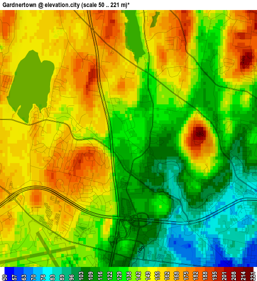
Below is the Elevation map of Gardnertown, which displays elevation range with different colors. Scale of the first map is from 50 to 221 m (164 to 725 ft) with average elevation of 139.1 meters (=456 ft) [note 1]
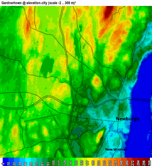
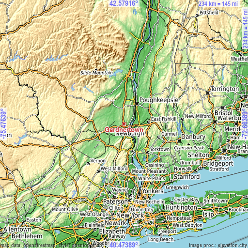
These maps also provides idea of topography and contour of this city, they are displayed at different zoom levels. More info about maps, scale and edge coordinates you can find below images.
| \ | Map #1 | Map #2 | Topo.Map |
| Scale [m] | 50..221 m | -2..308 m | × |
| Scale [ft] | 164..725 ft | -7..1010 ft | × |
| Average | 139.1 m = 456 ft | 125.4 m = 411 ft | × |
| Width | 7.32 km = 4.5 mi | 14.63 km = 9.1 mi | 234.1 km = 145.5 mi |
| Height | 7.32 km = 4.5 mi | 14.63 km = 9.1 mi | 234.1 km = 145.5 mi |
| ↑Max Latitude | 41.567977° | 41.600847° | 42.57916° |
| Latitude at center | 41.53509° | 41.53509° | 41.53509° |
| ↓Min Latitude | 41.502186° | 41.469266° | 40.47389° |
| ← Min Longitude | -74.114085° | -74.158031° | -75.47639° |
| Longitude center | -74.07014° | -74.07014° | -74.07014° |
| →Max Longitude | -74.026195° | -73.982249° | -72.66389° |
Nearby cities:
Cities around Gardnertown sort by population:
• Newburgh elevation 46 m
6.1 km,  125°
125°
• Beacon 44 m
9 km,  111°
111°
• New Windsor 54 m
7.5 km,  149°
149°
• Orange Lake 152 m
2.4 km,  282°
282°
• Walden 114 m
10.3 km,  286°
286°
• Firthcliffe 93 m
10.9 km,  168°
168°
• Vails Gate 88 m
9 km, 173°
• Balmville 74 m
4.6 km,  90°
90°
• Cornwall 54 m
11 km,  155°
155°
• Beaverdam Lake-Salisbury Mills 104 m
11.1 km,  200°
200°
• Beaver Dam Lake 121 m
10.4 km, 200°
• Plattekill 176 m
9.2 km,  356°
356°
Multilingual:
 En español:
Gardnertown elevación 132 m.
 En France:
Gardnertown élévation 132 m.
 Auf Deutsch:
Gardnertown höhe über dem Meeresspiegel ist 132 m.

Sources and notes:
- [note 1] Map square and city borders are not equal. Map elevation data is calculated only from area inside that square.
- [src 1] Elevation data from geonames database provided with same terms of usage.
- [src 2] The elevation map of Gardnertown is generated using elevation data from NASA's 3 arcsec (90m) resolution SRTM data.
- [src 3] Base (background) map © OpenStreetMap contributors tiles are generated by Geofabrik and OpenTopoMap.
Copyright & License:
This Gardnertown Elevation Map is licensed under CC BY-SA. You may reuse any part from this page, if you give a proper credit by linking to this URL:
 More info on terms of use page.