Fredonia elevation
Fredonia (New York, Chautauqua County), United States elevation is 224 meters and Fredonia elevation in feet is 735 ft above sea level [src 1]. Fredonia is a populated place (feature code) with elevation that is 55 meters (180 ft) smaller than average city elevation in United States.
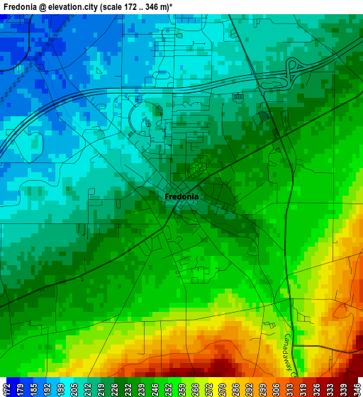
Below is the Elevation map of Fredonia, which displays elevation range with different colors. Scale of the first map is from 172 to 346 m (564 to 1135 ft) with average elevation of 233.7 meters (=767 ft) [note 1]
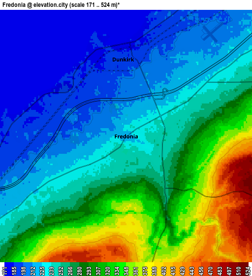
These maps also provides idea of topography and contour of this city, they are displayed at different zoom levels. More info about maps, scale and edge coordinates you can find below images.
| \ | Map #1 | Map #2 | Topo.Map |
| Scale [m] | 172..346 m | 171..524 m | × |
| Scale [ft] | 564..1135 ft | 561..1719 ft | × |
| Average | 233.7 m = 767 ft | 264.1 m = 866 ft | × |
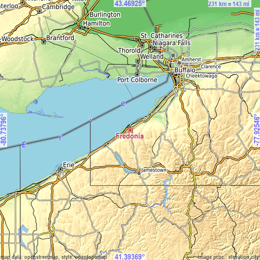
| Width | 7.21 km = 4.5 mi | 14.42 km = 9 mi | 230.8 km = 143.4 mi |
| Height | 7.21 km = 4.5 mi | 14.42 km = 9 mi | 230.8 km = 143.4 mi |
| ↑Max Latitude | 42.472483° | 42.504888° | 43.46925° |
| Latitude at center | 42.44006° | 42.44006° | 42.44006° |
| ↓Min Latitude | 42.407621° | 42.375165° | 41.39369° |
| ← Min Longitude | -79.375655° | -79.419601° | -80.73796° |
| Longitude center | -79.33171° | -79.33171° | -79.33171° |
| →Max Longitude | -79.287765° | -79.243819° | -77.92546° |
Nearby cities:
Cities around Fredonia sort by population:
• Dunkirk elevation 192 m
4.4 km,  357°
357°
• Portland 236 m
13 km,  238°
238°
• Lake Erie Beach 199 m
29.8 km,  46°
46°
• Westfield 230 m
24.1 km, 237°
• Gowanda 235 m
32.6 km,  85°
85°
• Silver Creek 182 m
17.8 km, 49°
• Angola 208 m
33.3 km, 48°
• Angola on the Lake 189 m
33.3 km,  44°
44°
• Mayville 444 m
25.1 km,  214°
214°
• Brocton 227 m
10.6 km, 237°
• North Collins 253 m
36.4 km,  61°
61°
• Celoron 407 m
37 km,  173°
173°
Multilingual:
 En español:
Fredonia elevación 224 m.
 En France:
Fredonia élévation 224 m.
 Auf Deutsch:
Fredonia höhe über dem Meeresspiegel ist 224 m.

Sources and notes:
- [note 1] Map square and city borders are not equal. Map elevation data is calculated only from area inside that square.
- [src 1] Elevation data from geonames database provided with same terms of usage.
- [src 2] The elevation map of Fredonia is generated using elevation data from NASA's 3 arcsec (90m) resolution SRTM data.
- [src 3] Base (background) map © OpenStreetMap contributors tiles are generated by Geofabrik and OpenTopoMap.
Copyright & License:
This Fredonia Elevation Map is licensed under CC BY-SA. You may reuse any part from this page, if you give a proper credit by linking to this URL:
 More info on terms of use page.