Coram elevation
Coram (New York, Suffolk County), United States elevation is 30 meters and Coram elevation in feet is 98 ft above sea level [src 1]. Coram is a populated place (feature code) with elevation that is 249 meters (817 ft) smaller than average city elevation in United States.
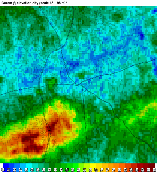
Below is the Elevation map of Coram, which displays elevation range with different colors. Scale of the first map is from 18 to 98 m (59 to 322 ft) with average elevation of 42.5 meters (=139 ft) [note 1]
These maps also provides idea of topography and contour of this city, they are displayed at different zoom levels. More info about maps, scale and edge coordinates you can find below images.
| \ | Map #1 | Map #2 | Topo.Map |
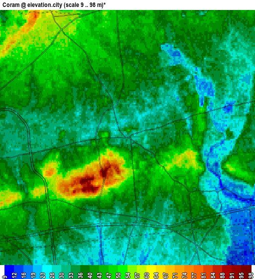
| Scale [m] | 18..98 m | 9..98 m | × |
| Scale [ft] | 59..322 ft | 30..322 ft | × |
| Average | 42.5 m = 139 ft | 38.3 m = 126 ft | × |
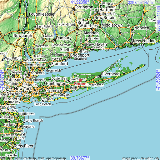
| Width | 7.39 km = 4.6 mi | 14.78 km = 9.2 mi | 236.5 km = 147 mi |
| Height | 7.39 km = 4.6 mi | 14.78 km = 9.2 mi | 236.5 km = 147 mi |
| ↑Max Latitude | 40.901934° | 40.93514° | 41.92358° |
| Latitude at center | 40.86871° | 40.86871° | 40.86871° |
| ↓Min Latitude | 40.83547° | 40.802213° | 39.79677° |
| ← Min Longitude | -73.045435° | -73.089381° | -74.40774° |
| Longitude center | -73.00149° | -73.00149° | -73.00149° |
| →Max Longitude | -72.957545° | -72.913599° | -71.59524° |
Nearby cities:
Cities around Coram sort by population:
• Centereach elevation 32 m
8.3 km,  262°
262°
• Holbrook 39 m
9 km,  225°
225°
• Medford 28 m
5.7 km,  178°
178°
• Selden 31 m
2.9 km,  265°
265°
• Holtsville 35 m
7 km,  211°
211°
• Farmingville 32 m
4.8 km, 209°
• Mount Sinai 16 m
9 km,  344°
344°
• Terryville 47 m
7 km,  309°
309°
• Middle Island 29 m
5.7 km,  72°
72°
• Port Jefferson Station 54 m
7.4 km,  328°
328°
• Yaphank 17 m
7.9 km,  116°
116°
• Gordon Heights 48 m
2.8 km,  113°
113°
Multilingual:
 En español:
Coram elevación 30 m.
 En France:
Coram élévation 30 m.


Sources and notes:
- [note 1] Map square and city borders are not equal. Map elevation data is calculated only from area inside that square.
- [src 1] Elevation data from geonames database provided with same terms of usage.
- [src 2] The elevation map of Coram is generated using elevation data from NASA's 3 arcsec (90m) resolution SRTM data.
- [src 3] Base (background) map © OpenStreetMap contributors tiles are generated by Geofabrik and OpenTopoMap.
Copyright & License:
This Coram Elevation Map is licensed under CC BY-SA. You may reuse any part from this page, if you give a proper credit by linking to this URL:
 More info on terms of use page.