Westwood elevation
Westwood (New Jersey, Bergen County), United States elevation is 24 meters and Westwood elevation in feet is 79 ft above sea level [src 1]. Westwood is a populated place (feature code) with elevation that is 255 meters (837 ft) smaller than average city elevation in United States.
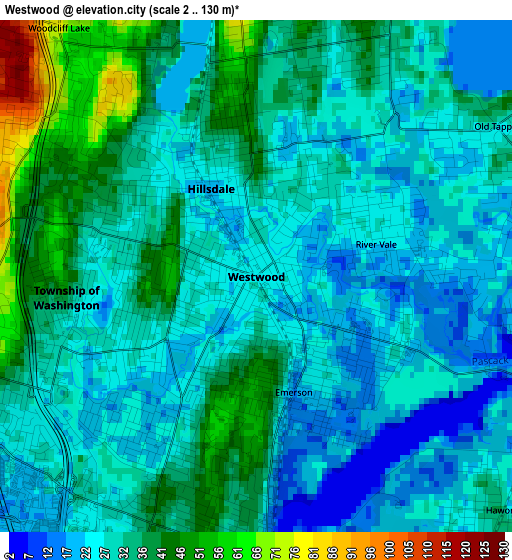
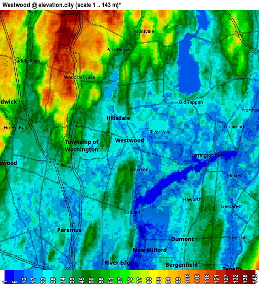
Below is the Elevation map of Westwood, which displays elevation range with different colors. Scale of the first map is from 2 to 130 m (7 to 427 ft) with average elevation of 30.6 meters (=100 ft) [note 1]
These maps also provides idea of topography and contour of this city, they are displayed at different zoom levels. More info about maps, scale and edge coordinates you can find below images.
| \ | Map #1 | Map #2 | Topo.Map |
| Scale [m] | 2..130 m | 1..143 m | × |
| Scale [ft] | 7..427 ft | 3..469 ft | × |
| Average | 30.6 m = 100 ft | 41.1 m = 135 ft | × |
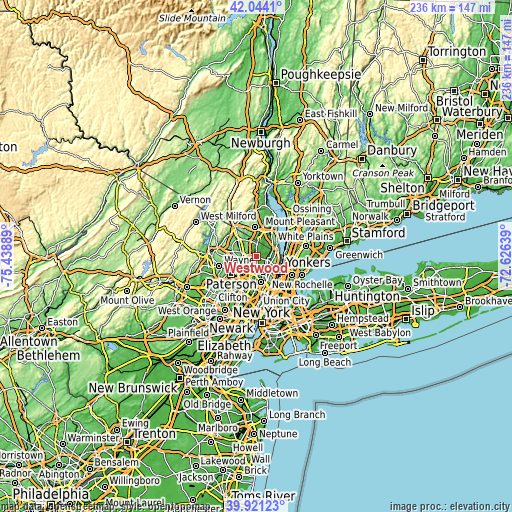
| Width | 7.38 km = 4.6 mi | 14.75 km = 9.2 mi | 236 km = 146.6 mi |
| Height | 7.38 km = 4.6 mi | 14.75 km = 9.2 mi | 236 km = 146.6 mi |
| ↑Max Latitude | 41.024372° | 41.057517° | 42.0441° |
| Latitude at center | 40.99121° | 40.99121° | 40.99121° |
| ↓Min Latitude | 40.958031° | 40.924836° | 39.92123° |
| ← Min Longitude | -74.076585° | -74.120531° | -75.43889° |
| Longitude center | -74.03264° | -74.03264° | -74.03264° |
| →Max Longitude | -73.988695° | -73.944749° | -72.62639° |
Nearby cities:
Cities around Westwood sort by population:
• Hillsdale elevation 19 m
1.4 km,  332°
332°
• River Vale 22 m
1.8 km,  74°
74°
• Park Ridge 55 m
5.2 km,  352°
352°
• Montvale 100 m
6.2 km,  7°
7°
• Oradell 35 m
3.6 km,  185°
185°
• Emerson 16 m
1.8 km,  162°
162°
• Old Tappan 27 m
4.1 km,  58°
58°
• Woodcliff Lake 79 m
4.6 km,  321°
321°
• Norwood 36 m
6 km,  82°
82°
• Harrington Park 21 m
4.5 km,  100°
100°
• Ho-Ho-Kus 44 m
5.8 km,  275°
275°
• Haworth 21 m
4.9 km,  133°
133°
Multilingual:
 En español:
Westwood elevación 24 m.
 En France:
Westwood élévation 24 m.


Sources and notes:
- [note 1] Map square and city borders are not equal. Map elevation data is calculated only from area inside that square.
- [src 1] Elevation data from geonames database provided with same terms of usage.
- [src 2] The elevation map of Westwood is generated using elevation data from NASA's 3 arcsec (90m) resolution SRTM data.
- [src 3] Base (background) map © OpenStreetMap contributors tiles are generated by Geofabrik and OpenTopoMap.
Copyright & License:
This Westwood Elevation Map is licensed under CC BY-SA. You may reuse any part from this page, if you give a proper credit by linking to this URL:
 More info on terms of use page.